
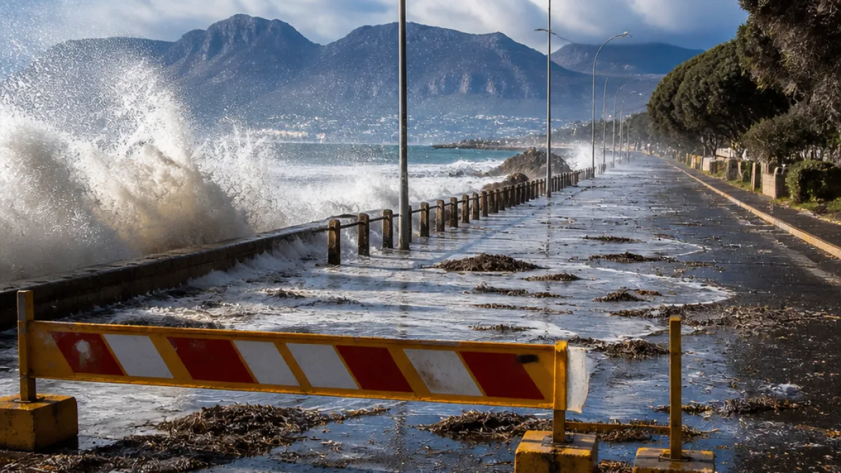
Provincial teams mobilise as SAWS warns of disruptive weather
The Western Cape faces two days of potentially disruptive weather after the South African Weather Service (SAWS) issued a Level 4 warning for heavy, disruptive rainfall in parts of the province. The forecast, covering Thursday and Friday, also includes strong winds and hazardous sea conditions along much of the coastline.
The warning prompted a meeting of the provincial Joint Operations Committee on Tuesday, where forecasters briefed disaster management officials on the approaching system. The Provincial Disaster Management Centre is monitoring developments with SAWS and has been in touch with municipalities and emergency services.
Where the heaviest rain is expected
SAWS is forecasting notable rainfall totals in specific districts. Officials say the most significant accumulations are expected in parts of the Overberg and the Garden Route, where the heaviest falls could occur.
| Area | Expected rainfall (mm) | Primary hazard |
|---|---|---|
| Overberg | 30–45mm | Disruptive rainfall, localised flooding |
| Garden Route | 30–45mm | Disruptive rainfall, river rises |
| Cape Winelands / Central Karoo / Little Karoo | Variable | Strong winds |
| Coastline | — | High waves, hazardous sea conditions |
What authorities are advising
Western Cape Local Government, Environmental Affairs and Development Planning MEC Anton Bredell said provincial authorities were coordinating with municipalities and emergency services ahead of the system. The Provincial Disaster Management Centre warned residents and motorists to take practical precautions.
- Do not attempt to cross flooded roads, bridges or low-water crossings.
- Avoid rivers, streams and stormwater channels during heavy rain.
- Secure loose outdoor items in areas expecting strong winds.
- Coastal residents and visitors should keep away from the waterline while high waves are forecast.
Transport and coastal risks
Disruptive rainfall of the scale forecast can make roads dangerous through standing water, wash-aways and reduced visibility. Low-lying crossings that are normally passable can become unsafe in a short period. Along the Cape coastline, high waves and rough seas present a direct danger to small craft, swimmers and people on piers or rocks.
Local government readiness and next steps
Disaster management teams across the province have been briefed and told to remain ready to deploy. The provincial centre will continue to monitor the forecast in collaboration with SAWS and will issue further warnings or updates if the system strengthens or the expected track changes.
Municipal disaster and emergency services have been asked to check equipment and ensure that sandbags, clearing teams and rescue resources are available where needed. Residents are advised to follow local municipal channels, social media and SAWS updates for real-time information.
Practical information for residents
Practical steps households can take in advance include moving vehicles to higher ground if there is risk of local flooding, ensuring drains and gutters are clear of debris, and preparing a small emergency kit with essential items should access to homes be disrupted.
Motorists should exercise caution, reduce speed in heavy rain, leave extra stopping distance and avoid standing water where the depth is uncertain. Pedestrians should avoid walking through flowing water, particularly on streets with strong currents.
Authorities say further warnings will be issued should the forecast change. Residents are urged to heed official advice and not put themselves at unnecessary risk.
Reporting from the Western Cape,













