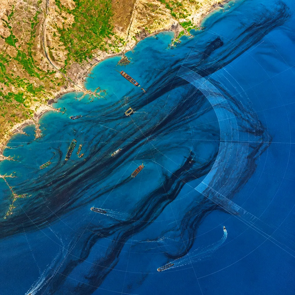
New Delhi: Satellite observations between 2023 and 2025 show that oil slicks affect roughly 1.58 million square kilometres of the world’s ocean surface each year, according to a new analysis by US-based non-profit SkyTruth. The study found that most slicks occur close to shore and that a large majority — about 80 per cent — are associated with vessel operations rather than single catastrophic spills.
Extent and verification
SkyTruth used synthetic aperture radar (SAR) imagery from the European Space Agency’s Sentinel-1 satellites, which can detect oil on sea surfaces day and night and through cloud. From 2023 to 2025 the organisation directly verified 3,152 individual oil slicks covering around 22,805 square kilometres of surface area. Aggregating observations and modelled drift, the organisation estimates the annual area impacted by oil slicks to be about 1.58 million sq km — nearly half the land area of India.
Sources, geography and implications
The analysis distinguishes between sudden large spills and chronic contamination from routine ship discharges, waste water and operational releases from vessels and offshore infrastructure. SkyTruth found that around 80% of the observed pollution links to ships, with the remainder attributed to offshore oil facilities. Because shipping lanes and port approaches concentrate vessel traffic, slicks are far more frequent near coasts, increasing risks to fisheries, mangroves, coral reefs and coastal livelihoods.
- Satellite-verified slicks, 2023–25: 3,152
- Area covered by verified slicks: 22,805 sq km
- Estimated annual ocean surface affected: 1.58 million sq km
- Share attributed to vessels: ~80%
The study also mapped regional concentrations. Among the most affected waters were the seas around Indonesia (832 observed slicks). Coastal zones of Malaysia and Romania each registered over 200 slicks, while Nigeria and Bulgaria recorded more than 150 each. The findings underline that even protected marine areas are not immune, since slicks can drift and spread across considerable distances.
| Region / Country | Observed slicks (2023–25) |
|---|---|
| Indonesia | 832 |
| Malaysia | >200 |
| Romania | >200 |
| Nigeria | >150 |
| Bulgaria | >150 |
How this differs from headline spills
Media coverage commonly intensifies around major tanker accidents, such as the August incident off Oman in which a vessel reportedly carrying about 800,000 barrels was attacked and a large spill spread toward the coast. SkyTruth emphasises that such events, while dramatic, represent only one class of marine oil pollution. The persistent, lower-volume releases from routine ship operations are widespread and cumulative, producing long-term exposure for marine ecosystems.
Because SAR can capture slicks irrespective of daylight or cloud cover, the platform revealed pollution patterns that optical cameras can miss. The technology also allows independent verification of suspected discharges, which can inform enforcement and liability inquiries.
Policy and enforcement considerations
The study’s findings raise questions about compliance with international and national rules governing operational discharges from ships and offshore facilities. For coastal nations, chronic slicks pose direct risks to livelihoods dependent on fisheries and tourism, and to sensitive coastal habitats such as mangroves and estuaries. Satellite detection can strengthen monitoring but effective action requires follow-through — inspection, fines, prosecution and changes in fuel and waste-management practices on board ships.
For India, with a long coastline and busy shipping lanes, the pattern underscores the need to combine satellite surveillance with on-water response capacity and tighter port-state control. Continued independent observation can also help policymakers prioritise hotspots for enforcement and habitat protection.
SkyTruth’s study adds to growing evidence that tackling marine oil pollution requires attention to routine operational practices, not only disaster response. Improved regulation, shipboard systems to retain oily waste, and rigorous enforcement are practical levers that authorities can deploy to reduce the chronic footprint of oil on the seas.