Typhoon Dolphin, which made landfall in eastern China on August 9, is being linked to a weakening of India’s monsoon by meteorologists and researchers tracking large-scale Pacific–Indian Ocean interactions, reports said.
How a Pacific storm can affect Indian rainfall
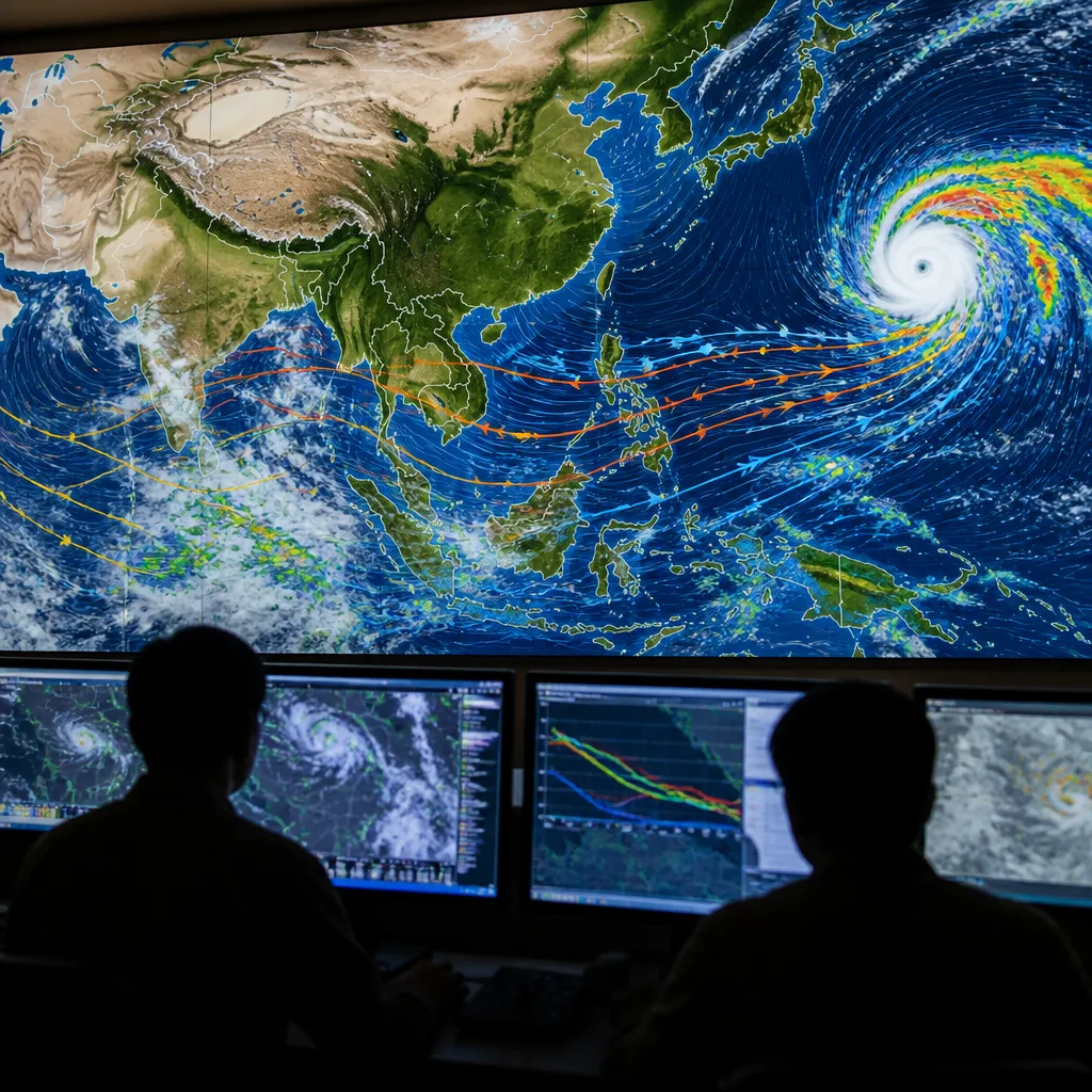
Although Dolphin struck near Yuhuan in Zhejiang province with sustained winds of about 151 kmph and caused significant flooding and evacuations in China, its wider significance lies in the hyperactive Pacific circulation that accompanied the cyclone, according to the report. Satellite imagery and weather analyses indicate multiple convective systems across the tropical and western Pacific that can change the atmospheric patterns far downstream over the Indian Ocean.
Scientists describe these connections as teleconnections: the distribution of tropical convection in the Pacific alters the Walker circulation and the patterns of atmospheric waves that propagate into the Indian Ocean sector. During El Niño‑type conditions, convection tends to shift eastward into the Pacific. That eastward shift can suppress rising motion and convection over the Indian Ocean basin, which in turn reduces the mechanisms that ordinarily support India’s monsoon rains.
Implications for the Bay of Bengal and monsoon lows
The report highlighted the Bay of Bengal as particularly vulnerable because many monsoon low‑pressure systems and depressions form there. When Pacific convection is strong and displaced east, the Bay of Bengal may receive fewer westward-propagating disturbances that normally amplify into monsoon lows.
Not all Pacific disturbances act to suppress the monsoon. In some cases, weather systems in the western North Pacific can generate westward‑moving perturbations that "seed" or trigger low‑pressure formation over the Bay of Bengal. Research cited in the report suggests that more than one‑third of monsoon low‑pressure systems can arise through such downstream amplification of Pacific disturbances — so the present situation is complex and depends on the phasing of multiple systems.
- Typhoon Dolphin landfall: Yuhuan, Zhejiang (eastern China) on August 9.
- Peak sustained winds reported: ~151 kmph.
- Distance from India: roughly 4,000 km, but effects mediated by large‑scale atmospheric teleconnections.
| Parameter | Reported value |
|---|---|
| Typhoon wind speed | 151 kmph |
| Approximate separation from India | 4,000 km |
| Share of lows linked to Pacific disturbances | More than one‑third |
What this means for rainfall and forecasting
If the present Pacific activity continues to favour eastward convection, India could see suppression of monsoon convective activity and fewer or weaker low‑pressure systems originating in the Bay of Bengal. That would translate into reduced widespread rainfall episodes over many parts of the country. Conversely, a favourable phase in which western Pacific disturbances propagate and amplify over the Bay could still trigger monsoon lows, showing the conditional nature of the teleconnection.
Operational forecasts for monsoon rainfall therefore need to account for evolving Pacific patterns as well as Indian Ocean conditions. This is particularly important for seasonal and sub‑seasonal outlooks that authorities and farmers rely on for planning. The interaction between El Niño signals and active western Pacific weather underscores the limits of looking at basin‑scale indices alone; wave propagation, timing and the spatial distribution of convection matter critically.
Context and caveats
Past studies and operational experience show that the Pacific’s influence on the Indian monsoon is statistically robust but not deterministic. The report emphasised both pathways: one in which Pacific convection suppresses Indian Ocean rising motion under El Niño‑like configurations, and another in which specific western Pacific disturbances can enhance Bay of Bengal low formation by downstream amplification.
Monitoring agencies will continue to track atmospheric waves, sea surface temperature anomalies and westward propagation of tropical disturbances in the coming weeks to refine forecasts. For the public and policymakers, the key takeaway is that remote cyclones can have consequential effects on India’s monsoon through large‑scale atmospheric linkages — making integrated ocean‑atmosphere monitoring essential for near‑term and seasonal preparedness.
"The current situation is complicated," the report said, underlining that Pacific disturbances can both suppress and help trigger Indian monsoon systems depending on their evolution.
Reported by indiatoday.in; analysis and synthesis by the Science Desk.