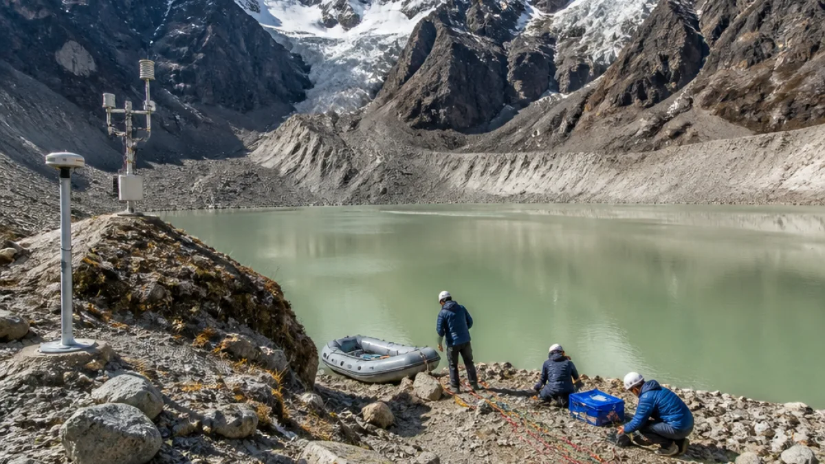
The Sikkim government's department of science and technology led a multidisciplinary field expedition to study selected high‑risk glacial lakes in Mangan district between 23 July and 8 August, officials reported. The mission collected comprehensive physical and meteorological data intended to support Glacial Lake Outburst Flood (GLOF) hazard and risk assessment, long‑term monitoring and lake‑specific mitigation planning.
Context and purpose
The exercise follows the October 2023 GLOF triggered by the outburst of South Lhonak Lake, which caused widespread damage in parts of the Himalayan state. According to officials, the latest expedition aimed to produce critical baseline information on lake morphology, surrounding terrain and hydrology to enable improved early warning and mitigation measures.
“The scientific information generated through the expedition will support detailed assessment of lake characteristics and surrounding terrain, hydrodynamic modelling, identification of potential GLOF hazards, long‑term monitoring and the development of lake‑specific comprehensive GLOF hazard mitigation plans,”
Who took part and how the work was done
The team combined expertise from state and central agencies as well as academic institutions. Participants included personnel from the department of science and technology, the Sikkim State Disaster Management Authority (SSDMA), the department of mines and geology, Sikkim University and the Sikkim Commission on Glacial Hazards. Technical partners named were the Centre for Development of Advanced Computing (C‑DAC), Thiruvananthapuram, the Central Water Commission, Gangtok, and the Brahmaputra Board.
The operation was carried out with assistance from the Indian Army and the Indo‑Tibetan Border Police, enabling work at high altitudes and in remote catchments.
Data gathered and techniques employed
Field teams used a mix of geophysical, hydrological and geomorphological methods. Survey and monitoring activities included:
- Electrical Resistivity Tomography (ERT) to investigate subsurface conditions;
- Bathymetric surveys to measure lake depths and volume;
- DGPS surveys for precise positioning of lake limits and terrain features;
- Hydrological measurements of inflows and outflows;
- Geo‑morphological mapping to record landforms and potential failure pathways;
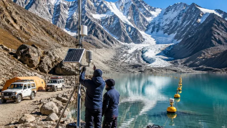
- Deployment of meteorological monitoring stations at high‑altitude sites, including Kerang hamlet and the Goma Chhu catchment.
One station was placed at Kerang, a hamlet at about 16,700 feet, and monitoring was also initiated at Goma Chhu, a glacier‑fed river in the state's northern reaches.
| Expedition element | Details |
|---|---|
| Duration | 23 July–8 August |
| Primary focus | High‑risk glacial lakes in Mangan district |
| Main techniques | ERT, bathymetry, DGPS, hydrology, geomorphology, meteorological monitoring |
| Supporting agencies | Indian Army, ITBP, C‑DAC, CWC (Gangtok), Brahmaputra Board, SSDMA |
Expected outcomes and local implications
Officials said the scientific datasets produced by the expedition will underpin hydrodynamic modelling and site‑specific hazard mapping. That information is intended to inform early warning systems and mitigation measures such as controlled lake drainage, stabilisation of moraine dams, and land‑use planning in downstream villages.
For local communities, the data could translate into clearer evacuation routes, targeted installation of monitoring instruments and improved preparedness planning by disaster management agencies. The multidisciplinary approach is designed to link physical measurements with operational decisions by the SSDMA and other authorities.
Next steps
Authorities will now process and analyse the field data to produce hazard assessments and monitoring recommendations. The expedition report is expected to feed into longer‑term mitigation strategies and coordination between state, central and security‑force partners active in the high Himalaya.
Given the complex interplay of glacial dynamics, extreme weather and steep Himalayan terrain, officials emphasised the need for continuous monitoring and periodic re‑assessment of vulnerable lakes as climate and cryospheric conditions evolve.