GANGTOK: A multidisciplinary scientific expedition carried out a comprehensive assessment of selected high‑risk glacial lakes in North Sikkim’s Mangan district between July 23 and August 8, the state Department of Science and Technology (DST) said on Tuesday. The field work is intended to provide baseline information for Glacial Lake Outburst Flood (GLOF) hazard and risk assessment, monitoring and mitigation planning.
Scope and objectives
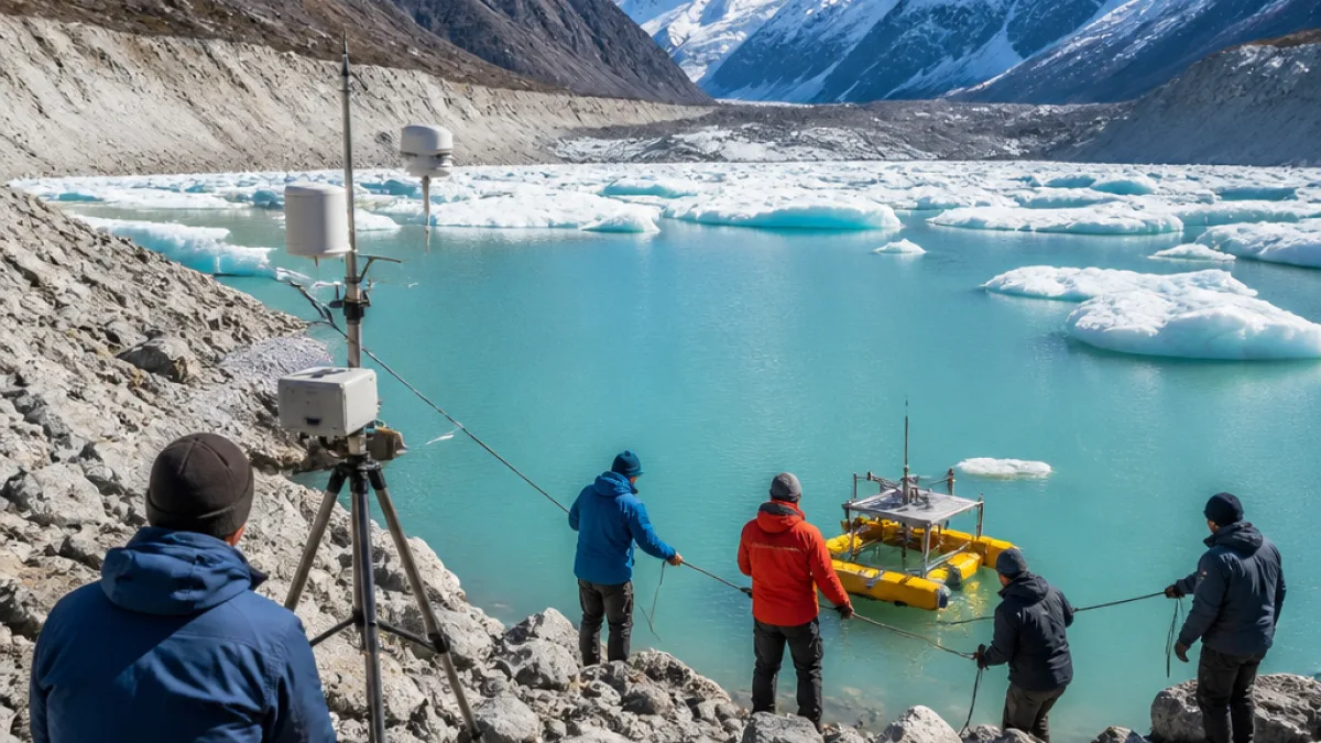
The expedition was planned to collect an integrated set of observations on lake and catchment behaviour, combining bathymetric, geological, geophysical, hydrological, geomorphological and meteorological measurements. According to the DST, the data will support assessments of lake morphology, surrounding terrain stability, hydrodynamic modelling and the development of lake‑specific mitigation plans for the state government.
Participating agencies and team composition
The team included scientists, researchers and technical staff from a range of state and central bodies: the Department of Science and Technology (Sikkim), Sikkim State Disaster Management Authority (SSDMA), Department of Mines and Geology (DMG), Sikkim University, the Sikkim Commission on Glacial Hazards, C-DAC, Trivandrum, Central Water Commission, Gangtok, Brahmaputra Board, Guwahati and Campbell Scientific, New Delhi. The DST described the exercise as multidisciplinary to reflect the varied technical expertise involved.
Techniques and field measurements
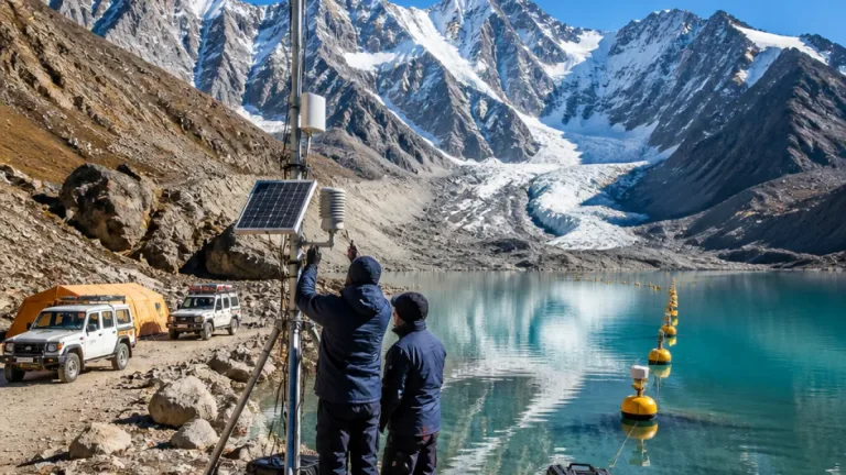
Field teams employed several advanced and field‑based methods. These included Electrical Resistivity Tomography (ERT) to probe subsurface materials, bathymetric surveys to measure lake depths and volumes, DGPS surveys for precise positioning, hydrological gauging, geomorphological mapping and the deployment of a meteorological monitoring station at Kerang and on the Goma Chhu.
| Method | Primary purpose |
|---|---|
| Bathymetry | Establish lake depth and volume estimates |
| Electrical Resistivity Tomography (ERT) | Characterise subsurface sediments and permafrost/ice content |
| DGPS surveys | Accurate mapping of lake rims and catchment features |
| Meteorological station | Continuous local weather data for hydrological modelling |
Outputs and intended use of data
The DST said the datasets produced during the expedition will underpin detailed analyses of lake characteristics and terrain, feed into hydrodynamic modelling of possible outburst scenarios and assist in long‑term monitoring design. Ultimately, the information will contribute to developing Comprehensive GLOF Hazard Mitigation Plans tailored to individual lakes for the Government of Sikkim.
Why this matters for Sikkim
Glacial lakes in the high Himalaya can pose significant downstream risks if natural dams fail, producing sudden floods known as GLOFs. Detailed scientific characterisation of vulnerable lakes — including their depth, volume, dam structure and surrounding geology — is a prerequisite for credible hazard assessments and effective early warning or engineering interventions. The new meteorological and hydrological records will also improve local models of how rapid warming or extreme precipitation could influence lake stability.
Next steps and monitoring
The DST indicated that the expedition’s scientific outputs will be used to identify potential hazards, design monitoring regimes and inform mitigation planning. The involvement of state disaster management and central water agencies suggests the datasets will be considered for both scientific assessment and operational planning. The deployment of a meteorological station at identified points is an initial step toward continuous observation.
- Expedition period: July 23–August 8
- Focus area: selected high‑risk glacial lakes in Mangan district, North Sikkim
- Main technical activities: bathymetry, ERT, DGPS, hydrological measurements and meteorological monitoring
Officials described the field campaign as generating critical baseline information for hazard assessment and mitigation, though the DST note did not list the names of individual lakes studied or release quantitative results from the surveys. Further technical reports and analyses are expected to follow as the data are processed and model runs are completed.