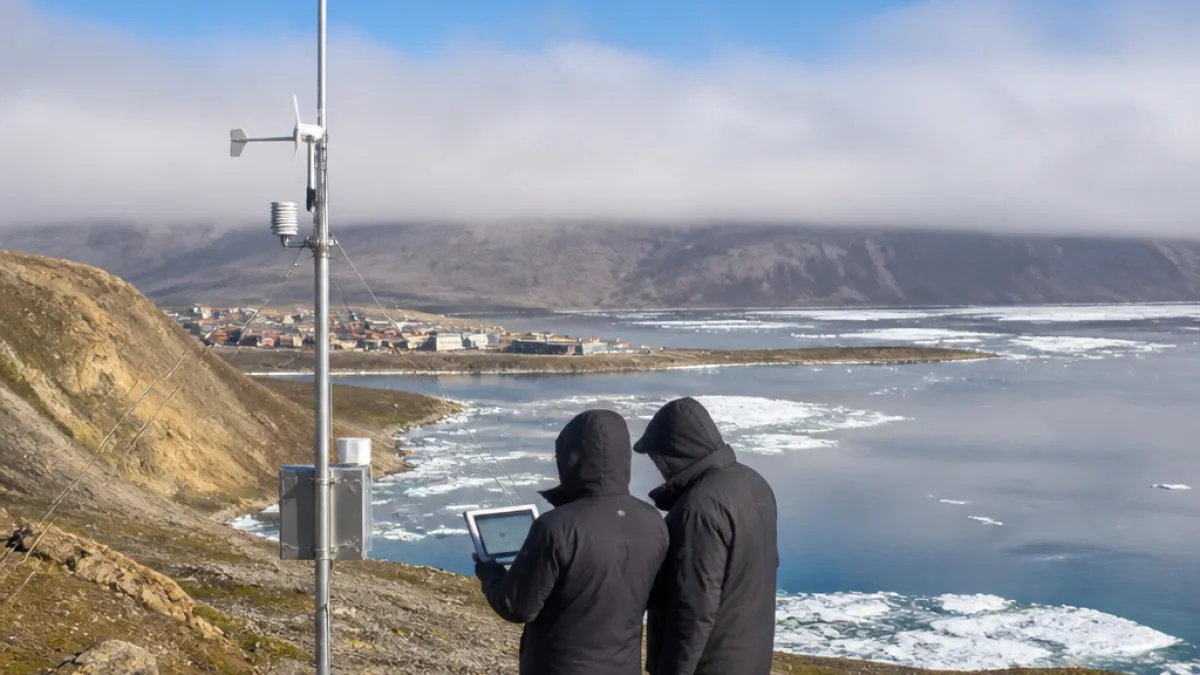
A newly installed weather station about five kilometres east of Grise Fiord is providing residents with live observations of fog, sea ice and coastal conditions while feeding a three-year research project that will study storm-driven erosion in Jones Sound.
Local tool, research purpose
The 10-metre meteorological mast, erected last month, streams images and environmental data through the Northern and Arctic Coastal Research Lab’s website. Community officials say the information is already being used to make safer travel decisions.
“So we went ahead to clear skies,”
said Marty Kuluguqtuq, Grise Fiord’s assistant senior administrative officer, describing how he checked the station’s live view when fog settled over the hamlet. He added the station provides “actual, tangible assistance in real time.”
The installation is part of a larger project led by Terry Noah, owner of local outfitting business Ausuittuq Adventures. The initiative has received $300,000 over three years from ArcticNet, a national non-profit network, to examine how storms are reshaping coasts and influencing ocean conditions in Jones Sound.
Funding and program links
ArcticNet announced the funding as part of a broader award package supporting Indigenous- and northern-led research across Inuit Nunangat and the Canadian North. Noah’s station is also one of seven projects to receive a portion of $1.6 million over three years through the Inuit Qaujisarnirmut Pilirijjutit program.
| Funding source | Amount | Purpose / duration |
|---|---|---|
| ArcticNet | $300,000 | Storm-driven coastal erosion study — 3 years |
| Inuit Qaujisarnirmut Pilirijjutit | Portion of $1.6M | Support for 7 northern projects — 3 years |
Impact on local hunting and access
Residents of Grise Fiord — Nunavut’s northernmost hamlet — depend on visual and local knowledge to plan outings for hunting and travel. Kuluguqtuq noted that a beach used to park small boats has become noticeably steeper over the past decade because of coastal erosion. Without a small craft harbour or floating docks, people continue to beach boats and are subject to tides and storm-driven changes.
The hamlet is pursuing construction of a small craft harbour with floating docks, a ramp and a breakwater to improve safety and access. Officials say the harbour project is scheduled for completion in 2029.
What residents will gain
The weather station provides:
- near real-time visual confirmation of fog, sea ice and visibility conditions;
- instrument data useful to researchers studying waves, wind and erosion;
- local evidence to support infrastructure planning and emergency decision-making.
For remote communities where weather can change rapidly and satellite imagery may not capture local detail, an on‑the‑ground camera and sensors can make the difference between delaying travel or proceeding safely.
Research questions and community knowledge
The project aims to better understand how storm events — their frequency, intensity and timing relative to sea ice conditions — are accelerating shoreline change. That work is directly relevant to community priorities: protecting access points for boats, preserving camps and travel routes, and informing future coastal infrastructure.
Locally led research and partnerships are increasingly seen as necessary for combining scientific monitoring with Inuit Qaujimajatuqangit — traditional knowledge — to interpret environmental change in the Arctic context. Having a station installed and operated by a local outfitter provides both data continuity and community connection to the research.
As the station continues to deliver live images and measurements, researchers and residents will have a shared resource for tracking storm impacts and planning safer movement along the coast. In a region where minutes can matter for travel safety, that information is valuable for hunters, municipal staff and emergency responders alike.
Ongoing monitoring will also produce a data record that can inform engineering choices for the planned harbour and other coastal adaptations, helping Grise Fiord face the accelerating coastline changes of the Arctic.