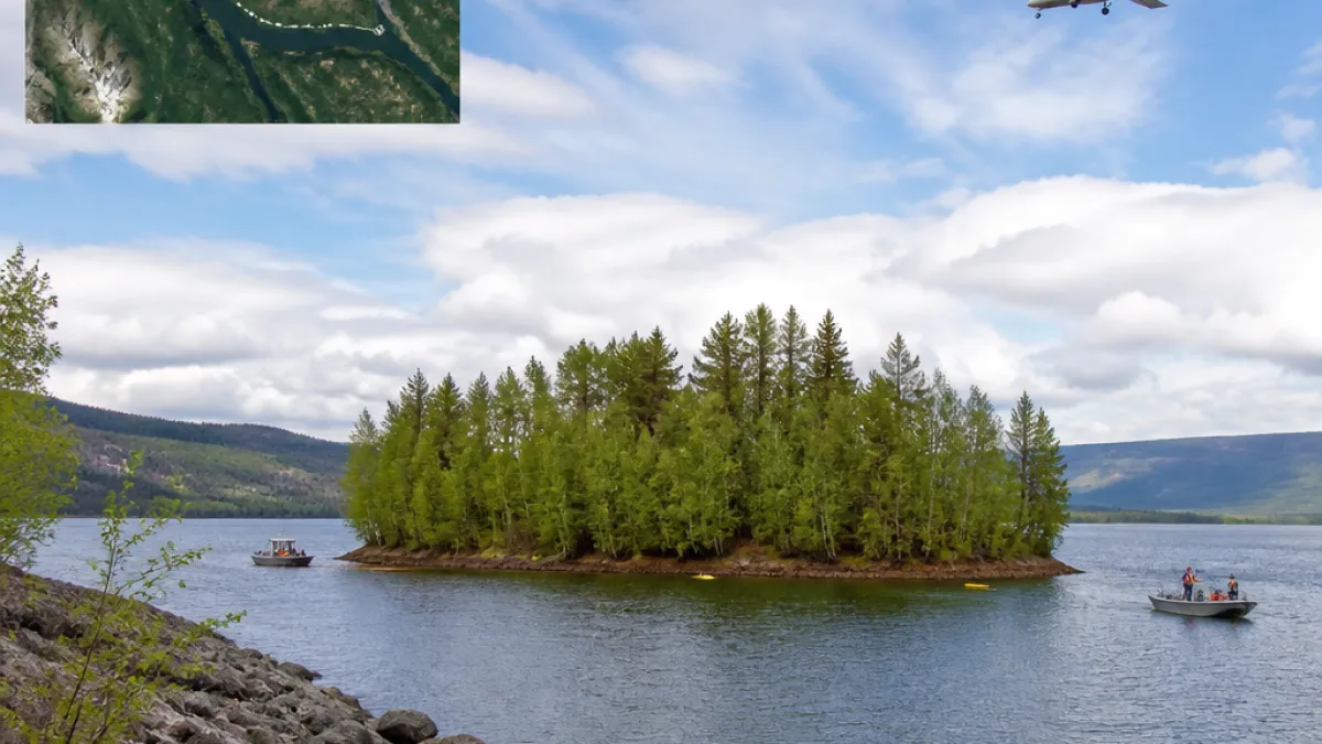
BC Hydro says the mystery of a tree-covered floating island that briefly captured international attention has been solved: the vegetated mass has been located on the Ospika Arm of Williston Reservoir, roughly 30 kilometres northwest of where it was first reported near Finlay Bay, close to Mackenzie.
How the island was found
The utility says the feature was first brought to its attention on Aug. 13, after receiving photographs and video believed to have been taken on or around July 21. Initial reports said the island was last seen west of Finlay Bay before it disappeared from view and became the subject of widespread curiosity.
BC Hydro confirmed the island’s location on Aug. 31 after reviewing satellite imagery dated Aug. 15, together with observations from small aircraft and reports from boaters. The utility estimates the island drifted about 30 kilometres over 15 days before settling against the shoreline on the Ospika Arm.
“When we first received photos and video of a floating island covered in trees, we weren’t entirely convinced,” BC Hydro community relations manager Bob Gammer said. “In the age of AI, it’s important to verify unusual reports before drawing conclusions.”
Size and condition
BC Hydro reports the island appears intact and supports established vegetation. Its dimensions are estimated at 70 metres wide by 140 metres long — an area the utility likened to about the size of two football fields.
The feature’s unusual appearance and mobility prompted attention from national and international media outlets. The CBC first reported the story on Aug. 29, and it was subsequently picked up by outlets including the BBC, The New York Times, National Geographic and others.
Why it mattered
BC Hydro said the episode drew interest not only from the public and media but also from scientists studying how floating vegetated islands form and move. The combination of remote sensing, aviation observations and reports from recreational boaters demonstrates how different sources of information were used to verify an unusual natural occurrence.
- First awareness: Aug. 13, photos and video received by BC Hydro (media said images taken around July 21).
- Public reporting: CBC story published Aug. 29.
- Location confirmed: Aug. 31, using satellite imagery dated Aug. 15.
- Estimated movement: ~30 km over 15 days.
- Estimated size: 70 m × 140 m (about two football fields).
Local geography and context
The Williston Reservoir, created by the W.A.C. Bennett Dam, is one of British Columbia’s large inland reservoirs. BC Hydro noted the island’s final resting place is farther away from the dam than its initial sighting near Finlay Bay. The Ospika Arm is a remote shoreline area northwest of the original report.
Floating vegetated islands are not common events in many parts of Canada, but they can form where mats of soil, roots and vegetation detach and remain buoyant. Those who observed or captured the island in photos and video helped prompt the investigation and eventual confirmation.
What remains unclear
BC Hydro confirmed the island’s position and general condition but has not offered a detailed explanation of the precise mechanism that caused the island to detach, nor predictions about its future stability or movement. Scientists studying similar features may draw on this episode and the imagery available to better understand formation and drift patterns.
| Item | Date | Detail |
|---|---|---|
| Photos/video believed taken | ~July 21 | Initial imagery reported to BC Hydro |
| BC Hydro notified | Aug. 13 | Photos and video received |
| Public reporting | Aug. 29 | CBC story led to wider media coverage |
| Location confirmed | Aug. 31 | Satellite imagery dated Aug. 15 used to verify island |
For residents and visitors on reservoirs and inland waters, the episode is a reminder of the value of careful observation and of corroborating unusual sightings with multiple sources — satellite data, aviation observations and eyewitness reports — before drawing conclusions. BC Hydro emphasised the need to verify reports in an era of sophisticated image manipulation.
The floating island has now been documented and located; whether it will remain anchored against the shoreline or move again remains to be seen by those monitoring the reservoir and by researchers interested in these rare natural phenomena.