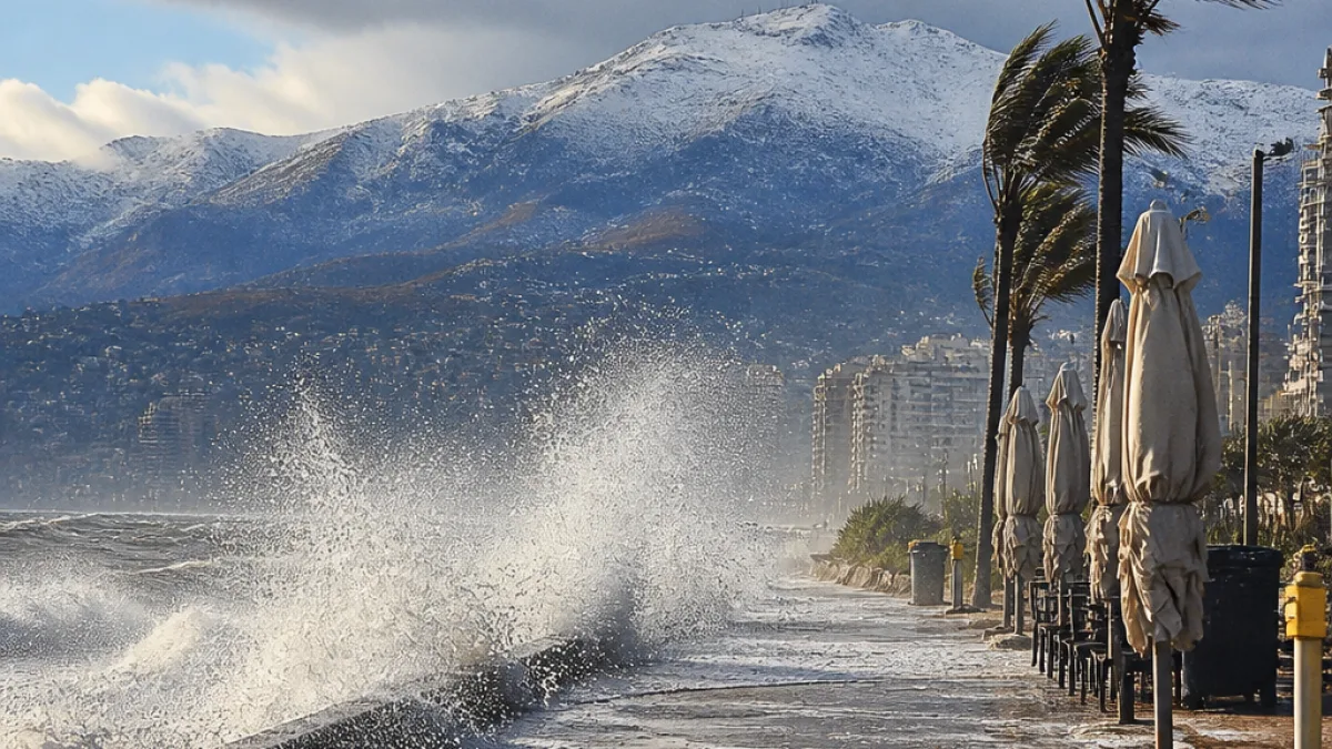
A harsh winter weather system is set to sweep across KwaZulu-Natal on Tuesday, bringing widespread rain, strong and potentially damaging winds, and very cold conditions. The South African Weather Service (SAWS) warns that the storm could disrupt travel and coastal activity and that the western high-lying areas of the province may see snowfall.
Where and how severe
Rainfall probabilities are highest along the eastern parts of the country. For KwaZulu-Natal specifically, SAWS forecasts a 60% chance of rain, increasing to widespread falls along the coast. Snow is expected over the western high ground of KwaZulu-Natal, while lighter snowfall may occur in the Lesotho-border areas of neighbouring provinces.
Strong winds accompanying the system are likely to worsen the cold conditions. Along the KZN coastline, SAWS cautions that damaging winds and rough seas could disrupt recreational and commercial activities and affect navigation.
Local impacts and preparedness
The timing and intensity of the system mean residents, motorists and those working at sea should take precautions:
- Expect slippery roads, reduced visibility and possible temporary road closures in higher-lying districts.
- Those planning coastal outings or maritime activities should postpone where possible; harbour masters and small-boat operators should take heed of rough-sea warnings.
- Farmers and livestock owners in exposed, high-altitude areas should secure animals and feed supplies against the cold and wet conditions.
Motorists are advised to check weather and road updates before travelling and to carry warm clothing, emergency supplies and a charged phone. If encountering heavy snow or drifting conditions in the western high ground, drivers should not try to force through blocked roads.
What other provinces will see
The wider system will affect much of the eastern half of the country. SAWS gives these odds for rain and showers:
| Province / Area | Chance of rain / showers |
|---|---|
| Mpumalanga | 60%–80% (widespread) |
| KwaZulu-Natal | 60% (increasing to widespread on the coast) |
| Eastern Cape (eastern parts) | High – with disruptive snowfall in parts |
| Gauteng | 30% (scattered showers) |
| Free State | 30%, rising to 60% in eastern areas |
In the Eastern Cape, SAWS has issued an Orange Level 6 warning for disruptive snowfall in places such as Emalahleni, Sakhisizwe, Senqu, Elundini and Matatiele. While KZN is not under an Orange warning, the province faces its own risks from strong winds, rough seas and very cold temperatures.
Practical advice for Durban and surrounding areas
Durban’s lower-lying coastal areas will feel the impact primarily through heavy rain and strong onshore winds rather than snow. Local authorities and emergency services advise residents to:
- Secure loose outdoor items that could be blown away by strong gusts.
- Avoid beachfront promenades during gale conditions and obey any temporary closures.
- Monitor local weather updates from SAWS and advisories from the municipality.
Public transport users should expect possible delays and should allow extra travel time. Schools, businesses and event organisers should consider contingency plans if conditions deteriorate.
SAWS emphasises that very cold temperatures will be felt across Gauteng, Mpumalanga, the Free State, KwaZulu-Natal and much of the Eastern Cape, and that strong winds will exacerbate the chill factor.
Stay tuned to official SAWS warnings and local emergency services for updates. If conditions become hazardous, follow instructions from authorities and prioritise safety.