Strong system to bring snow to high-lying KZN and coastal rain and winds
A powerful winter weather system is set to sweep across large parts of South Africa on Tuesday, with snow, heavy rain, strong winds and bitterly cold temperatures expected, the South African Weather Service (SAWS) has warned. While the Eastern Cape is likely to experience the most severe snowfall, the system will also affect KwaZulu‑Natal (KZN), particularly the western high ground and the coast.
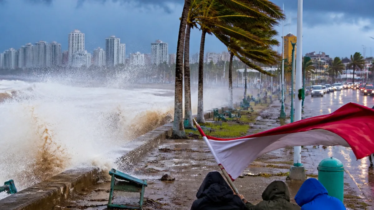
The weather service said snowfall is expected over the high‑lying regions of the Eastern Cape and the western high ground of KwaZulu‑Natal, with lighter falls possible along Lesotho border areas of the Free State. Along the KZN coastline, damaging winds and rough seas could disrupt coastal activities and navigation.
Rainfall chances will be highest along the eastern parts of the country. SAWS gave the following broad probabilities for rain and showers:
- Mpumalanga: 60%–80% chance of widespread rain and showers
- KZN and eastern Eastern Cape: about 60% chance of rain, increasing to widespread falls along the coast
- Gauteng: 30% chance of showers and rain
- Free State: 30% chance of showers, rising to 60% in eastern areas
- Limpopo and North West: isolated to scattered showers; North West cool and windy with isolated thundershowers
| Province / area | Expected conditions |
|---|---|
| Eastern Cape (high-lying) | Heavy snowfall; major traffic disruptions and possible temporary road closures |
| KZN (western high ground) | Snow possible; very cold conditions inland; damaging winds and rough seas along coast |
| Mpumalanga | Widespread rain and showers (60%–80%) |
| Gauteng & Free State | Cold with scattered rain; showers more likely in eastern Free State |
SAWS warned that strong winds will exacerbate the cold and could cause damage. Gale‑force winds are also expected along parts of the Western Cape coast later in the day. In coastal KZN, rough seas and damaging winds may affect navigation and port or beach activities.
Risks, likely impacts and what residents should do
The weather service highlighted several potential impacts, including:
- Major traffic disruptions and temporary road closures in areas seeing heavy snow;
- Isolated communities becoming inaccessible where snowfall is heavy;
- Disruption to coastal activities and navigation due to damaging winds and rough seas;
- Increased risk of vehicle accidents from icy or flooded roads and reduced visibility.
Motorists, farmers and residents in affected areas were urged to take precautions. SAWS specifically advised people to prepare for cold conditions and to heed local municipal, road‑agency and emergency‑services instructions.
Practical steps to consider:
- Check road and weather updates before travelling; expect delays and possible closures on mountain passes and rural routes.
- Keep warm clothing, blankets and a charged cellphone in vehicles; carry food and water if travelling through high ground.
- Avoid coastal recreation while gale‑force winds and rough seas are forecast; stay clear of the seafront where waves may be large.
- Protect livestock and sensitive crops from frost and cold; secure loose outdoor items that strong winds could dislodge.
Authorities and rescue services are likely to be busy in the coming hours and days. Residents in remote or high‑lying areas should make contingency plans for possible temporary isolation and follow municipal alerts on road accessibility. Motorists should treat conditions as hazardous and only travel if necessary.
SAWS emphasised that the combination of snow, rain and strong winds could lead to rapid changes in conditions. Those in the path of the system should monitor forecasts and warnings issued by the weather service and heed advice from local emergency management.
Stay tuned to local traffic and weather bulletins for updates and to find out when it will be safe to resume normal activities.