
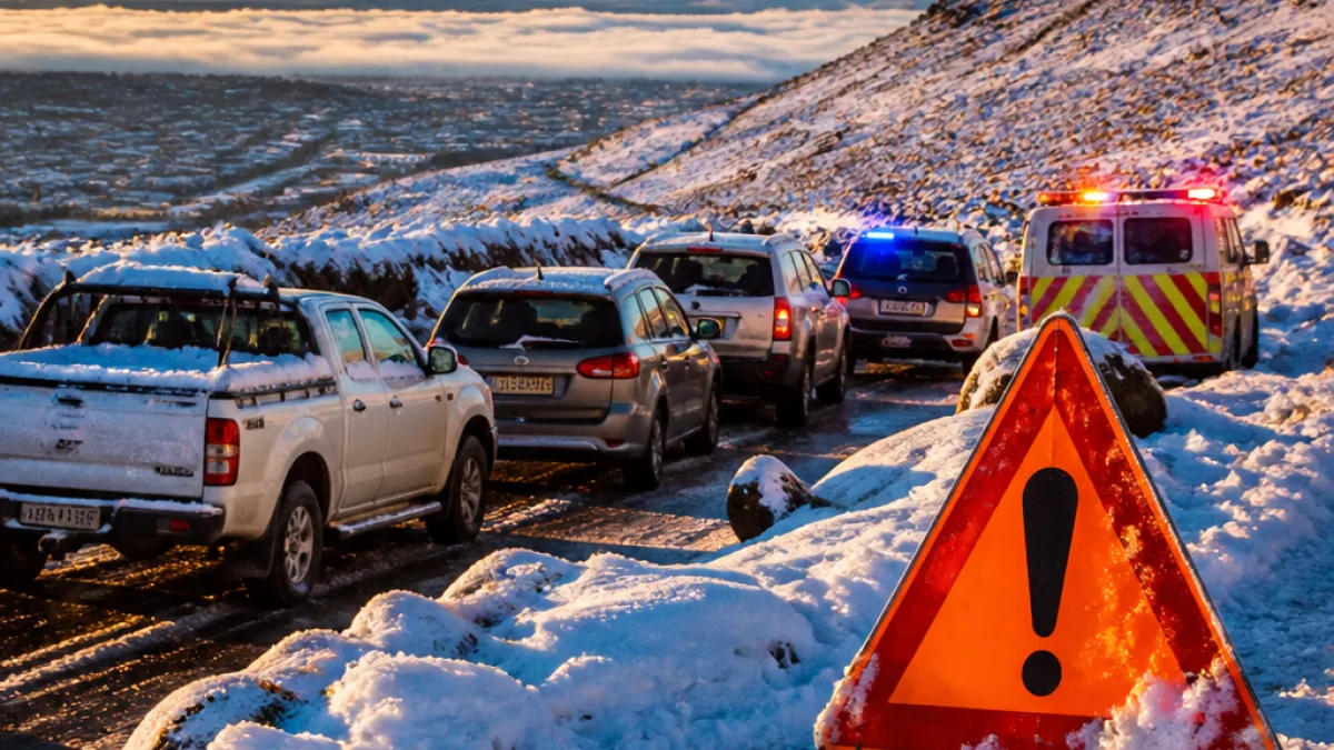
Snow and sleet on high ground in the Eastern Cape this week drew dramatic headlines after the South African Weather Service (SAWS) issued an Orange Level 6 disruptive snow warning for sections of the province. Authorities warned of major traffic disruption and communities becoming temporarily inaccessible, but forecasters said the system did not match the severity of the September 2024 event widely remembered as "Snowtember".
Where the warning applied
SAWS applied the Orange Level 6 advisory to the province’s Emalahleni, Sakhisizwe, Senqu, Elundini and Matatiele municipalities. Roads on high-lying passes and rural access routes were the main concern, with local authorities and emergency services put on alert to assist stranded motorists and isolated communities.
| SAWS alert level | Effect |
|---|---|
| Level 6 (Orange) | Disruptive snow; likely major traffic disruption and temporary inaccessibility |
| Level 8 (Red) — Sept 2024 | Severe, life-threatening snow systems; multi-province impact and large-scale rescues |
SAWS perspective and the 2024 benchmark
While the week’s weather produced heavy snowfalls in affected parts, SAWS forecasters emphasised the system was significant but not exceptional in the context of South African winters. As one forecaster put it:
"The system itself, while significant, was not out of the ordinary for a South African winter."
This contrasts with the system that struck in September 2024, referred to at the time as "Snowtember", when SAWS issued a Level 8 warning. That event shut the N3 Toll Route between Estcourt (KwaZulu-Natal) and Harrismith (Free State) for nearly two days, left motorists stranded for more than 14 hours in freezing conditions and affected five provinces. The 2024 response required a full multi-agency rescue and recovery operation to clear vehicles from Van Reenen’s Pass.
Why the comparison matters
Comparing this week’s Orange Level 6 event with the Level 8 benchmark from 2024 gives local residents and emergency planners a clearer view of risk. It helps avoid complacency in milder winters while preventing overreaction to disruptive but manageable weather systems. For communities on the high inland escarpment, even routine snow can cut off access to services and disrupt supply lines.
- Transport: High-altitude passes and rural routes remain vulnerable to closure during heavy snow and sleet.
- Emergency response: Local disaster management centres should be ready to assist isolated households and motorists.
- Community preparedness: Households in affected municipalities are reminded to keep emergency supplies and to avoid travel if conditions deteriorate.
Local impact and practical advice
Municipal road crews and traffic authorities typically prioritise provincial routes and known arterial passes, but smaller access roads can remain treacherous for longer. Motorists should:
- Check SAWS forecasts and traffic updates before travel;
- Avoid driving on untreated mountain passes in snow or sleet;
- Carry warm clothing, food and a charged phone if travel is essential;
- Report road obstructions or stranded vehicles to local emergency numbers so rescue services can be deployed.
Local health and disaster management centres often coordinate with the South African Police Service and municipal services during snow events. Where communities become temporarily inaccessible, authorities typically work to restore access as soon as road conditions permit.
Weather watch as winter progresses
Forecasters caution that although this week’s system was not comparable to the 2024 Level 8 event, severe winter systems can still occur. Residents of the high-lying interior of the Eastern Cape should remain alert to SAWS warnings as winter progresses and plan travel and essential supplies accordingly.
The recent Orange Level 6 advisory was a reminder that in this province, even an average winter front can have serious local consequences for transport and community access. Keeping a clear sense of historical benchmarks such as the 2024 event helps communities and planners calibrate their responses to future storms.












