
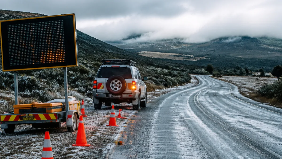
The South African Weather Service (SAWS) has downgraded this week’s disruptive snow warning in the Eastern Cape to an advisory, saying the system that produced dangerous snow and icy conditions is now easing but that very cold weather and slippery roads persist across several highland municipalities.
Where the risk remains highest
SAWS highlighted five Eastern Cape municipalities where cold and icy conditions are still expected: Emalahleni, Sakhisizwe, Senqu, Elundini and Matatiele. The move reduces the threat level from Tuesday’s more severe Orange Level 6 disruptive snow warning to a lower advisory status on Thursday, 13 August.
"easing doesn’t always mean"
The agency cautioned that, although the system has weakened, higher-ground communities remain vulnerable to localised freezing and hazardous travel conditions. The advisory alerts motorists, municipal teams and schools to continued risks rather than signalling the end of the event.
What else SAWS is monitoring
Beyond the Eastern Cape, SAWS issued a Yellow Level 2 warning for damaging interior winds and dust over parts of the northern West Coast District, Witzenberg municipality and Namakwa district until Thursday evening. The service also warned of extremely high fire danger in parts of the Northern and Western Cape, including Nama-Khoi, Hantam, Matzikama and Cederberg.
Nationally, SAWS forecast generally cloudy, cool to cold conditions across much of the interior:
- Gauteng: cloudy and cool to cold.
- Mpumalanga and Limpopo: morning fog over the escarpment, then cloudy to partly cloudy with isolated showers in the east.
- Free State and North West: cloudy and cold, with morning fog in parts.
- Northern Cape: fine and warm in the extreme west, but windy and cool elsewhere.
- Western Cape: generally fine, cool to warm with some cloud in the northeast.
Local impacts and practical advice
Although the advisory is a step down from an Orange disruptive warning, the conditions it describes can still impede travel, affect road safety and strain municipal services in smaller towns and rural highland communities. Motorists and travellers should plan for slower journeys and allow extra time.
- Expect icy patches on mountain passes and rural roads during early mornings and after sunset; reduce speed and increase following distances.
- Municipal road crews may need more time to treat affected routes; contact local traffic services for real-time road status.
- Residents with rooftop water systems or exposed pipes should insulate vulnerable plumbing to reduce freezing risk.
- People in isolated highland areas should ensure they have fuel, warm clothing and an emergency kit if travel becomes necessary.
Schools and community centres in the named municipalities should stay in contact with district emergency management structures and municipal offices to decide on closures or adjustments to services based on local conditions.
Summary table of current warnings
| Area | Current status |
|---|---|
| Emalahleni (EC) | Advisory – very cold conditions; icy/slippery roads |
| Sakhisizwe, Senqu, Elundini, Matatiele (EC) | Advisory – very cold, icy road risk |
| Northern West Coast District, Witzenberg, Namakwa | Yellow Level 2 – damaging interior winds and dust |
| Nama-Khoi, Hantam, Matzikama, Cederberg | Very high fire danger warned |
Why the warning changed
SAWS said the system has tracked through in stages: intense disruptive snow and hazardous conditions earlier in the week gave way to a lighter high-ground snow risk on Wednesday and further weakened to an advisory by Thursday. That progression reflects changing upper-air conditions and the retreat of the coldest air mass, but residual pockets of freezing temperatures can remain over the high veld and mountain passes.
Residents are advised to keep monitoring SAWS products and local municipal channels for updates. Road users can contact provincial traffic authorities for route-specific information, and communities should ensure vulnerable neighbours have access to shelter and warmth while temperatures remain low.
For travellers planning to use major mountain passes or drive between towns in the listed municipalities, allow extra time, check tyres and vehicle heaters, and consider postponing non-essential trips until conditions improve.
Local authorities and emergency services will continue to assess conditions and update warnings if the situation deteriorates or improves further.












