
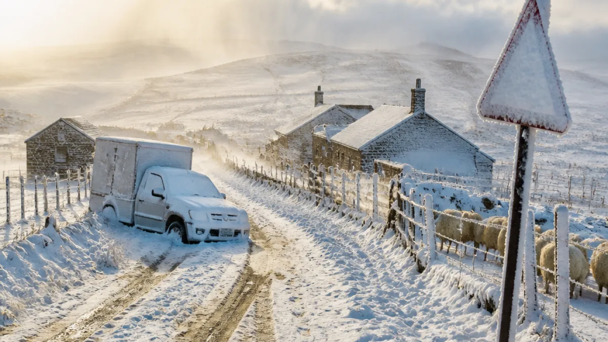
Parts of the Eastern Cape have been placed under an Orange Level 6 disruptive snow warning as a cold front and cut-off low bring heavy snow, damaging winds and rain that could make some communities temporarily inaccessible and affect livelihoods.
What the warning says
The South African Weather Service (SAWS) has issued an Orange Level 6 warning for disruptive snow covering the Chris Hani District and the Senqu, Elundini and Matatiele municipalities. The advisory is expected to remain in force until Tuesday, 11 August.
SAWS forecasts that the snow and associated conditions could lead to major traffic disruptions, isolated livestock and crop losses, and interruptions to services where access routes are affected.
Where impacts are likely
In addition to the Level 6 areas, a Yellow Level 2 disruptive snow warning applies to other parts of the Eastern Cape, the eastern and southern Free State along the Lesotho border, and western KwaZulu‑Natal. Municipalities in the Eastern Cape covered by a Yellow Level 2 include:
- Dr Beyers Naudé
- Blue Crane
- Raymond Mhlaba
- Amahlathi
- Intsika Yethu
- Dr AB Xuma
- Mhlontlo
- Mzimvubu
A Yellow Level 2 warning for disruptive rain is in place for Nyandeni, Port St Johns, Ingquza Hill and Bizana municipalities, as well as parts of southern and western KwaZulu‑Natal. That rain could cause localised flooding of vulnerable settlements, roads and bridges.
Damaging winds and coastal hazards
SAWS has also issued a Yellow Level 4 warning for damaging winds and coastal waves along the KwaZulu‑Natal coast, which could:
- Disrupt small harbours and coastal navigation
- Create hazardous conditions for coastal activities
- Cause damage to infrastructure and settlements
- Create the risk of flying debris
Separately, a Yellow Level 4 damaging wind warning covers the KZN coast and the north‑eastern adjacent interior.
Secondary hazards: thunderstorms and local flooding
Severe thunderstorms capable of localised damage are expected over parts of the extreme southern North West, north‑eastern Free State and southern Gauteng. In the Eastern Cape, heavy rain warnings highlight the risk of localised flooding that may disrupt roads and bridges and affect informal and formal settlements.
| Warning level | Primary hazard | Likely impacts |
|---|---|---|
| Level 6 (Orange) | Disruptive snow | Major travel disruptions; temporary inaccessibility of communities; impacts on livelihoods |
| Level 4 (Yellow) | Damaging winds and waves | Damage to infrastructure; hazardous coastal navigation; risk of flying debris |
| Level 2 (Yellow) | Snow / Rain | Localised traffic disruption; isolated livestock and crop losses; local flooding |
What residents and motorists should do
- Monitor official SAWS updates and local municipal advisories.
- Avoid non‑essential travel in affected areas until the warning is lifted.
- If you must travel, allow extra time, keep lights on, reduce speed and be prepared for long delays.
- Rural residents with livestock should take measures to protect animals and stock feed where possible.
- Coastal communities and fishers should heed marine warnings and avoid venturing into small harbours during high winds and waves.
Local services and preparedness
The scale of the Level 6 warning means municipal disaster management, road authorities and emergency services in affected districts will need to prepare for road closures, search and rescue support and humanitarian assistance where accessibility is compromised. Residents in isolated settlements should ensure they have essential supplies and a way to communicate if roads become impassable.
SAWS emphasises that while Level 2 advisories typically indicate localised impacts, Level 6 warnings denote significant disruption and require heightened readiness by both authorities and communities.
Authorities and transport operators are expected to issue route advisories and closures as conditions develop. Motorists are advised to check with local traffic and road agencies before departing and to follow directions from emergency services.
This developing situation could change rapidly; SAWS and municipal channels should be monitored for updated warnings and safety instructions.












