
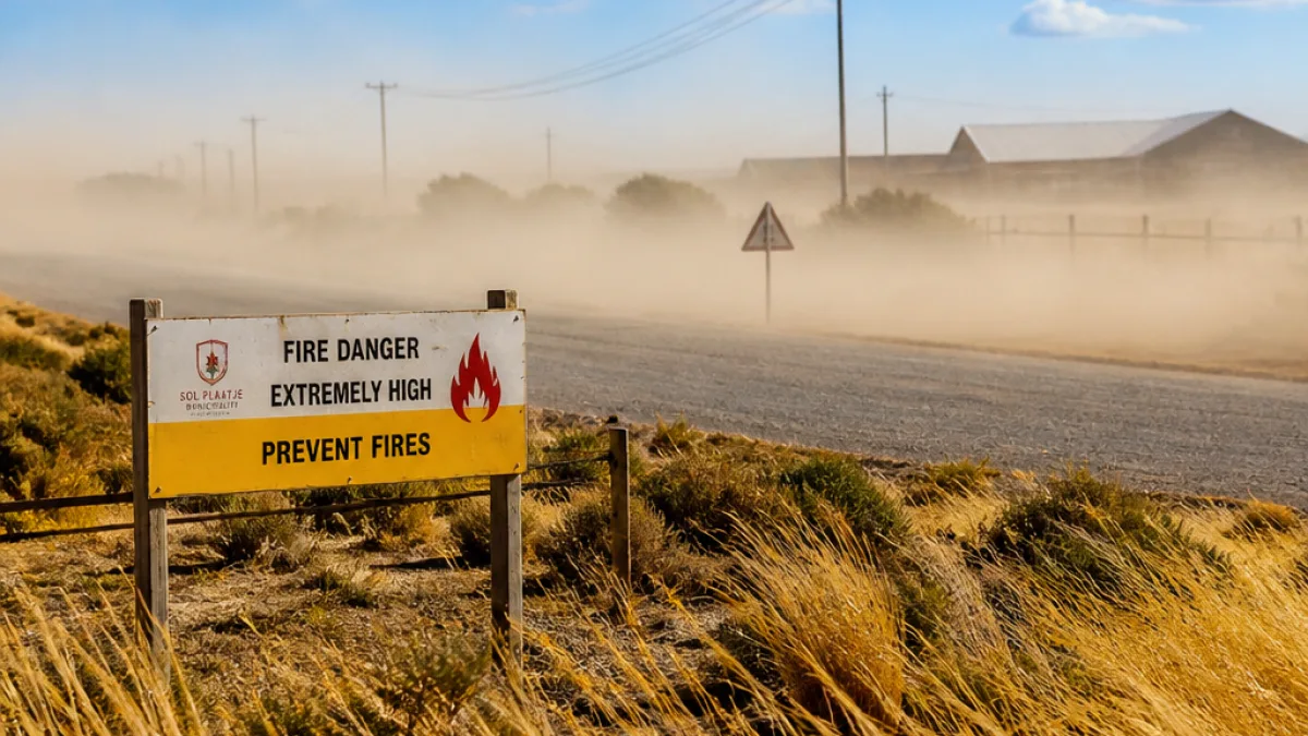
Kimberley, Northern Cape — Cold, windy conditions are spreading across parts of the Northern Cape this week, with the South African Weather Service (SAWS) issuing a range of warnings affecting the province on 13 August 2026. Residents and municipal services in the west and far north of the province are urged to take precautions against wind damage, dust-reduced visibility and a heightened fire risk.
What the warnings say
SAWS has placed a Yellow Level 2 warning for damaging winds covering the northern parts of the West Coast District and the Namakwa District in the Northern Cape. The winds could cause localised damage to temporary structures and reduce visibility due to dust storms, the weather service said.
“The wind along the coast will be light to moderate north-easterly, freshening from the south in the afternoon,” SAWS said.
The agency also warned of extremely high fire danger conditions in parts of the Northern Cape, specifically naming the Nama‑Khoi and Hantam local municipalities. These combined conditions — strong winds, low humidity and dry vegetation — elevate the risk of rapid fire spread.
Local expected conditions
Across the Northern Cape SAWS forecasted evening coastal fog in places, with generally fine and cool to warm weather in the west and partly cloudy, windy and cool to cold conditions in the eastern parts of the province. Wind directions are expected to shift during the day: easterly to north-easterly along the coast in the morning, becoming light to moderate north‑westerly from the afternoon.
The national outlook issued by SAWS also noted that the central parts of the country can expect fine, cold conditions into Friday and Saturday, with only isolated showers elsewhere.
Practical advice for residents and services
Municipalities, emergency services, farmers and residents in the affected areas are advised to prepare for gusty winds and to take precautions against both wind-related damage and the elevated fire danger. Practical measures include:
- Securing or storing loose outdoor items and temporary structures;
- Avoiding open burning and observing local fire restrictions;
- Monitoring visibility while driving and reducing speed during dust storms;
- Keeping up to date with local authority alerts and SAWS warnings.
Local firefighters and disaster-response teams often increase readiness during such warnings. Residents in Nama‑Khoi and Hantam should be particularly cautious with any activity that could ignite veld fires.
Summary of main warnings
| Warning | Areas affected | Possible impacts |
|---|---|---|
| Yellow Level 2 — Damaging winds | Northern parts of West Coast District; Namakwa District (NC) | Localised damage to temporary structures; reduced visibility due to dust |
| Extremely high fire danger | Nama‑Khoi and Hantam local municipalities (NC) | Rapid fire spread, increased difficulty in firefighting |
| General forecast | Coastal and central Northern Cape | Evening fog on the coast; cool to cold inland; windy |
SAWS emphasised the shifting wind patterns and the potential for rapidly changing conditions along the coast and interior. Local authorities in the Northern Cape and neighbouring Western Cape districts were included in the service’s advisory because the systems driving the wind and fire risk cross provincial boundaries.
Farmers and those living in informal settlements or in areas with a high number of temporary structures should take note of the damaging-wind warning and act to reduce hazards. Those travelling along exposed routes in the northern West Coast and Namakwa districts may experience reduced visibility in dust and should plan accordingly.
Residents can get updated forecasts and warnings directly from SAWS and through municipal emergency channels. The weather service’s outlook for the coming days indicates the cold spell will persist, with partly cloudy and cool conditions elsewhere and only isolated showers expected along the north coast of KwaZulu‑Natal on Friday.
The situation remains fluid; people in affected areas should monitor SAWS updates and heed instructions from local emergency and municipal officials.












