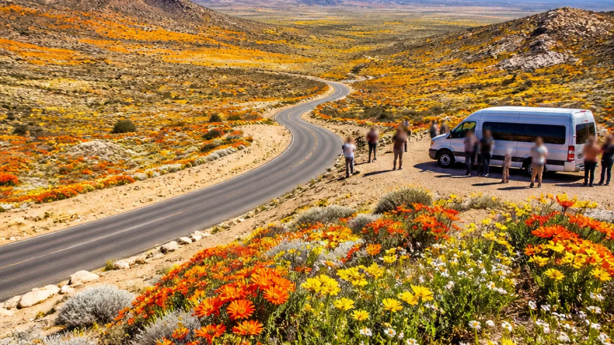
Springbok sits at the heart of Little Namaqualand, a semi-arid landscape that for parts of the year can be transformed from bare, rocky ground into sweeping carpets of wildflowers. The phenomenon draws visitors along established flower routes that radiate from the town into surrounding hills and plains, according to reporting by ad-hoc-news.de.
Where semi-desert becomes colour
The area around Springbok forms the South African portion of a much larger Namaqualand region that extends north into Namibia and follows the western seaboard for more than a thousand kilometres. The wider region is notable for its arid character for most of the year, with plains and low hills of hard rock, sandy soils and sparse scrub. Yet in seasons when rainfall patterns allow, annual plants germinate and produce broad swathes of daisies and other wildflowers across slopes and valley floors.
The patchwork of colour is most evident along roads and inside reserves near Springbok, making the town a practical starting point for people tracing the seasonal routes through Little Namaqualand. Springbok itself is described in the source material as the chief town on the South African side of Namaqualand and the largest settlement in Little Namaqualand.
Extent and terrain
The Namaqualand belt is extensive. The region runs along the west coast of Namibia and South Africa for over 1,000 km and covers an area given as roughly 440,000 km², with the South African portion lying within the Northern Cape province, ad-hoc-news.de reported. Within that broad zone, Springbok and its nearby reserves and plains represent a local environment of semi-desert hills, sandy plains and scattered succulent vegetation.
| Feature | Detail |
|---|---|
| Length of Namaqualand belt | Over 1,000 km |
| Approximate area | 440,000 km² |
| Springbok’s role | Chief town of South African Namaqualand / largest town in Little Namaqualand |
What this means for Springbok
For residents and local businesses, the wildflower season offers both environmental value and a tourism opportunity. The displays vary widely from year to year depending on the timing and amount of rain; when conditions are favourable, visitors arrive to follow mapped routes that showcase the blooms. The concentration of colour can be particularly striking along roads and within protected areas that conserve the fragile vegetation and succulents of the region.
- Springbok serves as the natural base for travellers exploring Little Namaqualand.
- Wildflower displays are seasonal and depend on rainfall patterns.
- Roadside corridors and nature reserves around Springbok are prime viewing areas.
"Namaqualand near Springbok is a semi-arid region where hard ground, scrub and rock can, for part of the year, turn into sweeping bands of wildflower colour," ad-hoc-news.de reported.
Local authorities and tourism operators usually monitor conditions and provide guidance on the best routes and viewing locations when a good season is developing. Residents who use country roads during the season are advised to be mindful of increased visitor traffic and to take care where roadside viewing or parking occurs.
The flowers themselves are part of an ecosystem adapted to aridity, with many annuals and succulents that flourish quickly after rain and set seed before the dry season returns. Conservation-minded visits — staying on designated roads, respecting private land boundaries and taking litter away — help ensure that the displays can be enjoyed in future seasons.
Springbok’s position as the region’s hub means the town will remain an important waypoint for those who plan trips along the Namaqualand flower routes. Local accommodation and services typically see increased activity when conditions produce a memorable bloom, underscoring the connection between the natural spectacle and the town’s small but vital tourist economy.