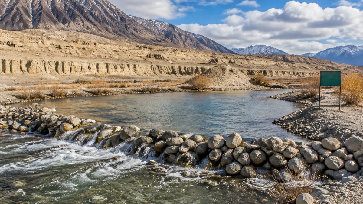
The Ladakh administration on Tuesday unveiled the Union Territory's first rock check dam on the Indus River near Upshi in Leh district, a low‑cost, nature‑based structure intended to improve water conservation, groundwater recharge and irrigation in the region's cold desert landscape.
Design and location
Built entirely from locally available natural rocks without the use of cement or concrete, the barrier is sited roughly 44 km from Leh at an altitude of approximately 11,400 feet. The structure works by slowing river flow, increasing local water retention and raising river depth to enhance short‑term storage and enhance recharge of nearby aquifers.
Project context and objectives
The project has been launched under the Sindhu Jal Samriddhi Abhiyan (SJSA), an initiative focused on strengthening water security in Ladakh. Authorities said the measure aims to:
- increase river water storage and surface availability;
- improve irrigation supplies for adjacent agricultural fields;
- support sustainable water management in a fragile Himalayan ecosystem.
By using stones collected from the riverbed and nearby areas, the scheme reduces construction costs and seeks to limit environmental disturbance compared with conventional concrete structures.
How a rock check dam works
A rock check dam is a small barrier assembled from natural rock material that slows stream velocity, promotes sediment deposition and elevates water levels locally to aid groundwater recharge. Unlike large dams, these structures are intended as decentralised, low‑impact interventions that can be replicated at multiple sites along a catchment to cumulatively improve water availability.
| Feature | Detail |
|---|---|
| Location | Near Upshi, Leh district (≈44 km from Leh) |
| Altitude | Approx. 11,400 feet |
| Construction material | Locally sourced natural rocks, no cement/concrete |
| Programme | Sindhu Jal Samriddhi Abhiyan |
Local significance and limitations
Ladakh is one of India's most water‑stressed regions owing to its cold desert climate, high altitude and short growing season. The new rock check dam is presented as a model for nature‑based measures that can augment surface and sub‑surface water resources for irrigation in nearby fields.
Experts and practitioners of watershed management generally caution that while such interventions can be effective for local recharge and sediment control, they are not substitutes for basin‑scale planning. The cumulative impact depends on placement, maintenance, sediment load, seasonal discharge and coordination across multiple structures in a catchment.
Broader hydrological context
The Indus River originates near Lake Manasarovar in Tibet, traverses Ladakh and continues downstream into Pakistan before draining into the Arabian Sea. Interventions on the Indus in the high Himalaya have to balance local water needs, sediment dynamics and downstream implications.
Next steps and potential for replication
Officials involved in the SJSA have indicated the project could serve as a template for future nature‑based water conservation works across Ladakh. Replication would require site‑specific surveys to assess geomorphology, seasonal flows and community irrigation needs, as well as plans for long‑term upkeep.
Local farmers and communities who depend on spring‑fed and river‑fed channels for agriculture stand to benefit if the check dam raises late‑season water availability. Continued monitoring of groundwater response and river ecology will be necessary to evaluate the intervention's effectiveness over multiple seasons.
Key immediate outcomes:
- Improved short‑term surface storage and river depth at the Upshi site;
- Potential increase in groundwater recharge and irrigation supply for nearby fields;
- Demonstration of a low‑carbon, low‑cost approach under the SJSA for water conservation in high‑altitude areas.
The commissioning adds to a growing interest in nature‑based solutions for water management in mountain regions, where infrastructure must be adapted to sensitive ecosystems and extreme climatic conditions.