
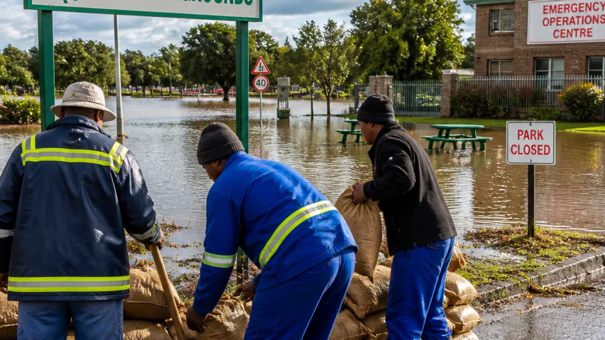
Hamilton County emergency officials have kept an operations centre active around the clock after the White River continued to rise, with forecasts showing the river could crest near 19 feet by Friday night. As of Thursday afternoon the river was measured at 13.5 feet under Logan Street in downtown Noblesville, and authorities warn flooding will expand into low-lying residential and recreational areas.
What authorities are doing
The county’s Emergency Operations Centre (EOC) remains activated to coordinate responses across roads, parks and communities. Hamilton County was placed under a Flood Watch until 10:00 on Friday, 14 August, and a Flood Warning until 14:00 on Sunday, 16 August, as staff track rising levels and potential impacts.
- Officials say flooding is expected to affect Riverwood, Clare, Strawtown, Riverbend, Trails End and other low-lying neighbourhoods.
- Several roads are already closed and more could become impassable; motorists are reminded never to drive through floodwater.
- Free sandbags are available to residents on a first-come, first-served basis at the 4-H Fairgrounds, 1717 Pleasant St., Noblesville; residents must load and transport them themselves.
Parks, campgrounds and recreational sites impacted
Flooding has forced closures and evacuations at multiple county parks and canoe launches. The county listed affected facilities, and said staff would reassess conditions once waters recede and crews can clean and inspect sites. Among the closures and impacts:
| Park / Location | Reported impact |
|---|---|
| Geist Park | Closure |
| Potter’s Bridge Park canoe launch and White River Greenway trail | Closure |
| Cool Creek Loop Road at Cool Creek Park | Closure |
| Prather Park canoe launch / Lafayette Trace canoe launch | Closure |
| Riverside and Lake parking lots at Strawtown Koteewi Park | Closure |
| White River Campground | Evacuated; closed through Monday, 17 August |
“As water levels rise, flooding is expected to expand in Riverwood, Clare, Strawtown, Riverbend, Trails End, and surrounding low-lying areas,” the county reported.
Practical lessons for our White River communities
The unfolding situation in Hamilton County underlines a few practical steps that apply equally to flood-prone communities in Mpumalanga and elsewhere. Local municipal and emergency plans depend on early monitoring, clear public communication and access to basic mitigation measures such as sandbags and road closures. Residents should note the following takeaways:
- Have an emergency plan and a grab bag ready; know evacuation routes and where to go if the municipality advises leaving your property.
- Never attempt to drive through flooded roads. Floodwater depth and flow can quickly disable vehicles and endanger lives.
- If local authorities provide sandbags, use them to protect low doorways but follow guidance about safe placement and disposal afterwards.
Local response in Hamilton County also highlights the importance of regular maintenance and inspection of recreational infrastructure along rivers. Parks and campgrounds often become hazardous first; timely closures reduce risk to the public and give crews time to restore sites after water levels fall.
For residents in Mpumalanga, the comparators are clear: keep an eye on river level bulletins, subscribe to municipal alerts where available, and treat official watches and warnings as triggers to act. Early preparation — even in systems with less frequent severe flooding — reduces harm to property, tourism businesses and livelihoods that depend on safe natural attractions.
The Hamilton County authorities set up a temporary webpage to update residents on flood-related road closures and safety notices. Locally, municipal disaster-management offices and ward councillors should be able to provide equivalent, up-to-date information and practical support during flood events.
As the weather systems that drive heavy rainfall change, so too will the demands on emergency services and infrastructure. Practical preparedness at household and municipal levels remains the most effective defence against river floods — whether the river is in Indiana or Mpumalanga.