
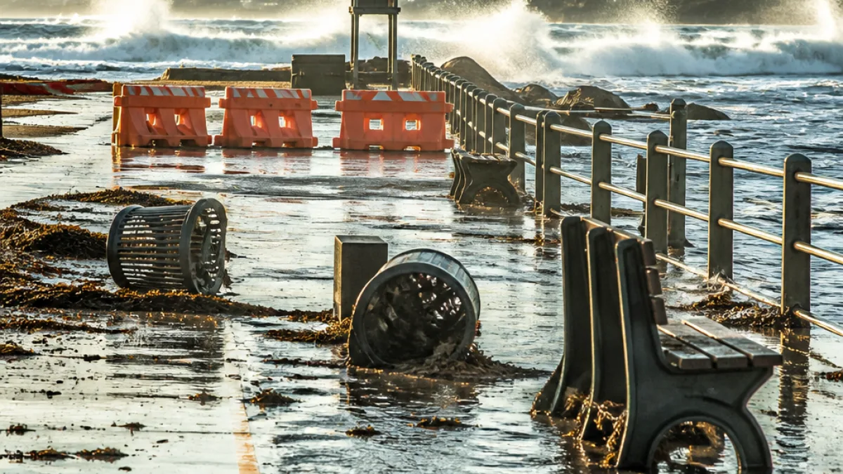
Storm-induced pressure changes drive lake surge; shoreline declared hazardous
Strong thunderstorm activity on Tuesday afternoon produced a rapid shift in atmospheric pressure over Lake Michigan that pushed a surge of water onto the shore — a phenomenon known as a meteotsunami. The event created hazardous conditions along Chicago’s lakefront and neighbouring Indiana shores, with waves large enough to inundate recreational paths and pose a risk to people near the water.
Meteorologists said the line of destructive storms forced large quantities of air upward ahead of the system and then down again in its wake. Those abrupt pressure fluctuations transmitted into the lake, producing water-level swings substantially greater than normal wave action.
Authorities issued a lakeshore flood warning that remained in force until 5pm, and officials advised that the lakefront should be avoided until conditions stabilised. Forecasts and local bulletins warned that the combination of strong winds and the meteotsunami would create generally very dangerous conditions for anyone on or near the waterfront.
How big were the waves — and what do they mean?
Observed wave heights linked to this event ranged between 3 and 6 feet, enough to reach and cover bike paths and walkways that normally sit above typical water levels. By comparison, minor meteotsunamis can cause water to change by up to 2 ft, while more severe events can swing levels by as much as 6 ft.
| Wave height | Typical shoreline effect |
|---|---|
| Up to 2 ft | Minor flooding of low-lying edges, slippery paths |
| 3–6 ft | Overtopping of promenades and bike paths; hazardous for swimmers and small craft |
Why this is not a seismic tsunami
Though the water surge may resemble a tsunami, the driving mechanism is different. Seismic tsunamis are produced by earthquakes or underwater landslides that displace water directly. In contrast, meteotsunamis arise from rapid changes in air pressure — most often associated with fast-moving thunderstorm complexes and squalls — which couple with the water and generate pronounced surges.
Regional climatology suggests these events are not unprecedented. Recent assessments have estimated that the Great Lakes can experience on the order of 100 meteotsunami events annually, many of them minor. However, under the right storm configuration, a single event can create conditions capable of damaging infrastructure and endangering people close to the shore.
Who is at risk and what to do
The principal danger is to pedestrians, cyclists, anglers and small-boat users along the shoreline. Sudden surges can sweep people off rocks or piers and can overturn small vessels. Because water levels can rise quickly and unpredictably, officials urged avoidance of the entire lakefront during the warning period.
- Stay clear of the shoreline and any paths that are covered by water.
- Do not attempt to drive through flooded promenades or roads near the lake.
- Keep clear of piers, jetties and rocks where waves can break with unusual force.
- If on the water in a small craft, head to safe harbour or shore as conditions allow; seek higher ground if capsized.
- Watch local emergency alerts and weather updates for changes and rescindments of warnings.
Local services and short-term outlook
Emergency-management and lakeshore authorities typically monitor these situations closely and will close affected public spaces if necessary. The immediate outlook depends on how quickly the storm system moves away and whether wind conditions ease; once pressure gradients subside the lake should return to more normal levels, though dangerous currents and debris can persist.
For communities and recreational users, the key message is caution: the suddenness of a meteotsunami means everyday familiarity with the waterfront can be deceptive. Even experienced boaters and regular walkers on the promenade should treat warnings seriously and avoid complacency until officials confirm it is safe to return.
Reporting from the lakeshore underscored that while meteotsunamis are a recognised Great Lakes hazard, their timing and magnitude can be hard to predict precisely — reinforcing the need to heed immediate warnings and to give emergency services space to respond effectively.