
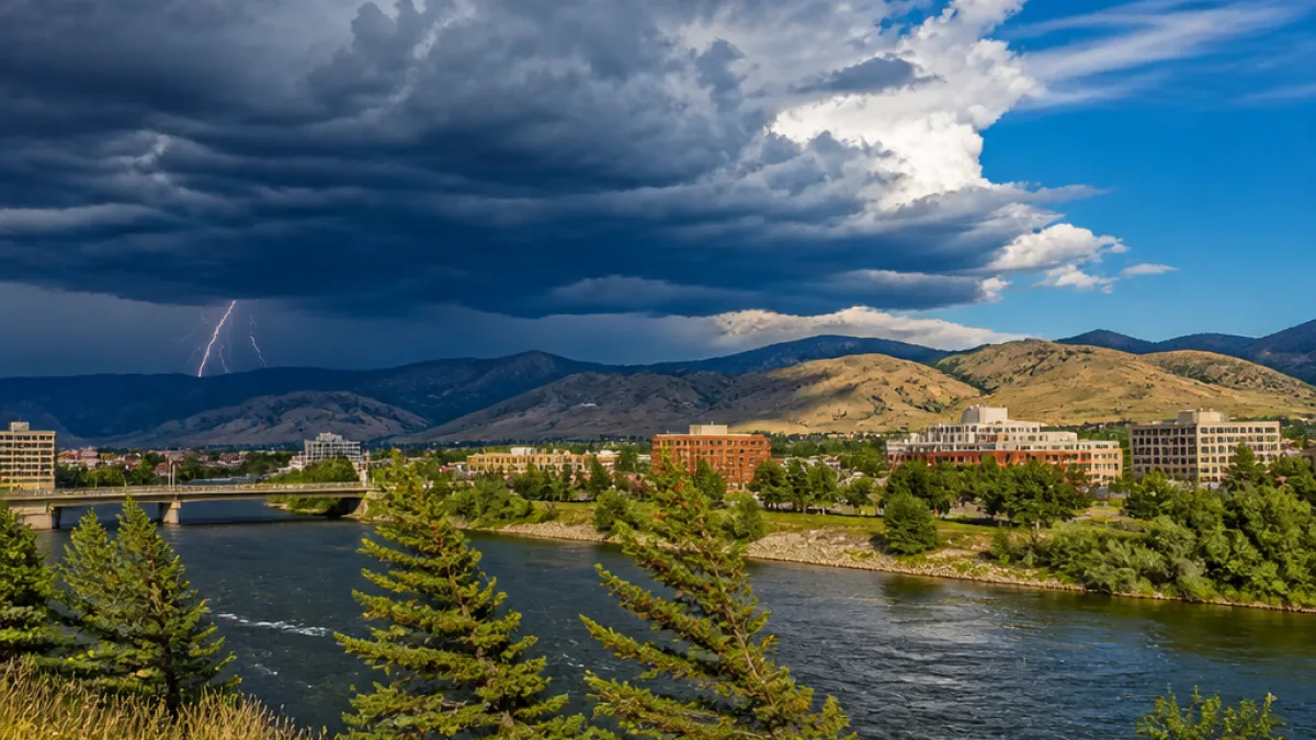
MISSOULA — Western Montana will see a short-lived warm spell to start the week as a ridge of high pressure rebuilds over the Northern Rockies, bringing mostly sunny skies and above-average temperatures. That pleasant pattern will be interrupted midweek as moisture from the monsoon pattern increases, elevating the risk of afternoon and evening thunderstorms from the Bitterroot to the Flathead Valley.
Warm start, then wetting trend
Sunday’s passage of a cold front provided a brief cool-down across portions of western Montana — including Missoula, the Flathead Valley, Kalispell and Polson — but skies cleared and conditions have stabilized. Monday should be calm and largely dry as the ridge strengthens, allowing temperatures to climb back above typical values for late August.
Forecasters say the warming trend continues into Tuesday. Morning cloudiness or a few light showers cannot be ruled out, but attention will shift to the afternoon when isolated storms may develop and spread toward the Interstate 90 corridor, including Missoula. The Flathead Basin may remain drier than areas to the south and east, though an isolated thunderstorm there is possible late in the day.
Wednesday could be the most active day
Wednesday is currently expected to be the most active day of the week. Increasing monsoonal moisture will make showers and thunderstorms more widespread, from the Bitterroot Valley north through Kalispell, Whitefish and the Flathead Valley. Some storms could produce frequent lightning while offering limited rainfall; that combination raises concerns for new wildfire starts. Other storms may deliver locally beneficial rain.
Thursday will likely hold continued thunderstorm chances as the residual moisture lingers, producing scattered afternoon and evening showers from mountain slopes into valley floors. Despite the clouds and storm threat, temperatures should remain warmer than normal for the time of year.
Cooling and breezy conditions by weekend
By Friday a Pacific Northwest trough is expected to begin eroding the ridge over the region. That will bring a modest cooldown and increasing afternoon winds. Scattered storms remain possible, but growing gusts could once again elevate fire-weather concerns across portions of western Montana.
The trend toward cooler, windier conditions continues into Saturday as the ridge breaks down further. The weekend should feel less summerlike than the first half of the week, with lower highs and more persistent breezes.
- Monday: Mostly sunny, warming; light winds.
- Tuesday: Warmer; isolated afternoon storms possible, especially later in the day.
- Wednesday: Most widespread shower and thunderstorm coverage expected.
- Thursday: Scattered afternoon/evening storms; warm.
- Friday–Saturday: Cooler with increasing winds; scattered storms possible.
| Day | Primary hazards | Notes |
|---|---|---|
| Monday | Warm temperatures | Quiet; rebuilding ridge |
| Tuesday | Isolated thunderstorms | Storm coverage depends on morning clearing |
| Wednesday | Widespread storms, lightning | Localized heavy rain or little rainfall; wildfire ignition risk |
| Thursday | Scattered storms | Warm but cloudier |
| Friday–Saturday | Cooler, gusty winds | Fire-weather concerns may increase |
Residents and outdoor visitors should pay particular attention to midday and afternoon forecasts as convective activity develops. Lightning from dry storms can start new wildfires even when total rainfall is light. Officials recommend that anyone recreating in the backcountry carry means to receive weather updates and plan for sudden changes if thunderstorms approach.
Officials also remind the public that gusty winds late in the week can rapidly change fire-behavior conditions, particularly where fuels are dry. Those living or working in wildland-urban interface areas should review local burn restrictions and be prepared to modify activities if fire-weather alerts are issued.
For the most current conditions and any watches or warnings, follow the National Weather Service office covering your county and local media outlets. Short-term changes remain possible as the week progresses, and forecast confidence on the timing and coverage of storms is variable.
This evolving pattern will deliver a taste of summer warmth early in the week before introducing a more unsettled, storm-prone middle period and a cooler, breezier finish to the week across western Montana.














