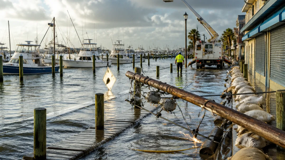
A slow-moving nor'easter rolled up the Atlantic coast Saturday, sending strong winds, heavy rain and dangerous tides into parts of the Northeast — including New Jersey's shoreline — and cutting power to roughly 100,000 customers at one point as the storm battered coastal communities.
Immediate impacts along the Jersey Shore
National Weather Service forecasters warned of sustained high winds, repeated high tides and heavy rainfall during the weekend. The service said the highest tides were likely to occur north of Atlantic City from Saturday night into Sunday, raising the potential for widespread road flooding in coastal and bayside neighborhoods.
Scenes from the region underscored the threat. In Surf City, on Long Beach Island, surveillance camera footage showed water creeping inside a marina owned by Kenny Formica — an event he said he remembered only during Hurricane Sandy in 2012, when his business suffered more than $4 million in damage. Elsewhere on Long Island, some residents kayaked through flooded streets.
Warnings from officials and forecasters
"There will be 'a lot of high winds, a lot of high tides and heavy rain possibility over the next few days for the northeastern U.S.,'" said Bob Oravec, lead forecaster with the National Weather Service in College Park, Maryland.
"Anyone who goes in or near the water this weekend is literally gambling with their life," New York Gov. Kathy Hochul said.
Emergency managers and local officials urged residents in flood-prone areas to stay off flooded roads and to move vehicles and valuables away from low-lying spots. Utility companies were responding to outages as crews worked to restore service where safe to do so.
What we know so far
- Roughly 100,000 customers lost electricity across the Northeast at the storm's peak.
- Forecasters highlighted the greatest tidal threat north of Atlantic City from Saturday night into Sunday.
- Localized flooding affected marinas, streets and businesses; anecdotal reports included water inside a Surf City marina.
Because the storm was moving slowly, coastal areas faced repeated cycles of high tides that can worsen flooding when combined with heavy rain and strong onshore winds. That pattern increases the risk of road closures and damage to shoreline structures.
Local perspective and preparations
Marina operators and shoreline businesses took precautionary steps before the worst conditions arrived. In Surf City, workers tightened dock lines, moved loose equipment, and parked trucks and forklifts on higher ground. Those steps reflect lessons from prior storms and acknowledged vulnerability along New Jersey's coast.
Residents in vulnerable neighborhoods faced familiar choices: shelter in place, move vehicles to higher ground, or evacuate if directed by officials. Local emergency management offices typically post the latest advisories and evacuation orders; residents should consult municipal channels for updates.
| Reported impact | Detail |
|---|---|
| Power outages | About 100,000 customers without power across the region at peak |
| Highest tide threat | North of Atlantic City, Saturday night into Sunday |
| Notable local effect | Flooding inside a Surf City marina; comparisons to Hurricane Sandy (2012) |
What to watch next
Forecasters said there was no immediate reprieve, with more high winds, tides and rain expected over the coming days. The combination of onshore winds and repeated high tides can force saltwater into bayside streets and low-lying neighborhoods multiple times as the storm persists.
Residents should monitor the National Weather Service forecasts, local emergency management announcements and utility company outage maps. Where officials issue evacuations or road closures, those directions should be followed for safety.
As response and recovery unfold, communities along the Jersey Shore will again confront questions about infrastructure resilience and future storm risk. For now, emergency crews and municipal officials remain focused on minimizing harm and restoring services as conditions allow.
(State correspondent reporting from the region.)