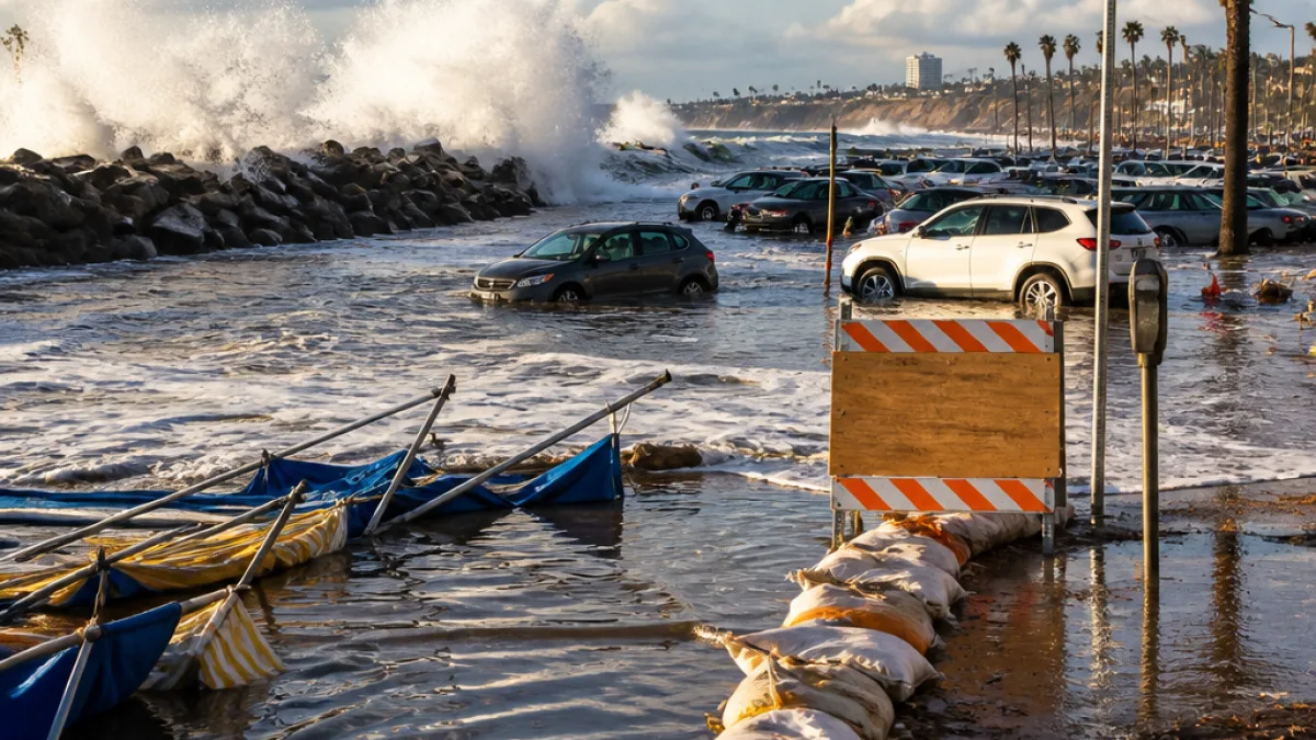
The National Weather Service is urging caution for Southern California shoreline communities as a combination of large waves and elevated tides is expected to produce hazardous beach conditions and pockets of coastal flooding through Tuesday, Sept. 29.
What the advisories cover
The Los Angeles/Oxnard office of the NWS issued a coastal hazard message on Monday covering the Santa Barbara Channel islands and a broad stretch of mainland coastline from Ventura County to Los Angeles County, including Malibu and harbor areas. A high surf advisory and a coastal flood advisory remain in effect through 5 p.m. Tuesday.
Forecasters say breaking surf of roughly 4 to 7 feet is likely along many beaches, while strong rip currents will pose a drowning risk for swimmers and surfers. Areas with low elevation near the waterfront — such as beach parking lots, bike paths and harbor walkways — are particularly vulnerable to inundation, especially around high tides.
Areas of greatest concern
The NWS identified several local hot spots where impacts could be most pronounced, including Avalon on Santa Catalina Island and shoreline neighborhoods in Long Beach such as Belmont Shore. Those locations remain under close watch because previous storms have left the sand and dunes weaker, increasing the chance of significant localized flooding.
County and city officials warn people to stay away from jetties, rocks and seawalls. Emergency services stress that once water covers roads or parking areas, conditions can change rapidly and become dangerous.
Safety guidance for residents and visitors
- Avoid entering the water; rip currents can sweep even experienced swimmers offshore.
- Do not drive around barricades or through standing water; depth and roadway damage are often hidden.
- Keep clear of cliffs, bluffs and areas subject to wave run-up or erosion.
- If you live in a low-lying coastal zone, secure outdoor items and consider moving vehicles to higher ground before high tide.
Officials also advised anyone going to the shoreline to remain near staffed lifeguard towers if they do choose to be near the water, and to resist the temptation to watch waves from exposed rocks or structures.
Why this event matters to Southern California
While the expected surf is not forecast to match the size of waves generated earlier this month by Hurricane Marie, the coastline has not fully recovered from that event. Beach erosion has reduced natural buffers in some communities, leaving promenades, parking areas and harbor facilities more likely to see flooding from the current swell.
For coastal cities that rely on tourism and waterfront recreation, interruptions caused by hazardous surf and inundation can have immediate economic and public-safety consequences. Lifeguards, harbor personnel and public works crews often respond to multiple, simultaneous incidents during these episodes, stretching local resources.
| Advisory | Areas covered | Expires |
|---|---|---|
| High Surf Advisory | Santa Barbara Channel islands, Ventura beaches, Malibu, Los Angeles beaches | 5 p.m. Tuesday |
| Coastal Flood Advisory | Vulnerable low-lying coastal areas, harbor walkways, beach parking | 5 p.m. Tuesday |
Residents and visitors should monitor local forecasts and official channels for updates; coastal conditions can change quickly when swell, wind and tides align. City and county emergency management offices typically post real-time advisories and any closures on their websites and social accounts.
With Labor Day-weekend traffic behind the region and schools back in session, authorities emphasized routine preparedness: secure loose items, follow posted warnings, and report emergencies to local dispatch centers rather than attempting risky rescues or observations from unsafe vantage points.
Forecasters expect conditions to ease after the advisory period, but they cautioned that subsequent swell events remain possible during the active late-summer and early-fall storm pattern.