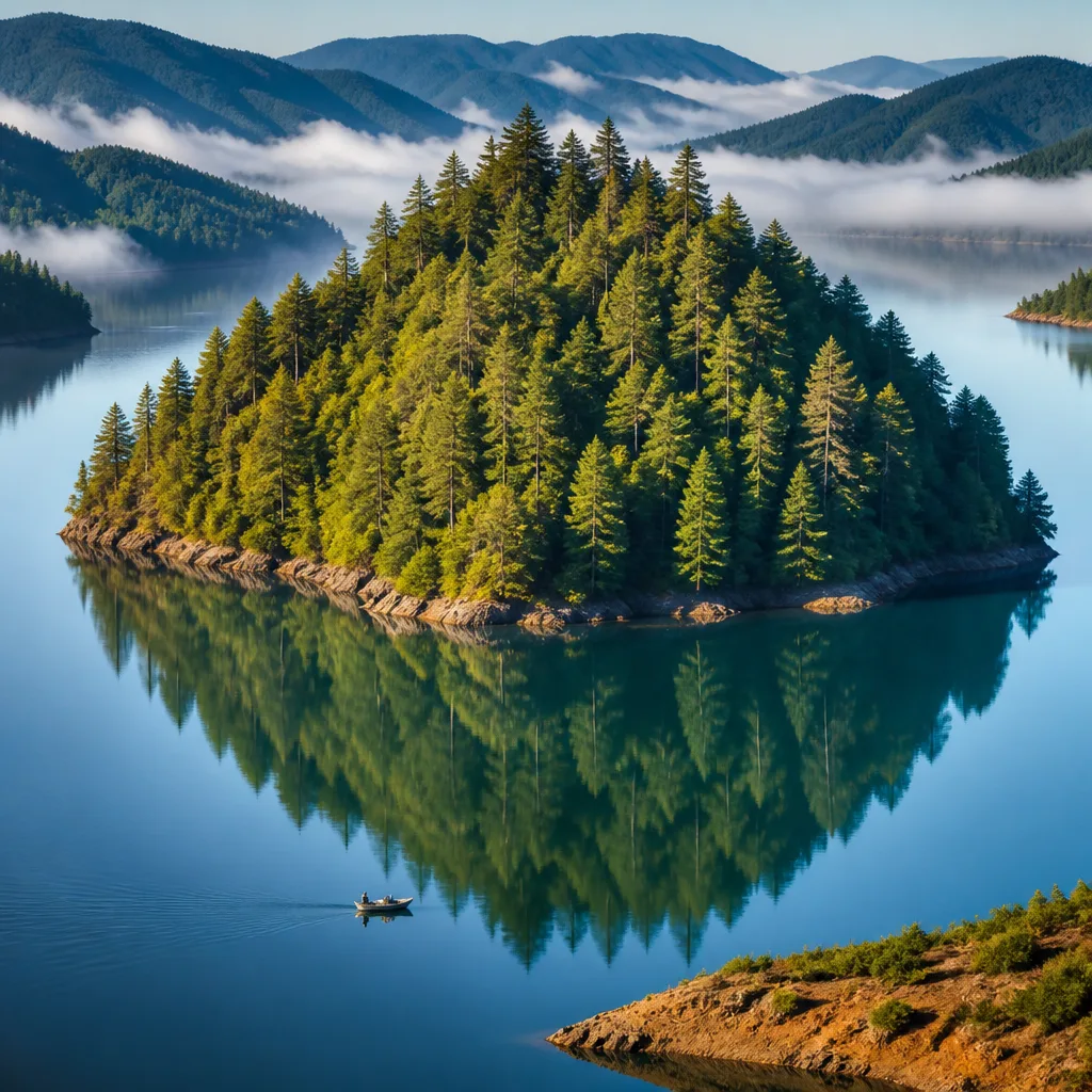
A puzzling, tree‑covered island briefly appeared in a remote British Columbia reservoir this month before disappearing without a trace, prompting viral social media posts, official skepticism and satellite confirmation of both its arrival and its swift absence.
What happened
Boaters in the Williston Reservoir north of Mackenzie photographed and filmed a floating landmass earlier in July. The images were shared with local resident Rocky Avery and then posted on social media, where they drew wide attention.
“It was a pretty amazing sight to see, never seen anything like that in my 40 years in this country,” Avery told CBC.
Initial reactions included disbelief. BC Hydro, the provincial Crown corporation that generates and transmits most of British Columbia’s hydroelectric power, said it had not previously observed anything like the island and expressed caution about the authenticity of online images. A BC Hydro spokesman cited the rise of generative AI and the difficulty of verifying imagery posted on social platforms.
“It’s certainly something we’ve not heard of before,” BC Hydro spokesman Bob Gammer said.
Satellite confirmation and disappearance
Satellite imagery dated July 21 confirmed a floating landmass in the main body of the Williston Reservoir, west of Finlay Bay and roughly 60 miles west of the W.A.C. Bennett Dam. Analysts estimated the formation measured about 230 feet wide by 460 feet long, covering nearly 105,000 square feet — an area comparable to two NFL football fields.
Despite the clear satellite evidence of its presence on July 21, imagery from Aug. 5 showed the landmass had vanished from the reservoir.
| Date | Event |
|---|---|
| Early July | Boaters photograph a tree‑covered floating landmass |
| July 21 | Satellite imagery confirms island in Williston Reservoir |
| Aug. 5 | Satellite imagery shows island no longer present |
| Location | West of Finlay Bay, Williston Reservoir (about 60 miles west of W.A.C. Bennett Dam) |
| Estimated size | ~230 ft × 460 ft (~105,000 sq ft) |
Local reaction and possible hazards
Residents who saw the photos described the sight as extraordinary. One boater who provided the images told Avery he wanted to alert other recreational users and BC Hydro in case the island drifted toward areas with boating traffic or infrastructure.
Although the precise make‑up and origin of the landmass remain unconfirmed in public reporting, floating islands can form when peat, root mats and vegetation detach from shorelines or riverbanks during high water events. Such masses can carry mature trees and appear as solid ground until they fragment or become waterlogged.
- Safety concern: Floating islands, while visually striking, can pose hazards to boaters and shoreline structures if they drift into populated or high‑use areas.
- Verification challenges: Officials noted the prevalence of manipulated images online, underscoring the role of satellite imagery in confirming unusual sightings.
- Environmental curiosity: The event highlights how reservoir dynamics and natural detachment processes can produce transient landscape features.
BC Hydro’s initial skepticism and subsequent satellite confirmation illustrate both modern challenges for rapid verification in the age of viral content and the value of remote sensing in documenting rare natural events. The island’s disappearance within weeks left residents and recreationists with more questions than answers about its composition, origin and final fate.
For now, the brief appearance of the floating island stands as a reminder of how natural forces in large, managed water bodies can generate ephemeral but dramatic phenomena — and how quickly those phenomena can change or vanish entirely.