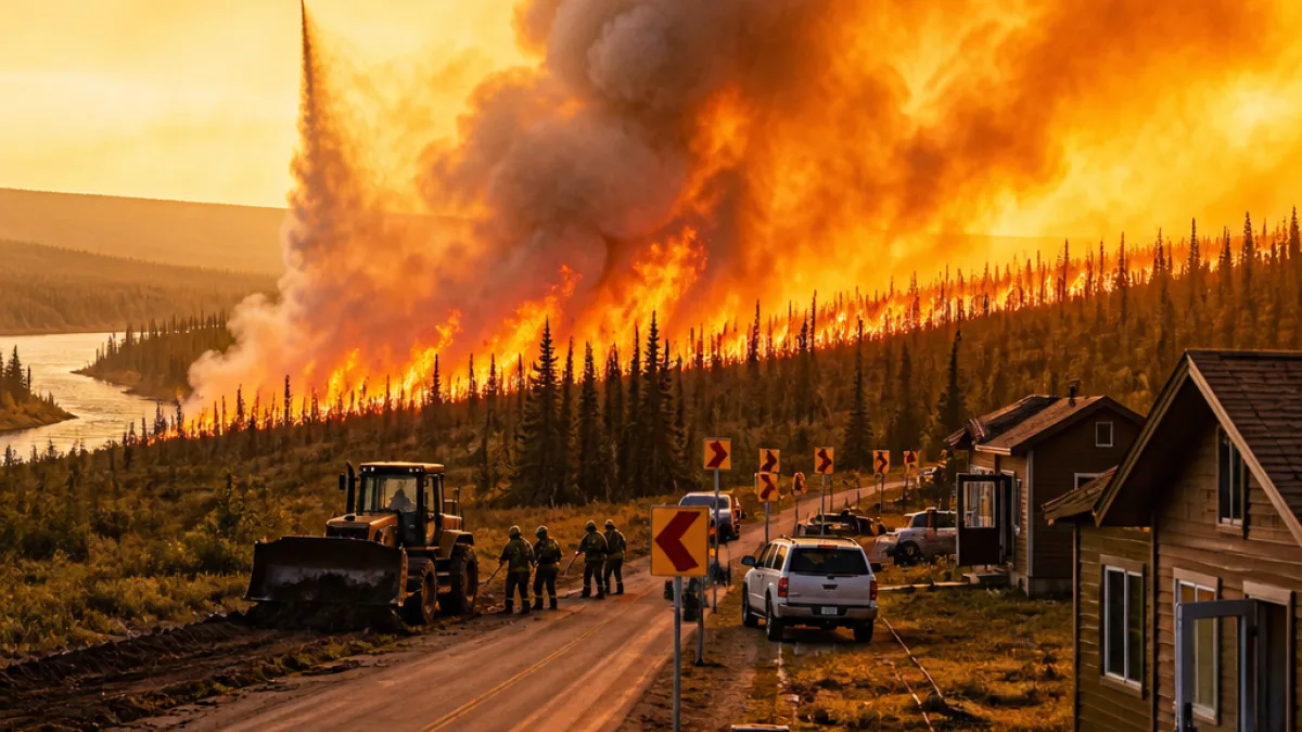
The Mukluk Fire erupted late Monday morning in the backyard of a residence along the Alaska Highway near Sundog Trail and grew rapidly, prompting evacuations and a large-scale response from state, local and federal firefighting resources.
The blaze was reported shortly before noon and was estimated at about 20 acres by early afternoon, according to the Alaska Division of Forestry & Fire Protection. Officials later reported the fire had expanded to more than 1,500 acres by 7 p.m., spreading to the east and northeast and running parallel to the Alaska Highway toward the Tanana River.
Cause and early spread
Authorities have identified the Mukluk Fire as human-caused, according to the Alaska Wildland Fire and Lightning Dashboard. The circumstances that led to ignition were not detailed in initial agency updates.
Fires that start near homes and travel into fuels along transportation corridors can be driven quickly by roadside winds and dry vegetation. In this incident, the fire’s eastward and northeastward movement put it on a path that paralleled the Alaska Highway, raising concerns about both property risk and potential impacts to highway travel.
Evacuations and response
- Evacuations were ordered for residences in the immediate area around the origin near Sundog Trail.
- State, local and federal firefighting resources were mobilized to address the blaze.
- Fire managers reported rapid growth through the afternoon and early evening, necessitating expanded response and public warnings.
Details on the number of people evacuated, shelter locations or road closures were not available in initial reports. Officials advised residents in the area to follow instructions from local emergency personnel and to monitor official state communications for updates.
Timeline of the Mukluk Fire
| Time (local, Monday) | Reported detail |
|---|---|
| Shortly before noon | Fire reported in backyard along Alaska Highway near Sundog Trail |
| Early afternoon | Estimated at about 20 acres (Division of Forestry & Fire Protection) |
| About 7 p.m. | Expanded to more than 1,500 acres, spreading east and northeast toward the Tanana River |
Potential impacts and what residents should do
Wildfires of this speed and size can threaten homes, cut off access roads and create hazardous smoke conditions that affect air quality across a broad area. Local officials typically provide specific guidance during incidents; the following general steps are recommended when a wildfire threatens nearby communities:
- Follow evacuation orders immediately and keep routes clear for emergency vehicles.
- If you are told to evacuate, take critical documents, medications, and an emergency kit with you.
- Monitor official channels such as the Alaska Division of Forestry & Fire Protection and local emergency management for updates on containment, road closures and reentry instructions.
- People with respiratory conditions should be prepared for smoky conditions and consider staying indoors or using air filtration if available.
Local authorities and state agencies were on scene and coordinating response efforts Monday evening. Fire managers were focused on protecting structures and slowing the fire’s movement along the highway corridor while assessing resources and strategies for containment.
Additional information, including maps and advisories, is expected to be released by the Alaska Division of Forestry & Fire Protection and local emergency management as crews work through the night and into Tuesday to limit the blaze’s spread.
WE NEWS will continue to monitor official updates and will provide new information as agencies release more details about evacuations, road impacts and containment progress.