
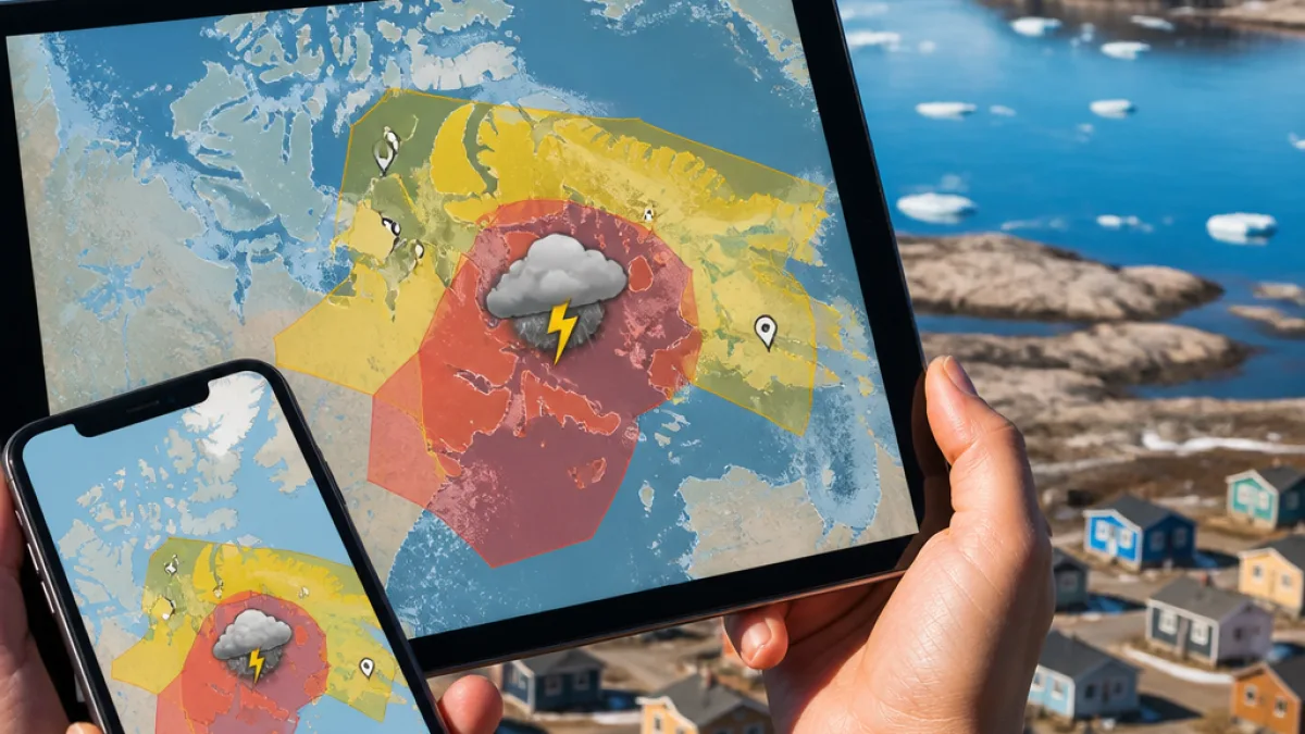
Environment Canada has introduced a new method for issuing thunderstorm and tornado warnings that narrows alerts to the storm’s expected path rather than broad, predefined zones — a change the federal forecaster says will reduce unnecessary notifications and better protect people in harm’s way.
What’s changing
On Aug. 11 the agency began using polygon shapes on its forecast maps to identify where a thunderstorm or tornado is likely to travel over the next 10, 30 or 60 minutes. Anyone located inside the polygon will receive push notifications for the warning alert, while people outside the polygon will not be notified.
Jonathan Bau, senior meteorologist with Environment Canada, told Black Press Media that the new system allows forecasters to pinpoint threats more precisely than the larger, predetermined alert zones that were previously used.
“It’s a nice, blue, sunny day and then you receive the thunderstorm alert, but really it’s 50 kilometres to the south of them, just all because they live within the predefined zones,”
The polygon approach aims to prevent what Bau described as “alerting fatigue” by ensuring warnings are received primarily by people who are likely to experience impacts from the storm.
Local implications for Nunavut
In the Arctic, where communities are often small and widely spaced, a targeted system can make alerts more meaningful. Residents who receive a warning are now more likely to be directly affected, helping families and community emergency planners prioritise preparation and response.
At the same time, Environment Canada says that other types of weather alerts — such as rainfall, heat, and broader watches for severe thunderstorm conditions — will continue to be issued to the existing, larger alert zones. That means some community-level warnings will remain broad when the nature of the hazard requires it.
How the system works
- Polygons mark the projected track of an individual thunderstorm or tornado for short-term forecasts (10–60 minutes).
- Multiple warnings can be issued and overlapping polygons are possible if different storm cells or threats are present in the same region.
- Broader alerts such as watches and warnings for other hazards continue to use the larger predetermined zones.
The ability to issue overlapping warnings also allows forecasters to track distinct weather threats within one or several storm systems simultaneously. According to Environment Canada, this flexibility helps account for complex storm behaviour that can evolve quickly.
Practical advice for residents
For people living in Nunavut, the operational change means a few practical adjustments:
- Keep weather notifications enabled on phones and devices so polygon-based push alerts are received promptly.
- Take any thunderstorm or tornado alert seriously if you are inside the polygon — these are now targeted to the storm’s projected path and indicate a higher likelihood of local impacts.
- Continue to monitor broader watches and zone-based warnings, especially when travel between communities is planned or when community-level advisories are issued.
| Alert type | Delivery area | Typical duration |
|---|---|---|
| Polygon thunderstorm / tornado warning | Targeted polygon (short-range path) | 10–60 minutes |
| Severe thunderstorm / tornado watch | Predetermined alert zones | Longer-term / area-wide |
Plasticity in alerting is particularly valuable in a changing climate. Short-lived but intense convective systems that produce hail, damaging winds or tornadoes can travel rapidly across northern landscapes. The polygon method aligns the alert footprint with the immediate threat rather than with administrative boundaries or large geographic zones.
Environment Canada used Alberta as the first jurisdiction to receive a targeted alert on the day of rollout. While the initial focus is on thunderstorms and tornadoes, the agency says the polygon approach was chosen because these phenomena most immediately benefit from short-term, highly localised warnings.
For residents and community leaders in Nunavut, the change should make warnings more actionable. But it also raises the need to remain aware of both polygon alerts and zone-based advisories so that people can respond appropriately to fast-moving storms as well as to broader environmental risks.
This reporter will continue to follow updates from Environment Canada and local emergency management offices as the new system is used over the coming seasons.