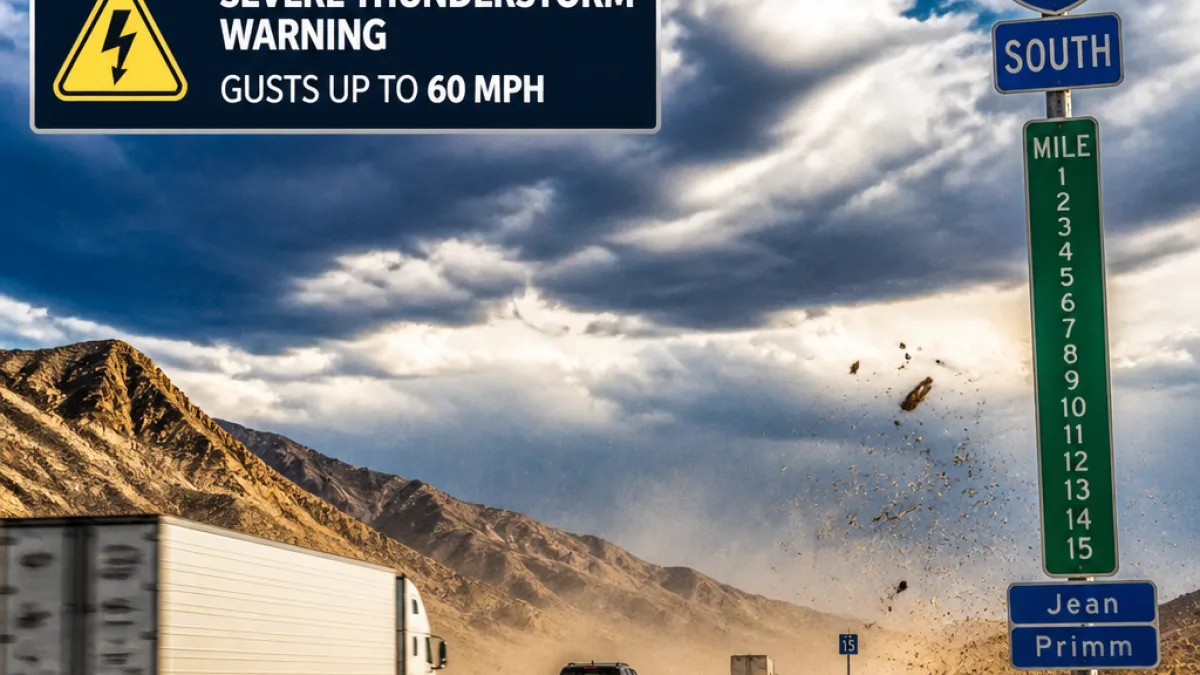
Severe thunderstorm warning covers San Bernardino County; shelters and alerts urged
The National Weather Service updated a severe thunderstorm warning Thursday at 1:04 p.m. that includes portions of San Bernardino County and neighboring Clark County in Nevada. The warning was in effect until 1:30 p.m., according to the NWS Las Vegas office.
Forecasters advised residents to prepare for damaging wind gusts up to 60 mph and warned the storm could cause roof, siding and tree damage. At the time of the update, the NWS located the thunderstorm about 6 miles southwest of Jean, Nevada, moving east at 10 mph, and specifically named the communities of Jean and Primm in the advisory.
- Time of advisory: Updated at 1:04 p.m.; in effect until 1:30 p.m.
- Expected winds: Gusts up to 60 mph
- Areas named: Jean and Primm; includes Interstate 15 between mile markers 1 and 15 in Nevada
"Seek shelter inside a well-built structure and stay away from windows. This storm is capable of producing damaging winds," the NWS advised.
Transportation officials urged drivers to exercise caution, particularly along Interstate 15 between mile markers 1 and 15, which the NWS included in its warning. Motorists should be prepared for sudden gusts that can make high-profile vehicles unstable and can blow debris onto roadways.
Road, alert and preparedness information for residents
CalTrans maintains updates on road closures and travel conditions. Travelers can check CalTrans' website, use its mobile app, or call 800-427-7623 for the latest information. Given the short notice of such warnings, officials recommend avoiding nonessential travel while a storm warning is in effect.
Emergency alerting systems differ by severity. For hazards the NWS classifies as "considerable or catastrophic," emergency alerts are sent to all enabled mobile phones in the impacted area. For lesser risks, residents are encouraged to sign up for their county's alert systems and monitor official social media accounts for updates.
Local resources and sign-up links mentioned by agencies include county alert portals for Los Angeles, Orange, Riverside and San Bernardino County. Residents unsure which alerts they receive should review their mobile settings and register with county systems to ensure they get timely local notices.
Flooding preparations and sandbag availability
Officials also offered guidance for residents in areas at risk of flooding. Sandbags can be a limited but useful line of defense where local guidance recommends them. County fire departments commonly provide a supply of free sandbags for nearby residents; those picking up bags are typically required to bring a shovel and proof of residency. Sand and sandbags are also available for purchase at many home improvement and hardware stores.
Links to sandbag resources provided by regional agencies include pages for San Bernardino County and neighboring counties to help residents locate distribution sites and instructions. The City of Seal Beach has also made a how-to video available demonstrating proper sandbag filling and placement, which may be useful to residents unfamiliar with the procedure.
What residents should do now
Officials recommend the following immediate actions when a severe thunderstorm warning is issued for your area:
- Move indoors to a well-built structure and stay away from windows.
- Secure loose outdoor items that could become airborne in strong gusts.
- Avoid travel if possible; if driving, slow down, allow extra following distance and be alert for debris.
- Sign up for county emergency alerts and check official agency social channels for updates.
- If flooding is possible at your location, obtain sandbags as directed by local fire or public works agencies.
This advisory is based on the NWS release and the guidance provided by state and local agencies. Residents should follow updates from the National Weather Service and local emergency management offices for evolving conditions.
| What | Detail |
|---|---|
| Issuing agency | National Weather Service Las Vegas NV |
| Effective | Updated at 1:04 p.m.; until 1:30 p.m. |
| Primary hazard | Damaging winds (gusts up to 60 mph) |
| Areas named | Jean, Primm; I-15 between mile markers 1–15 (NV) |
Local residents with immediate safety concerns should contact local emergency services. WE NEWS will provide updates as additional information becomes available from the National Weather Service and county officials.