Yellowknives Dene and the Tłı̨chǫ Government have announced a consensus on a proposed corridor for an all-season road that would link the Grays Bay Road and Port in Nunavut with the Northwest Territories highway system.
What was announced
The two Indigenous governments said on Saturday they reached agreement on the proposed location for the project that has been described federally as one of the country’s “nation-building projects.” The announced corridor would be roughly 400 kilometres long and conceived as an all-season connection between the territories.
Leaders stressed the announcement marks an early step in a longer process. In a joint statement, Yellowknives Dene Chief Ernest Betsina and Chief Fred Sangris underscored the distinction between a proposed corridor and a final road.
“This is a proposed corridor, not a final road, and that matters,”the chiefs said.
Indigenous leadership and partnerships
The initiative is being led by the Yellowknives Dene First Nation and the Tłı̨chǫ Government in partnership with both territorial and federal governments. The project was first flagged earlier this year among a set of large infrastructure projects that are intended to expand military presence and mineral exploration in Northern Canada.
Tłı̨chǫ Grand Chief Jackson Lafferty said the agreement demonstrates Indigenous capacity to take leading roles on major projects. “It is exciting to show Canada how we can lead and design major projects as Indigenous nations,” he said in a statement accompanying the announcement.
Route description and environmental concerns
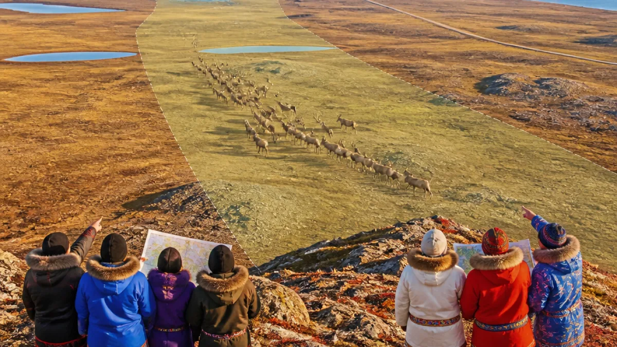
Maps released by the two governments show the corridor as a band about 30 kilometres wide that cuts through the Slave Geological Province. That area has been identified as having mineral potential, which is one of the drivers behind interest in the route.
At the same time, the corridor traverses land used by migratory caribou and contains important habitat. Both nations said the proposed alignment was drawn deliberately to try to reduce impacts on wildlife and land users, but they were clear that significant technical and environmental work remains before any road is built.
Community benefits and access
For communities in the Northwest Territories, proponents say the corridor would provide year-round road access to Wekweètì and Gamètì, remote communities that currently rely on winter roads and air travel for much of their freight and travel needs. In Nunavut the corridor would connect with the Grays Bay Road and Port proposal, which has been advanced as a means to open access to resources and shipping on the Arctic coast.
Project backers have described it as contributing to national priorities including defence presence and resource development in the Arctic, but they also point to potential local economic benefits through jobs, contracting and improved transportation links.
Next steps and remaining work
Both governments emphasised the corridor announcement is an initial planning milestone. The word “proposed” was used repeatedly to indicate that the corridor is not equivalent to a committed construction project. Detailed environmental assessments, consultations with other Indigenous groups and communities, engineering design, and permitting remain ahead.
The governments did not provide a timeline for those processes in the announcement, nor did they outline a funding plan or a construction schedule. Those details will be central to determining whether the corridor proceeds, how impacts will be mitigated, and what benefits will flow to affected communities.
Why this matters in Nunavut
Any road that improves year-round access to Nunavut’s proposed Grays Bay Port has implications for shipping, resource development and local economies. At the same time, the territory’s communities and hunters rely on healthy caribou populations and intact land for food security and culture. Balancing development and environmental stewardship will be a sustained challenge as planning continues.
- Scale: Proposed corridor band ~30 km wide; road length ~400 km.
- Leadership: Yellowknives Dene First Nation and Tłı̨chǫ Government leading, with territorial and federal partnership.
- Concerns: Mineral potential, caribou habitat, and the need for further consultation and assessments.
| Item | Detail |
|---|---|
| Proposed road length | 400 km |
| Corridor width | ~30 km |
| Region traversed | Slave Geological Province |
The announcement marks a rare instance where neighbouring Indigenous governments have publicly agreed on a corridor route at an early stage of planning. Whether that consensus smooths later stages of design, environmental review and community negotiation remains to be seen. For people living across our North, the stakes include economic opportunity, sovereignty and the protection of lands that sustain our ways of life.
As the project advances, Nunavummiut will be watching for detailed plans on potential environmental effects, the nature and extent of consultation with affected harvesters and communities, and any commitments about how benefits will be shared.