
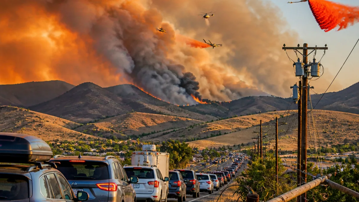
A wind-driven wildfire that ignited Saturday morning near the Somersett Golf and Country Club in northwest Reno expanded rapidly and had burned more than 10,500 acres by Saturday night, authorities said, with 0% containment.
Evacuations, power outages and emergency declaration
Local and state officials issued mandatory evacuations for multiple zones north of U.S. 395 and evacuation warnings for nearby areas such as Panther Valley as the blaze — officially named the Hawk Fire — pushed toward residential neighborhoods. Officials said the fire threatened roughly 1,000 homes and that utility outages affected about 50,000 customers in the Reno and Sparks areas.
Nevada Gov. Joe Lombardo declared a state of emergency in Washoe County as the fire rapidly grew. Multi-agency firefighting resources, including local, state and federal crews supported by air tankers and helicopters, were deployed to battle the blaze from the ground and air.
- Location of origin: Near Somersett Golf and Country Club, northwest Reno
- Reported size: More than 10,523 acres as of Saturday night
- Containment: 0%
- Homes threatened: Approximately 1,000
- Customers without power: About 50,000 in Reno and Sparks
How the fire spread and response challenges
Truckee Meadows Fire & Rescue Chief Richard Edwards described the incident as "very dynamic," saying wind was the primary driver of the fire's explosive growth. In a statement posted to social media, Edwards warned that wind-driven fires can move quickly into residential areas and create significant challenges for crews trying to protect homes and lives.
"The Hawk Fire is a very dynamic incident for us as it's being driven by the winds. The wind-driven fires move very rapidly into our residential areas, creating a lot of challenges for our firefighters to save homes and protect lives."
Authorities urged residents to consult live mapping tools such as Perimeter Map and the Genasys Protect system for the latest evacuation zones and safety information. Reno Police and fire officials also asked the public to avoid calling 911 for general information about the fire, so emergency dispatchers could remain available for life-safety calls.
Resources on scene and public safety guidance
Incident commanders said air tankers and helicopters were being used to slow the fire's forward progress while crews worked to establish containment lines on the ground. Local law enforcement set up evacuation routes and coordination points for displaced residents.
Officials emphasized basic steps residents should take now:
- Follow mandatory evacuation orders immediately if your zone is listed.
- Monitor Perimeter Map and Genasys Protect for real-time boundary changes and shelter information.
- Keep roads clear for emergency vehicles and do not call 911 for information requests.
- Prepare property defensible space where possible and heed instructions from emergency personnel.
| Metric | Reported figure |
|---|---|
| Estimated acreage | 10,523+ |
| Containment | 0% |
| Homes threatened | ~1,000 |
| Customers without power | ~50,000 |
As crews continue suppression efforts, officials said additional resources, including federal asset assignments, were being coordinated to protect property and support evacuations. Residents in affected areas should consider family emergency plans, keep pets and livestock preparations in mind and watch official channels for shelter locations and road closures.
WE NEWS will continue to follow the incident and provide updates as officials release more information about containment, damage assessments and assistance for displaced residents.














