Two rapidly expanding wildfires in southwestern Montana have burned nearly 28,000 acres combined and remain at 0% containment as firefighting crews focus on protecting homes, recreation assets and critical values at risk.
Scope and spread
The larger of the two, the Sand Creek Fire, started Aug. 1 and is estimated at 19,683 acres. Fire managers reported the blaze’s southeast corner has reached Maverick Mountain, prompting concentrated efforts to protect structures and facilities in that corridor.
About 13 miles southwest of Wise River, the Bobcat Lakes Fire began July 31 and has grown to an estimated 8,521 acres. Both incidents are currently listed at 0% containment.
| Fire | Start date | Estimated acres | Containment |
|---|---|---|---|
| Sand Creek Fire | Aug. 1, 2026 | 19,683 | 0% |
| Bobcat Lakes Fire | July 31, 2026 | 8,521 | 0% |
Response and tactics
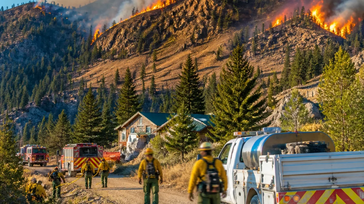
Crews have prioritized structure protection from Elkhorn Hot Springs toward Maverick Mountain as the Sand Creek Fire advances. Firefighters set up pump-and-sprinkler kits around vulnerable buildings and established point-protection measures for critical values at risk.
Smokejumpers were deployed to build handline intended to connect with the Sand Creek Trail, creating defensible space and potential anchor points for future containment lines. Fire managers said teams are continuing to scout for opportunities to establish indirect line on the fire’s south side where terrain and conditions may allow safer, more effective containment work.
On both fires, crews have been balancing aggressive protection of life and property with caution given current fire behavior and the complex mountain terrain.
Local impacts and public safety
Residents and visitors in the Wisdom and Wise River areas should expect heavy smoke and the potential for rapidly changing fire behavior. Authorities have emphasized that protection of structures and public safety are the top priorities while crews work to assess longer-term containment strategies.
- Expect smoky conditions and reduced air quality in nearby valleys and recreational areas.
- Be prepared for temporary road or trail closures as firefighters establish lines and move equipment.
- Follow instructions from local emergency management and fire officials; stay alert for possible evacuation warnings or orders.
The fires’ locations—near popular backcountry and ski areas such as Maverick Mountain—mean recreation users should confirm access before traveling. Fire managers have focused efforts to protect visitor facilities and hot springs in the path of the Sand Creek Fire.
What officials are watching next
Fire behavior will be influenced by local winds, fuel conditions and topography. Managers are scouting for locations to place indirect control lines on the Sand Creek Fire’s south flank; success on those efforts would provide opportunities to slow the fire’s progress and give crews safer positions from which to work.
At this stage, containment remains elusive. The combination of steep terrain and active fire growth complicates direct line construction, increasing reliance on point protection and strategic indirect tactics until conditions allow expanded containment work.
Residents should continue to monitor official updates from local fire management teams and regional news outlets for evacuation notices, road closures and air-quality advisories. For those with property in the affected areas, preparing defensible space, moving vulnerable items away from structures and having an evacuation plan remain the most effective immediate steps.
As the situation develops, investigators and fire managers will work to determine cause and update acreage and containment figures. For now, the focus is on protecting life and property while crews use handlines, sprinkler systems and other measures to blunt the blazes.
Local authorities and fire managers did not provide a containment timeline as of the latest updates. The public is urged to avoid the areas to allow safe access for firefighting resources.