
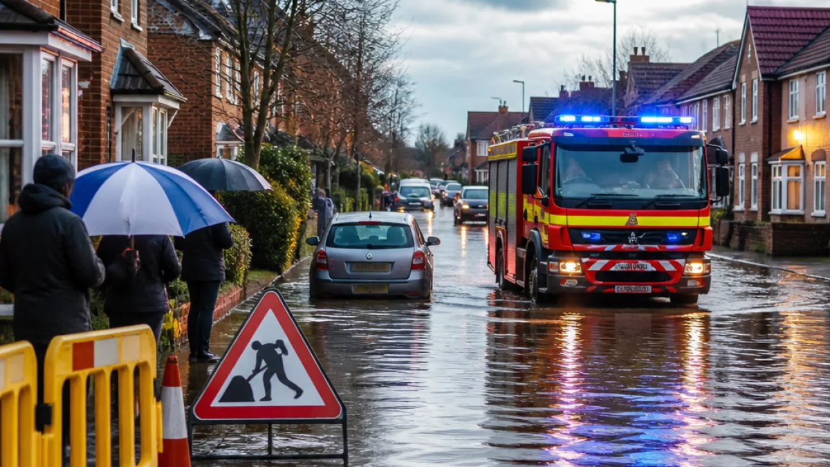
Parts of Birmingham have experienced flooding after heavy overnight rain as national weather warnings remain in force across much of England and Wales. West Midlands Fire Service confirmed it was responding to “significant flooding” in the city following a flood warning for the Perry Barr area due to rising river levels.
Emergency response and local advice
The fire service said crews were dealing with incidents around Curbar Road, Thornbridge Avenue and Haddon Road, and that operation teams were being supported by West Midlands Police and Birmingham City Council. In a post on X the service urged people to keep clear:
“Crews are being supported by West Midlands Police and Birmingham City Council. Please avoid the area, where possible.”
Birmingham City Council also cautioned residents to take care and avoid walking, cycling or driving through flood water. The Environment Agency has issued multiple flood alerts across the Midlands and the South East, signalling that flooding is possible in a number of locations.
What the forecasters say
The Met Office has declared two yellow thunderstorm warnings for Thursday: one covering London and the South East until 08:00 and a wider notice for Wales and much of England from 05:00 until 22:00. Forecasters warned some places could receive between 50–75mm of rain on Thursday, with the potential for higher totals in parts of the warning area.
Met Office forecaster Craig Snell warned of bands of heavy, thundery rain moving north from the south. He said some areas within the larger warning zone could see more than 75mm of rain in a 12‑hour period, and that the South East might experience 30–40mm together with “fairly large hail between 1–2cm”.
Short-term outlook and likely impacts
Temperatures are expected to remain warm on Thursday with highs of around 27–28°C in places, before easing to about 24–25°C on Friday and into the low twenties through the weekend. The Met Office warned that the heavy showers and thunderstorms could cause localised disruption, including flash flooding and travel delays.
- Local incidents: Significant flooding reported in Perry Barr; specific streets affected include Curbar Road, Thornbridge Avenue and Haddon Road.
- Warnings: Two yellow thunderstorm warnings in force for Thursday over wide swathes of England and Wales.
- Safety advice: Avoid driving or walking through flood water; follow instructions from emergency services and local authorities.
Rainfall guidance and figures
The following table summarises the rainfall guidance issued by the Met Office for affected areas:
| Area | Forecast rainfall | Additional hazards |
|---|---|---|
| Parts of the Midlands & Wales | 50–75mm (some places more than 75mm in 12 hours) | Thunderstorms, lightning, hail |
| South East | 30–40mm | Fairly large hail (1–2cm) |
Local services are likely to prioritise safety and access. Residents in low-lying areas or close to rivers should monitor Environment Agency alerts and local council updates. Where a flood warning is issued it means flooding is expected and immediate action to protect life and property may be required.
On the ground in Birmingham, emergency crews have already been mobilised and council teams are coordinating with partners to assess and resolve incidents. Motorists and commuters in the region should expect possible delays and disruption during and after the heavy rain, as roads and public transport can be affected by surface water and localised flooding.
Further heavy rain and thunderstorms are anticipated to continue into Friday in parts of the UK, with more unsettled weather forecast over the bank holiday weekend. Residents are advised to stay alert to updates from the Met Office, West Midlands Fire Service, Birmingham City Council and the Environment Agency.










