State-funded centre at IIT-Patna to create digital records of monuments
Patna: The preservation of Bihar's archaeological and monument heritage will move into the digital age after IIT-Patna signed a five-year memorandum of understanding (MoU) with the Bihar Heritage Development Society (BHDS). The agreement designates the institute as the principal geospatial technology consultant to BHDS and establishes a state-funded Centre of Excellence on Geospatial Technologies for Heritage at IIT-Patna.
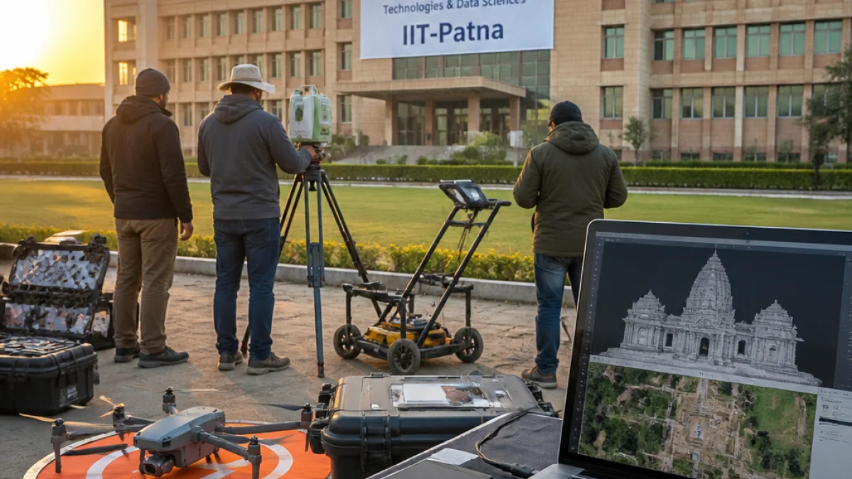
The collaboration will use a suite of remote-sensing and computational tools — drones, Light Detection and Ranging (LiDAR), Ground Penetrating Radar (GPR), UAV-based photogrammetry and artificial intelligence/machine learning — to create thorough digital documentation of archaeological assets, according to the MoU.
- Survey methods: LiDAR, UAV photogrammetry, GPR and radar.
- Digital products: 3D models, digital elevation maps, orthomosaics and GIS databases.
- Analytical tools: AI/ML for automated mapping and integration of multisensor data.
Project activity will also include structural engineering input from IIT-Patna to inform conservation and, where appropriate, reconstruction plans. A joint steering committee comprising representatives of IIT-Patna, BHDS and the state government will oversee implementation and conduct quarterly reviews to track progress.
"This collaboration will turn cutting-edge technology towards real-world heritage challenges," said T N Singh, director of IIT-Patna.
BHDS executive director Anil Kumar described the initiative as having the potential to set "new national benchmarks in heritage conservation," signalling the state's intention to adopt scientific, technology-driven methods rather than only conventional preservation techniques.
Deliverables and local implications
The immediate outputs named in the MoU include high-resolution digital records that can be used for long-term monitoring, structural assessment and public dissemination. These digital assets are expected to aid multiple objectives:
- systematic documentation of at-risk sites for conservation planning;
- scientific assessment of structural stability to prioritise restoration work;
- creating open or restricted-access GIS and 3D databases to support research and tourism management.
For Patna and neighbouring districts, the programme could mean more precise mapping of sites that are currently understudied or threatened by urban expansion, groundwater extraction, river erosion and other development pressures. The state-funded Centre of Excellence will also build technical capacity at IIT-Patna, potentially offering training and research opportunities for local students and professionals.
| Output | Purpose |
|---|---|
| 3D models | Visualisation, restoration planning, virtual access |
| Digital elevation maps | Landscape change detection, flood/erosion risk assessment |
| Orthomosaics & GIS | Integrated site databases for monitoring and management |
The initiative was proposed and coordinated by Akshar Tripathi, an assistant professor at IIT-Patna. The MoU commits both partners to quarterly reviews, which the steering committee will use to measure milestones and shape subsequent phases of work.
Officials say the use of AI to integrate datasets from multiple sensors is intended to accelerate mapping and reduce manual interpretation, but success will depend on field validation and ongoing maintenance of databases. The partnership places emphasis not only on capture but on institutionalising workflows so that the documentation remains useful to conservation managers, archaeologists and policy-makers.
By combining geospatial technologies with structural engineering expertise, the IIT-Patna–BHDS plan aims to create a replicable model for other states. For Bihar, with its rich but often vulnerable archaeological landscape, the project marks a significant shift towards scientific, data-driven heritage stewardship.