
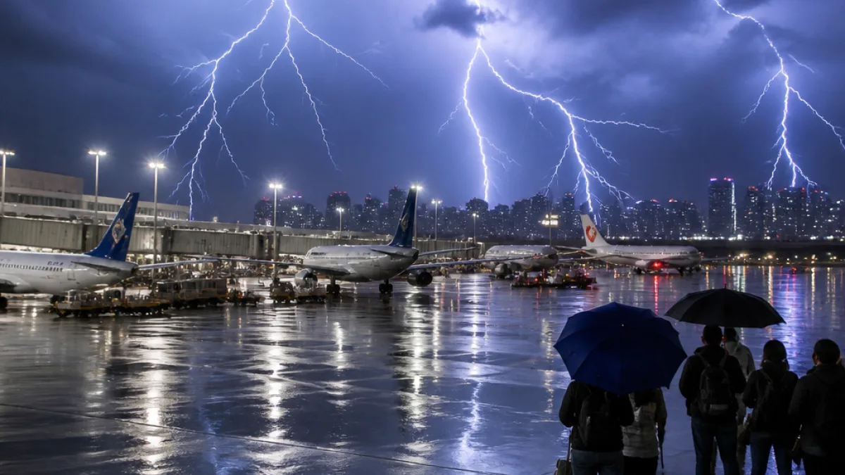
An unusually intense thunderstorm raced across British Columbia's South Coast late Saturday and into the early hours of Sunday, producing hundreds of lightning strikes and major disruption at Vancouver International Airport (YVR).
Lightning, delays and grounded planes
Environment Canada warned of a severe thunderstorm as the system pushed onshore near Richmond, bringing heavy rain and frequent lightning to Vancouver, Richmond and surrounding communities. The storm forced YVR to halt departures and restrict ground movement for arriving aircraft during the height of the thunder activity, with airport operations notably affected between approximately 9 p.m. and 3 a.m.
“This was quite the system, hundreds of cloud to ground strikes ... mainly in Vancouver/Richmond,” said CBC meteorologist Johanna Wagstaffe.
Airport officials said the pause in ground handling meant some flights could not depart and others could not taxi to gates once they landed. YVR’s website showed multiple delays and cancellations as staff and airlines worked to recover schedules on Sunday. Passengers were urged to check flight statuses before travelling to the terminal.
Wider impacts across the South Coast and Central Interior
Social media and submissions to media outlets captured dramatic images of lightning arcing across the downtown skyline and illuminated clouds above the University of British Columbia campus. Videos also appeared to show localised flooding within parts of the airport perimeter.
While the most visible effects were along the coast, the system carried moisture inland. Environment Canada reported that Central B.C. regions such as the Cariboo and Chilcotin were also affected by heavy rain, with officials issuing high streamflow advisories where conditions warranted.
What authorities are advising
Emergency-management and transportation officials commonly advise the public to expect lingering travel disruption after widespread lightning events. Recovery of flight schedules can take many hours as aircraft and crew are repositioned, and runway and gate operations resume once it is safe to do so.
- Check flight status with airlines and YVR before departing for the airport.
- Expect delays on roads in areas experiencing heavy rainfall and localized flooding.
- Follow local advisories for possible streamflow or flood warnings in inland regions.
Why this storm was notable
Meteorologists pointed out that the storm was fuelled by a low-pressure system that tracked north from equatorial latitudes with abundant moisture, allowing it to generate rapid development of convective cells and many cloud-to-ground strikes in a short time. Such concentrated lightning over a major airport poses specific hazards because standard ground operations — including refuelling, baggage handling and aircraft movement — are suspended during active lightning to protect workers and passengers.
| Area | Reported impact |
|---|---|
| Vancouver / Richmond | Hundreds of lightning strikes; flight ground holds and delays |
| Vancouver International Airport (YVR) | Departures stopped; arriving aircraft unable to taxi to gates during peak lightning |
| Central Interior (Cariboo, Chilcotin) | Heavy rain; high streamflow advisories in effect |
BC Hydro and other utilities often see increased outages following thunderstorms because lightning can strike equipment and strong winds can topple trees onto lines. At the time of the storm, customers across the region reported interruptions, and crews remained on alert for repair work once it was safe to deploy field teams.
Practical implications for residents and travellers
Commuters and travellers should prepare for possible residual impacts through Sunday and into the coming days. Flight operators typically need time to reassign gates, crews and aircraft, which can extend delays beyond the period of active thunder. Road users should remain cautious where drainage is overwhelmed; sudden surface flooding can create hazardous conditions even after rainfall eases.
This storm underscores the importance of real-time monitoring and heeding official advisories. For residents on the South Coast, that means checking Environment Canada warnings, YVR flight updates and local municipal traffic notices. For communities in the Central Interior, watch for river and creek level bulletins and follow guidance from regional emergency management if streamflow warnings are escalated.
The storm was a reminder that powerful convective systems can develop quickly in summer months when atmospheric ingredients align, disrupting travel and exposing infrastructure vulnerabilities across an urban and regional footprint. Officials and travellers will be assessing recovery through Sunday as flights and ground services resume normal operations.