Streets that shaped a city
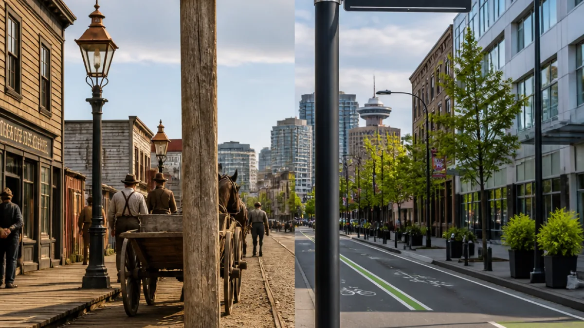
Vancouver’s modern streetscape — smooth asphalt, bike lanes and LED streetlights — rests on a surprisingly varied past. More than a century ago, the city's thoroughfares were a patchwork of surfaces and solutions that reflected a growing settlement coping with geography, technology and rapid development.
“
Roads are one of the great unifiers of a city.” That observation captures why the evolution of Vancouver’s roads matters beyond nostalgia: from how people moved and traded to how neighbourhoods were named and remembered.
What the surfaces tell us
Today, asphalt dominates, but that was not always the case. Around 110 years ago, Vancouver streets were built with a mix of materials: dirt, gravel, brick, granite and wooden planks. The variety was practical — different parts of the growing city used whatever durable or economical material was at hand.
By the 1930s, while the city had already expanded, the majority of roadways remained gravel or dirt, reflecting Vancouver’s still partly rural character at that time. Even the route encircling Stanley Park used an unconventional base: sections were laid on the shell midden that local First Nations had created in what is now the park.
| Era | Common road surfaces |
|---|---|
| Early 1900s (~110 years ago) | Dirt, gravel, brick, granite, wooden planks |
| 1930s | Majority gravel or dirt |
Names on the map: a city shaped by surveying
Street names in Vancouver carry the imprint of early planners and surveyors. Lauchlan Alexander (L.A.) Hamilton, who served as land commissioner for the Canadian Pacific Railway while here, had a hand in naming many of the original city streets. Among his contributions were the tree-named streets in Kitsilano and Fairview, such as Fir and Oak, and the decision to formalize names like Burrard.
Hamilton also gave his own name to Hamilton Street, and for a period the intersection of Hamilton and Hastings was regarded as the city's first street corner. Not all names stuck to their intended spellings: a handful of modern signs reflect historical errors or adaptations. Examples include McLean Drive (originally for Malcolm MacLean), Cardero Street (after Cordero Channel) and Bidwell Street (intended for Bedwell Bay).
Lighting the way
Before electric street lighting became widespread, Vancouver — like many cities of its era — relied on human labour to keep streets lit. The reference to a one-armed lamplighter in historical summaries points to the era when lamplighters physically tended lamps at dusk and dawn. That system would eventually give way to electric lights, changing both safety and the rhythm of the city after dark.
Why these details still matter
These early choices — from where roads were laid to what they were called — left a lasting imprint. Surface materials affected maintenance patterns and traffic; naming choices shaped neighbourhood identity; and early lighting methods influenced how public space felt at night. Today’s conversations about street design, transportation equity and heritage conservation are informed by that layered past.
- Material history: Vancouver streets once used a wide array of paving materials, not just asphalt.
- Naming legacies: Many street names date to early planners like L.A. Hamilton, including several tree streets and Hamilton Street itself.
- Urban transition: The move from manual lamplighting to electric lights and from gravel roads to paved streets shaped daily life and city growth.
Understanding these particulars helps frame current debates about how the city should move forward — whether that concerns road resurfacing priorities, heritage signage or how to reconcile modern infrastructure with Indigenous sites such as the Stanley Park shell midden. Vancouver’s streets are more than conduits for traffic; they are a palimpsest of the city’s social and physical history.