CARMEL, Indiana — Officials in Carmel warned on 17 August that changes to the landscape following historic flooding have created a new channel that is nearing the White River and could divert the river into a nearby quarry, potentially causing the discharge of raw sewage and leaving parts of the riverbed dry further downstream.
New channel threatens to capture main flow
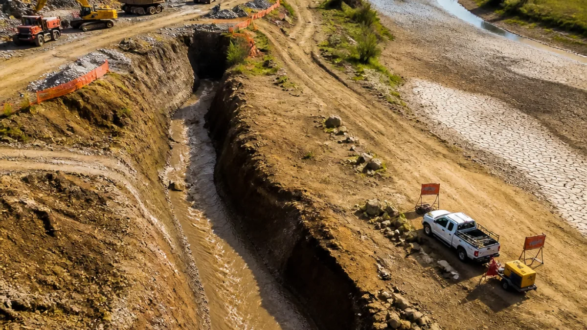
At a city council meeting on the evening of 17 August, Carmel city engineer Bradley Pease reported that floodwaters have carved a deeper channel from Blue Woods Creek into a quarry on the city’s south‑east side. That new cut is now approaching the White River and is deeper than the existing riverbed in the area, increasing the likelihood that the river could change course.
“For a brief period, all flow or a significant portion of the flow could divert totally into the quarry so that south of there, there would be no water in the White River,” Pease said, according to the council briefing. City officials put the probability of diversion in the short term at about 70–75%.
“We don’t want to frighten anybody or concern anybody, we just want people to be aware that we are watching this and trying to measure the effects of this and want to make sure we are speaking openly about it,” Carmel Mayor Sue Finkam said during the meeting.
What could happen if the river diverts
Officials explained two key hazards if the river breaches into the quarry:
- Risk of sewage discharge: Infrastructure adjacent to the present river course could be undermined or damaged, allowing raw sewage to enter the quarry and river system.
- Temporary loss of flow downstream: If the quarry captures the river flow, sections of the White River south of the capture point could be left without surface flow for a period while the quarry fills and water returns to the original channel.
Engineers said that if diversion occurs it could take between two and six hours for the quarry to fill and for water to resume flowing back into the original river channel, though local conditions will determine exact timings.
Local infrastructure already impacted
The city and Hamilton County are also facing a long repair project after a bridge on Hazel Dell Parkway, south of 106th Street, was washed out by the floods. The bridge allowed motorists to cross Blue Woods Creek; officials said replacement work will be substantial and will take years to complete.
| Issue | Reported detail |
|---|---|
| Probability of river diversion | 70–75% (city engineer) |
| Estimated quarry refill time | 2–6 hours |
| Bridge damage | Bridge on Hazel Dell Parkway washed out; replacement expected to be a multi‑year project |
Coordination with downstream communities
Pease told the council the city has alerted partners downstream who would be affected should the White River lose surface flow. Those water departments and agencies have been notified and would be expected to respond if the diversion becomes a reality, he said.
This sequence — erosion creating a deeper cut nearer the main channel, capture of flow by a quarry or side channel, and downstream impacts including pollution and interrupted flow — highlights how extreme rainfall and landscape changes after flooding can quickly translate into public‑health and infrastructure emergencies.
For residents and interest groups monitoring river health and recreational access, the situation is a reminder that river courses can shift rapidly after major flood events and that municipal planning and emergency response must account for such geomorphological change.
City officials said they are continuing to monitor the channel advance and are measuring effects in real time. They urged transparency and community awareness while response plans remain under preparation.