
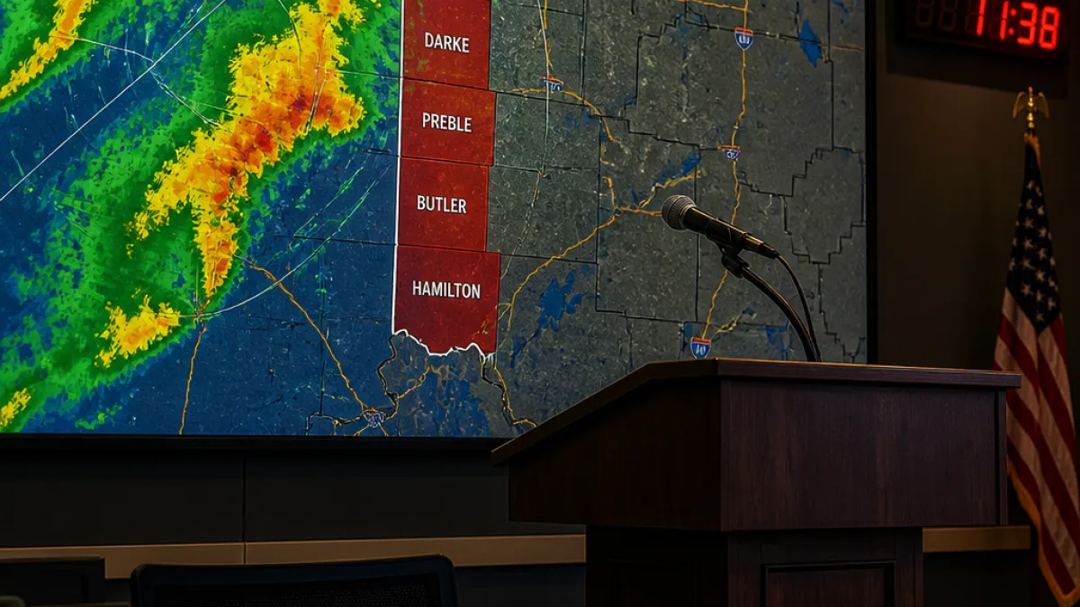
COLUMBUS — Gov. Mike DeWine said Thursday evening that western Ohio faces a heightened risk of overnight flooding as meteorologists expect sustained heavy rain in counties along the Indiana border.
At a briefing at the Ohio Emergency Operations Center, DeWine singled out Darke, Preble, Butler and Hamilton counties as areas likely to see continuous rainfall between 11 p.m. and 4 a.m. Forecasters are projecting total rainfall amounts of 1 to 4 inches during that stretch, and state officials warned that saturated ground from earlier storms could worsen runoff and flash-flood risk.
“Meteorologists have no way of completely predicting what will happen or where it will happen, but we have been following this all day,” DeWine said. He added that conditions could develop while people are asleep and urged residents in low-lying or flood-prone locations to stay alert overnight.
Immediate safety steps for residents
DeWine emphasized basic preparedness steps people should follow if they live in vulnerable areas or are traveling late at night:
- Make sure you can receive severe-weather warnings overnight — keep a cellphone nearby or have a radio or television on for updates.
- Keep a flashlight and other emergency items accessible in case of a power outage.
- If you encounter water on the road, do not drive through it: stop, turn around and find another route.
“These things can creep up on people during the middle of the night, and again, that’s why, at this point in the early evening, we’re asking you to be very, very careful.”
State officials noted the difficulty in predicting exact impacts but said the consistency of forecasts throughout the day justified the advisory tone of the briefing. The primary concern is that saturated soils will produce rapid runoff and potentially flash flooding even from a few inches of additional rain.
Where the rain is expected
Officials named four counties by the Indiana border as most likely to see the heaviest, continuous rain. The table below summarizes the specific counties and the forecast window and rainfall totals provided by the governor’s office.
| County | Forecast window | Expected rainfall |
|---|---|---|
| Darke | 11 p.m. to 4 a.m. | 1–4 inches |
| Preble | 11 p.m. to 4 a.m. | 1–4 inches |
| Butler | 11 p.m. to 4 a.m. | 1–4 inches |
| Hamilton | 11 p.m. to 4 a.m. | 1–4 inches |
Authorities urged residents in low-lying areas and along streams to take the advisory seriously, noting that localized flooding can occur quickly when the ground is already saturated. DeWine also recommended simple preparedness measures such as charging phones, having freshwater supplies and identifying higher ground if evacuation becomes necessary.
State response and recent context
The governor said he recently visited Perry County, where a state of emergency had been declared earlier this week amid severe weather impacts. While details from his visit were not expanded upon at the briefing, the trip underscored the continuing strain on local resources and the reason for the statewide watchfulness.
Emergency management officials have been coordinating with local authorities to monitor river gauges, road conditions and storm reports. They advised motorists to avoid driving at night if possible in the affected counties and to report any floodwaters or damaged infrastructure to local emergency management offices.
Even modest additional rainfall can produce hazardous conditions when soils are saturated and stormwater systems are already stressed. Residents are encouraged to follow local weather alerts and directives from county emergency management agencies for the latest information on road closures and evacuations.
WE NEWS will continue to follow updates from the Ohio Emergency Operations Center and local emergency management agencies as the overnight period progresses and will publish advisories as new information becomes available.
Damon Carver, State Correspondent