The prospect of a limited border adjustment between India and Myanmar in Manipur's Chandel district has provoked unease in the state after foreign reporting suggested a demarcation of a short stretch of the international boundary could involve the exchange of territory.
What was reported
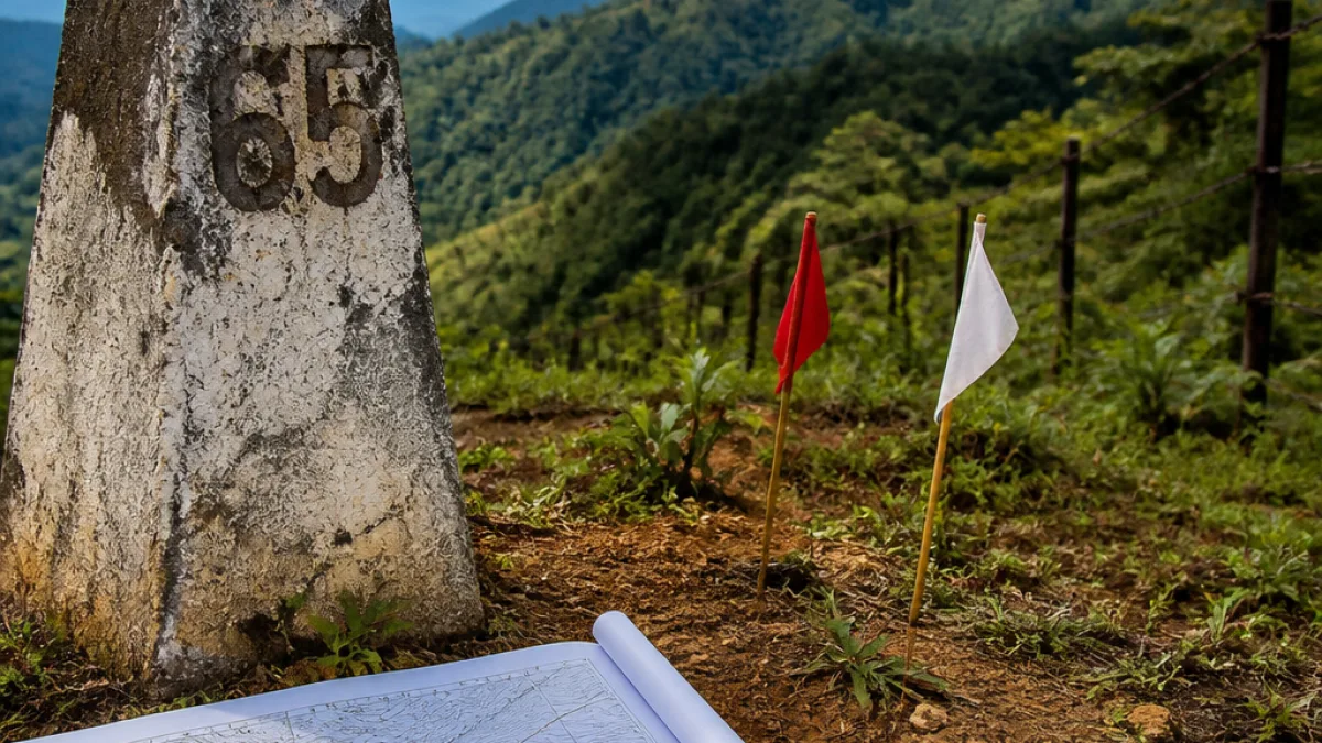
An American publication reported in July 2026, citing an internal Indian government document, that officials were examining a final demarcation of roughly 2.75–2.8 kilometres of the border between Border Pillars 65 and 68. The report said the area under consideration could amount to around 3.5 square kilometres — roughly 1.4 square miles — and suggested the possibility of a land swap between the two countries.
"Only certain portions of the India–Myanmar border remain unsettled and discussions regarding their demarcation are continuing," said Randhir Jaiswal, a Ministry of External Affairs spokesperson.
The MEA statement, however, stopped short of confirming that any land had been transferred or that an agreement had been finalised.
Why the issue matters in Manipur
The border with Myanmar is a sensitive subject in Manipur, where questions of territory intersect with identity and security concerns. Local political leaders and civil society have historically reacted strongly to any perceived alteration of the state's boundaries. Reports of possible concessions or swaps are likely to generate public debate and political scrutiny in the state capital and affected districts.
Analysts and community representatives in Manipur describe territorial adjustments as particularly fraught because of the symbolic and practical implications for land, livelihoods and cross-border links. The report that a small segment of the border is being re-examined has therefore elicited heightened attention from both officials and residents.
Historical context
The roots of the present-day India–Myanmar boundary lie in the colonial era and disputes over the Kabaw Valley. After the First Anglo-Burmese War (1824–26) and the Treaty of Yandabo, British cartographers drew a frontier known as the Pemberton Line in 1834, which placed the Kabaw Valley under Burmese administration. Historical arrangements included a compensatory payment to the Manipur ruler that continued for more than a century; according to historical accounts, payments were discontinued following consultations between Prime Minister Jawaharlal Nehru and Burmese Prime Minister U Nu in 1953.
Today, India and Myanmar share a long international boundary of about 1,643 kilometres, passing through the north-eastern states of Arunachal Pradesh, Nagaland, Manipur and Mizoram. While much of the border is agreed upon, officials acknowledge that certain stretches remain to be mutually demarcated.
What authorities say and what is not confirmed
The MEA has characterised outstanding issues as limited portions left to be demarcated and emphasised that discussions are under way. The ministry has not issued any confirmation of a land transfer or an executed land-swap agreement.
- Reported scope: 2.75–2.8 km between BP 65 and 68.
- Reported area: about 3.5 sq km (approximately 1.4 sq miles).
- Official line: discussions continuing; no confirmation of transfer.
| Item | Reported detail |
|---|---|
| Border Pillars | BP 65–68 |
| Length under review | 2.75–2.8 km |
| Approximate area | 3.5 sq km |
Implications and next steps
Any formal step toward changing the alignment of the international boundary would involve detailed technical surveys, diplomatic agreement and likely consultations with state authorities. The MEA's public comments indicate that, at this stage, the matter remains in the discussion phase and that no unilateral action has been confirmed.
For local stakeholders in Manipur, the immediate priority will be clarification from central and state authorities about the nature of discussions and any potential impact on residents and land use. MPs, state ministers and district officials can be expected to seek briefings from the Centre. Meanwhile, civil society groups and political leaders in the region may call for transparency and for constitutional and legal protections to be observed if any proposal moves forward.
Given the sensitivity of boundary issues in the north-east, observers say careful diplomacy and clear communication with affected communities will be essential to prevent misunderstanding and unrest until the government provides definitive information.