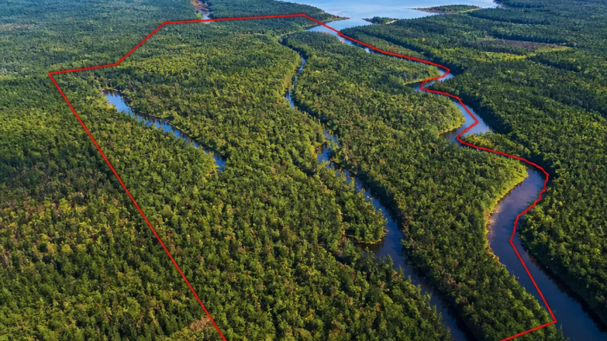
COPPER HARBOR — The Michigan Department of Natural Resources is moving to purchase 4,494 acres of heavily wooded land near the tip of the Keweenaw Peninsula from The Nature Conservancy for $4.9 million, officials said Tuesday. The acquisition, the first phase of the Keweenaw Heartlands project, would expand public holdings adjacent to the Copper Country State Forest and protect streams, the Montreal River and several thousand acres of working forest from being subdivided for private development.
What the purchase covers
The tract under negotiation sits next to existing state forest lands and contains multiple creeks and segments of the Montreal River, according to Michigan Department of Natural Resources materials. The state plans to pay for the purchase with grant money from the Michigan Natural Resources Trust Fund and the federal Land and Water Conservation Fund. DNR public lands specialist Tori Irving confirmed the deal is the first of two planned acquisitions under the broader Keweenaw Heartlands effort.
| Item | Amount |
|---|---|
| Land area (phase one) | 4,494 acres |
| Purchase price | $4.9 million |
| Planned phase two | 5,476 acres |
Part of a larger conservation push
The Keweenaw Heartlands project envisions two state purchases that together would add nearly 10,000 acres to Michigan's public land holdings. The second parcel, to the west of this first tract, comprises about 5,476 acres, bringing the combined total close to 10,000 acres if both transactions are completed.
For generations the lands have functioned as working forests, historically tied to timber harvests and open to the public for recreation including hiking, biking, hunting, fishing and snowmobiling. The property had been part of the Calumet and Hecla Mining Co.'s holdings for more than a century before coming under The Nature Conservancy's stewardship.
Local access and economic considerations
Residents and local recreation users have long relied on large, contiguous woodlands in the Northwoods for outdoor activities and as an economic driver through timber harvests and tourism. Community concern mounted when parcels appeared on the market, and advocates argued that private development could have reduced public access and disrupted both recreation and the timber-based local economy.
- Public recreation: hiking, biking, hunting, fishing, snowmobiling have been practiced on these lands.
- Economic role: working-forest management and timber harvests have supported local jobs and services.
- Conservation goals: protecting waterways and contiguous habitat near the Montreal River.
Funding and next steps
The state intends to use established conservation funding streams — the Michigan Natural Resources Trust Fund and the federal Land and Water Conservation Fund — to complete the purchase. Those funds are commonly used for acquiring lands for public recreation, wildlife habitat protection and water-resource conservation. DNR staff will complete due diligence and move through the formal acquisition process, with the agency identifying the parcel as the initial phase of the Heartlands project.
If the second acquisition proceeds as planned, the two transactions together would represent a significant expansion of public land on the northern tip of the Keweenaw Peninsula and would solidify protections against subdivision or development that could fragment habitat and restrict long-standing uses.
Context for readers
Large-scale, state-led land acquisitions in the Upper Peninsula have gained traction in recent years as communities and conservation groups seek to preserve contiguous forest tracts for recreation, wildlife and sustainable forestry. The Keweenaw Heartlands project is another example of public and nonprofit collaboration to keep lands accessible and manage them for multiple uses.
Local stakeholders and outdoor users will likely watch the process closely as the DNR completes the purchase process and proceeds with any management plans. The purchases, if finalized, will both maintain public access and fold these tracts into the state's managed public land system.
Further details, including maps and the DNR’s management intentions for the newly acquired lands, will be available through the department as the acquisitions move forward.