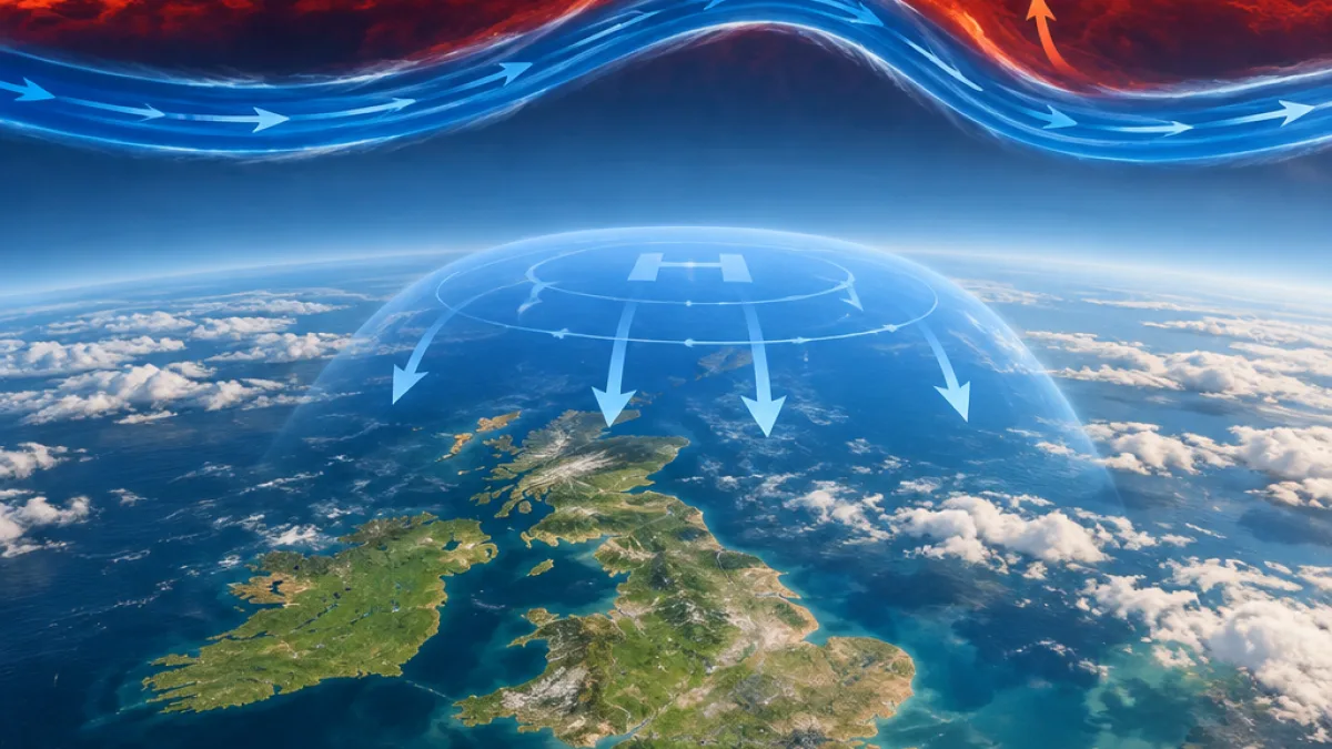
The UK could see the effects of an unusually early sudden stratospheric warming towards the end of November, according to the Met Office, although forecasters stress that it is too soon to say precisely what weather will follow.
The event is expected to take place this week and could be the earliest major sudden stratospheric warming on record by about three weeks. A cooler and drier period may arrive earlier than it otherwise would, but the Met Office has emphasised that such an atmospheric disturbance does not always produce a clear or predictable change at the surface.
“It doesn’t always affect our weather.”
What sudden stratospheric warming means
Sudden stratospheric warming is a rapid increase in temperature high above the Earth. The warming takes place in the stratosphere, between about 10 and 50 kilometres above the surface, and temperatures there can rise by as much as 50C within a few days.
That increase would not be felt directly by people at ground level. Instead, forecasters watch for possible changes in the atmospheric circulation below it, particularly the behaviour of the jet stream. Any influence on UK weather generally develops over a period of weeks rather than immediately.
| Development | What it could mean |
|---|---|
| Stratospheric warming | Rapid warming high above the Earth |
| Jet-stream response | A possible increase in large north-to-south undulations |
| Potential UK outcome | A cooler, drier spell later in November |
Why the polar vortex matters
During winter, powerful westerly winds normally circle the pole high in the stratosphere. This circulation, known as the stratospheric polar vortex, helps contain very cold air over the Arctic.
In some years those winds weaken temporarily or reverse direction. The cold air in the vortex can then descend rapidly, while temperatures in the stratosphere rise sharply. This is the process associated with sudden stratospheric warming.
The possible consequences are not identical every time. A warming event may cause the jet stream to develop larger bends, sometimes allowing a broad area of high pressure to become established. One typical pattern described by forecasters places blocking high pressure over the North Atlantic and Scandinavia.
Possible weather patterns across Europe
If that arrangement develops, northern Europe, including the UK, could experience a prolonged period of dry and cold weather. Southern Europe would more typically be milder, wetter and windier, while areas between the two patterns could see colder easterly winds.
- The most likely timing for any UK influence is currently towards the end of November.
- A cooler, drier spell is one possible outcome identified by the Met Office.
- The atmospheric event does not guarantee a particular type of weather in the UK.
- Forecast confidence is limited because the effects can vary from one warming event to another.
For now, the development should be treated as an indicator of a possible change in the broader weather pattern rather than a direct forecast of snow, frost or severe cold. The event is taking place far above the surface, and its potential influence depends on how the jet stream responds in the following weeks.
That distinction is important for households and travel planners. The Met Office’s current message is that a cooler, drier period could arrive sooner, not that a specific nationwide cold spell has been confirmed. More reliable details will only emerge as the atmospheric response becomes clearer.
What to watch next
Forecasters will be monitoring whether the polar vortex weakens or changes direction, and whether the jet stream begins to form the kind of pronounced pattern associated with blocking high pressure. Until those signals become established, the precise effect on the UK remains uncertain.
The immediate practical advice is therefore to follow updated Met Office forecasts rather than relying on the stratospheric event alone. If the expected connection to the jet stream develops, the UK may move into a colder and drier phase later in November, but the strength, duration and exact distribution of that weather cannot yet be determined.