
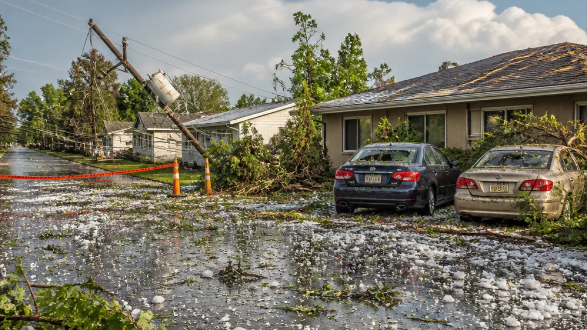
Environment Canada cancelled a yellow severe thunderstorm warning Tuesday evening after a fast-moving storm system moved through portions of southern Alberta, bringing large hail, violent wind gusts and periods of heavy rain.
Where the storm hit
Storm reports and photos from the region showed significant hail in and around Claresholm, roughly 120 kilometres south of Calgary. The weather agency’s advisory covered areas stretching from Claresholm east toward Lethbridge and Medicine Hat, with watches remaining in effect in parts of the region into Tuesday night.
What officials warned
When the alert was issued earlier in the day Environment Canada warned the storm had the potential to produce baseball-sized hail and sustained damaging winds capable of downing trees and causing structural damage. The initial bulletin described conditions that, in extreme cases, could threaten homes and vehicles.
Local impacts and images
Local residents captured hail striking rooftops, vehicles and vegetation. Media and social posts from the Claresholm area showed large accumulations of ice and rapid runoff from heavy rainfall. While the warning has been lifted, emergency and municipal crews in affected communities are still assessing any property damage and clearing debris.
- Primary affected corridor: Claresholm to Medicine Hat, via Lethbridge.
- Main hazards reported: Large hail, damaging wind gusts, heavy rainfall.
- Timing: Storm moved through Tuesday afternoon into evening; watches persisted in some areas into the night.
Safety and practical information
Residents in southern Alberta are advised to remain cautious even though the immediate warning has been cancelled. Thunderstorm systems can produce localized damage and secondary hazards such as flooded roadways, downed power lines and scattered debris. Officials recommend:
- Keeping clear of downed power lines and reporting them to local utilities.
- Avoiding driving through flooded sections of road and turning around where water covers the roadway.
- Inspecting property for damage once it is safe to do so, and documenting any loss for insurance claims.
How the warning system works
Environment Canada issues colour-coded watches and warnings based on the likelihood and severity of weather events. A yellow watch indicates conditions that could become dangerous and warrant close attention. Alerts are updated as storms evolve and forecasters get new radar and ground reports.
| Alert | Meaning |
|---|---|
| Yellow watch | Potentially dangerous weather is likely; monitor updates |
| Warning | Dangerous weather is occurring or imminent; protect life and property |
Context for Alberta
Southern Alberta sits on a frequent track for vigorous summertime storms that form when warm, moist air from the south meets drier, cooler air from the mountain or interior. Those clashes can produce severe convective activity including hail cores and powerful downdrafts that generate damaging winds. Local farmers, ranchers and rural communities often bear the brunt of such events; crop loss and structural damage to outbuildings are common concerns after intense hail.
While the immediate emergency has eased, Environment Canada’s updated forecasts and watches will remain the best source for ongoing risk assessments. People with storm damage or who witnessed hazardous conditions are encouraged to share photos and reports with local media and authorities to assist post-storm response and verification.
The most current information on severe weather affecting Alberta is available on the Environment Canada website and via municipal emergency information channels.