Major east–west link complete between Markham and Richmond Hill
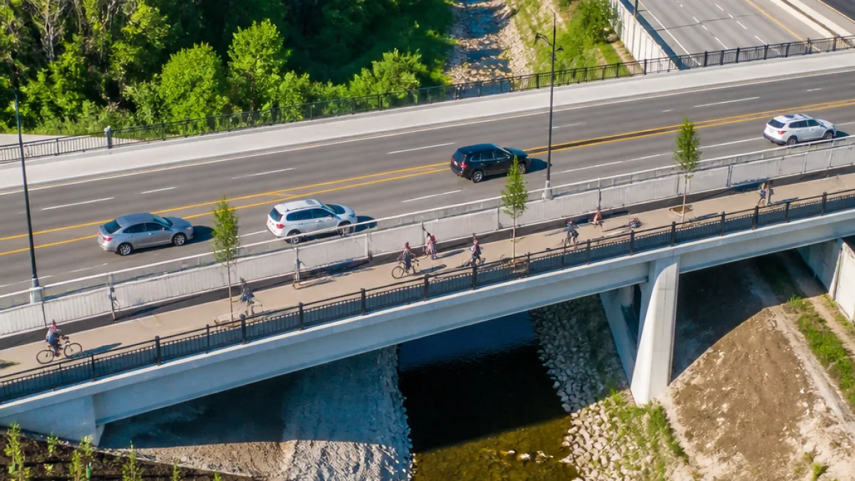
A new four‑lane road crossing spanning Highway 404 and the Rouge River has been completed, creating a direct connection between Richmond Hill and Markham and introducing new options for motorists, pedestrians and cyclists.
The project, which began construction in 2023 in partnership with the Ontario Ministry of Transportation, builds a route between Orlando Avenue in Richmond Hill and Markland Street in Markham. It also provides a new connection between Leslie Street and Woodbine Avenue, intended to improve access to communities and employment areas on both sides of the 404.
Funding and partners
The overall budget for the crossing was reported at $110 million. Municipal contributions were the largest share, with Markham covering about $65 million, Richmond Hill contributing roughly $28 million, and York Region providing approximately $17 million.
| Partner | Contribution |
|---|---|
| City of Markham | $65 million |
| City of Richmond Hill | $28 million |
| York Region | $17 million |
Construction elements and environmental work
The project included two separate bridge structures — one over Highway 404 and another over the Rouge River — along with an extension of Cachet Woods Court to tie into the new crossing. New sidewalks and multi‑use pathways run along the roadway to support walking, cycling and other micromobility.
Environmental work formed an explicit component of the build. Contractors carried out riverbank stabilization and naturalization on sections of the Rouge River, and landscaping included the planting of thousands of native trees and plants. Stormwater-quality improvements were also installed as part of the project scope.
“This $110 million total investment improves connectivity between communities and employment areas, making it easier for residents and businesses to move throughout the Region,”
York Region Chairman and CEO Eric Jolliffe made the remark at a ceremonial gathering of municipal and provincial officials to mark the crossing’s completion.
Markham’s mayor noted the city’s financial commitment to the project, with the municipal share estimated at about $65 million. Richmond Hill’s mayor emphasised the dual focus on transportation and environmental improvements, saying the work expands options for residents.
Local impact and what to expect
Municipal officials expect the new crossing to serve as an alternative east–west route, helping to reduce traffic volumes on some existing arterial and local roads. For Markham residents, the crossing provides:
- an additional option for automobile traffic aiming to cross Highway 404 without routing through more congested interchanges;
- new pedestrian and cycling infrastructure linking neighbourhoods and employment zones;
- environmental upgrades intended to stabilise and naturalize riverbanks and improve stormwater quality.
How travel patterns will change remains to be seen. The new route is likely to redistribute some commuter flows, particularly for trips that previously relied on fewer east–west crossings of the 404. Local residents, delivery operators and transit planners will be watching for shifts in congestion and bus routing as traffic settles into the new network.
Planning and coordination
Officials said the crossing was completed through cooperation between municipal governments and the provincial ministry. The work demonstrates a model of joint funding and planning intended to address both transportation capacity and environmental stewardship.
For residents of Markham, the crossing represents a tangible municipal investment in connectivity and active‑transportation infrastructure. As the route opens to public use, municipal staff and regional planners will monitor traffic impacts, active‑transportation uptake and the long‑term condition of restored river areas.
Further operational details, including any changes to local bus routes or formal opening dates for the multi‑use paths, will be provided by municipal staff as they finalise signage and related works.