
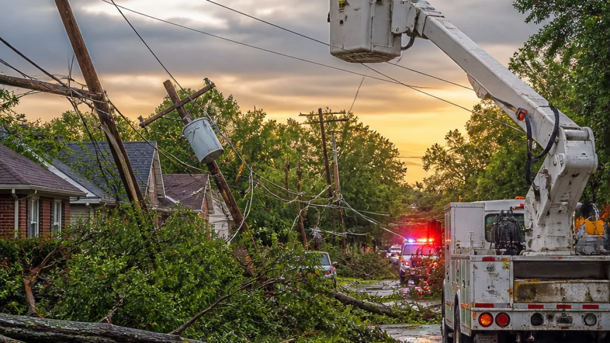
Severe thunderstorms that raced across Kentucky Tuesday evening left more than 103,000 customers without power, spawned confirmed high wind gusts and triggered multiple flash-flood warnings, officials said.
Widespread outages and dangerous winds
By 8 p.m. Tuesday, outage tracker PowerOutage.us showed in excess of 103,000 affected customers statewide, with many interruptions concentrated in Northern and Eastern Kentucky. Fayette County reported 3,342 outages late Tuesday, and utility crews worked through the night to assess damage and restore service.
Meteorologists confirmed damaging wind gusts in several counties. The National Weather Service in Louisville reported an 81 mph gust in Nicholas County and a 60 mph gust in Harrison County, readings consistent with winds that can uproot trees and bring down power lines.
| Item | Detail |
|---|---|
| Estimated customers without power | 103,000+ |
| Fayette County outages | 3,342 |
| Confirmed wind gusts | 81 mph (Nicholas), 60 mph (Harrison) |
Flash flooding concerns and watches
In addition to high winds, forecasters warned of heavy, repetitive rainfall that could produce localized flooding. Flash-flood warnings were issued late Tuesday for several counties, including Pulaski, Casey, Lincoln, Laurel, Knox and Harlan. Much of Central Kentucky, including Lexington, remained under a flood watch through Wednesday morning.
“Excessive runoff may result in flooding of rivers, creeks, streams, and other low-lying and flood-prone locations,” the National Weather Service said. “Flooding may occur in poor drainage and urban areas.”
Forecasters said some areas could receive as much as 3 to 4 inches of rain during repeated rounds of thunderstorms. Observed rainfall amounts before the worst of the evening storms ranged from roughly 0.5 to 1.5 inches across parts of the region, with spots expecting up to an additional inch in the hours ahead.
Local impacts and where flooding was expected
The NWS issued more focused flood guidance for Fayette and Clark counties, which were under a flood advisory until 8:15 p.m. Tuesday. The advisory noted that the initial rain totals could lead to minor flooding in low-lying and poor-drainage areas.
- Areas specifically mentioned for potential flooding included Lexington, Winchester and several neighborhoods such as Bryan Station and Thoroughbred Acres.
- Travel disruptions were reported as trees fell across roadways and traffic signals lost power in parts of Lexington.
- Utility crews and emergency responders remained active overnight monitoring downed lines and assessing storm damage.
National Weather Service meteorologist Brian Foster warned that the initial line of storms could be followed by additional thunderstorm rounds Wednesday evening, meaning the risk of further heavy rain, damaging winds and lightning would persist.
What residents should do
Officials urged residents to take standard storm precautions: avoid flooded roads, stay indoors during lightning and report downed power lines and hazardous conditions to local authorities. Motorists should expect outages at some intersections and exercise caution where traffic signals are dark or flashing.
As crews work to restore service, customers affected by outages should contact their utility provider for updates and follow guidance from local emergency management offices for sheltering or road-closure information.
State and local agencies continue to monitor conditions and will provide updates as damage assessments are completed and power restoration progresses.
— Marcus Ellison, State Correspondent














