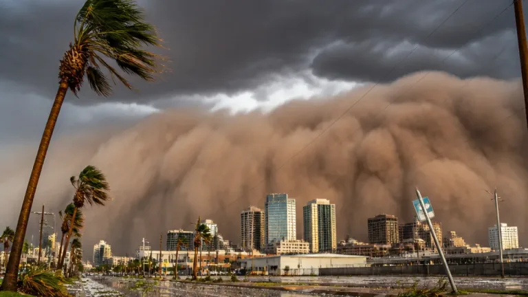

The National Weather Service has issued a hazardous weather outlook as scattered thunderstorms move into north and central Georgia Saturday afternoon, with the greatest coverage expected along and south of the I-85 corridor. Forecasters say a few of the storms could become strong, producing locally heavy rainfall and gusty winds.
When and where to expect the strongest storms
Scattered activity is anticipated to develop during the afternoon hours and continue into the evening. The highest storm coverage is forecast along and south of the I-85 corridor, a region that includes sprawling suburban and urban neighborhoods as well as smaller communities.
Officials warned residents to prepare for brief but intense downpours that can lead to localized flooding and reduced visibility on roadways. Gusts from strong storms could knock down limbs and create hazardous driving conditions.
Outlook for the week ahead
The NWS outlook extends through the coming week, noting that isolated to scattered afternoon thunderstorms are expected Sunday and each day next week. In addition to daily storm chances, forecasters said heat index values may approach hazardous levels Monday through Friday, increasing the risk for heat-related illness.
Emergency managers and meteorologists stress that even storms that do not produce tornadoes can create dangerous conditions through flash flooding and damaging winds. Motorists, outdoor workers and people planning events should monitor forecasts and have contingency plans.
What the hazardous weather outlook covers
The outlook released early Saturday lists more than 80 counties in north and central Georgia under consideration for hazardous weather impacts. Some of the counties named include Baldwin, Cobb, DeKalb, Fulton, Gwinnett, Hall and Muscogee, among many others spanning from the Chattahoochee Valley to the mountains and the Piedmont.
| Threat | Timing | Impacts |
|---|---|---|
| Scattered thunderstorms | Saturday afternoon into evening | Frequent lightning, reduced visibility, brief heavy rain |
| Strong storms (limited) | Saturday afternoon into evening | Gusty winds, localized flooding |
| Daily afternoon storms | Sunday through next week | Repeated downpours, localized flash flooding |
| Hazardous heat index | Monday–Friday next week | Increased risk of heat-related illness |
Practical safety steps
Local officials recommend simple precautions to stay safe during the stormy and hot stretch:
- Monitor weather updates from the National Weather Service and local broadcasters.
- Avoid driving through flooded roadways — "Turn Around, Don’t Drown."
- Secure outdoor furniture and loose objects that can become projectiles in strong gusts.
- Limit strenuous outdoor activity during peak heat and hydrate regularly if working outside.
- Have an emergency kit ready, including a battery-powered weather radio or charged mobile device.
Even relatively short bursts of heavy rain can overwhelm small creeks, culverts and low-lying roadways. If you live in an area prone to flooding, consider moving vehicles to higher ground and avoid walking through floodwater, which can conceal hazards and strong currents.
Forecasters say the pattern bringing afternoon storms and heightened heat is likely to persist through much of the coming week, so residents should expect repeated rounds of high humidity, storm chances and elevated heat indices. Check the National Weather Service for watches or warnings that may be issued as conditions change.
Local emergency management agencies will post updates and safety guidance as needed. For the most current forecasts and alerts, visit weather.gov or follow your county emergency management office on social media.
Reporting from Atlanta, Tamara Ellison, WE NEWS.