
Flood and rainfall warnings remain in effect across much of British Columbia as a succession of storms moves through the province, with additional rain expected over the weekend and several regions also facing reduced visibility from fog.
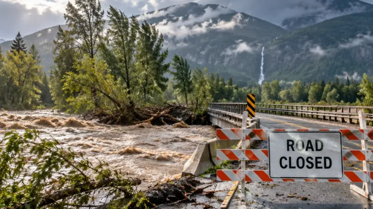
The entire South Coast, including Vancouver Island, was under a flood watch or warning Friday morning. The North Shore-Sea-to-Sky corridor, the Lower Fraser and the Kingcome River area on the Central Coast were identified as particular concerns after a prolonged period of heavy rain earlier in the week.
The River Forecast Centre says water levels in those areas have reached, or are expected to reach, levels that could overtop river banks and produce flooding. The situation is unfolding as saturated ground and swollen waterways leave communities with less capacity to absorb additional rainfall.
Evacuation and shelter measures in the Pemberton Valley
People in the Pemberton Valley have been told either to leave or to shelter in place, depending on their location. The guidance remains in effect while authorities monitor flooding and the continuing storm pattern.
On Thursday, the Líl̓wat Nation reported that water was flowing across sections of Lillooet Lake Road to a depth ranging from six inches to one foot. Aerial images also showed flooding near Highway 99 and the Lillooet River in the Pemberton area.
The flooding has implications beyond individual properties. Routes through the region can be affected by water on roads, rising rivers and unstable travel conditions, making current information especially important for anyone planning to drive through affected areas.
Rain and fog expected to continue
Environment Canada says rain is expected to persist through the weekend on Vancouver Island. Fog advisories were issued Friday for the Cariboo, East Kootenay, Similkameen and South Okanagan regions, adding a visibility hazard in areas that may already be dealing with wet roads and changing conditions.
| Area or concern | Current weather information |
|---|---|
| South Coast | Flood watch or warning in effect |
| Vancouver Island | Rain expected through the weekend |
| Cariboo, East Kootenay, Similkameen and South Okanagan | Fog advisories issued Friday |
| Pemberton Valley | Evacuation orders or shelter-in-place advice, depending on location |
The province previously warned drivers about the potential for storm impacts along the Malahat Highway, Highway 99 and Highway 1 through the Fraser Valley. Travellers were advised to consult DriveBC before setting out, a step that is particularly important when forecasts, road conditions and water levels can change quickly.
A reminder of B.C.'s recent flood history
The warnings arrive as British Columbia marks five years since heavy rain affected the southern half of the province in 2021. That event washed out key transportation routes, flooded homes and farmland, and left several people dead. The current storm sequence is not described as a repeat of that disaster, but the anniversary underscores how quickly persistent rain can create widespread disruption in the province.
Officials are continuing to track river levels and rainfall as the storms pass. For residents in areas under evacuation or shelter-in-place direction, following local instructions remains the priority. Drivers should check road information before travelling and be prepared for flooding, poor visibility and delays along affected routes.
- Flood watches and warnings cover much of the South Coast.
- Additional rain is expected on Vancouver Island through the weekend.
- Fog advisories are in place in four Interior regions, while the Pemberton Valley remains under emergency measures.