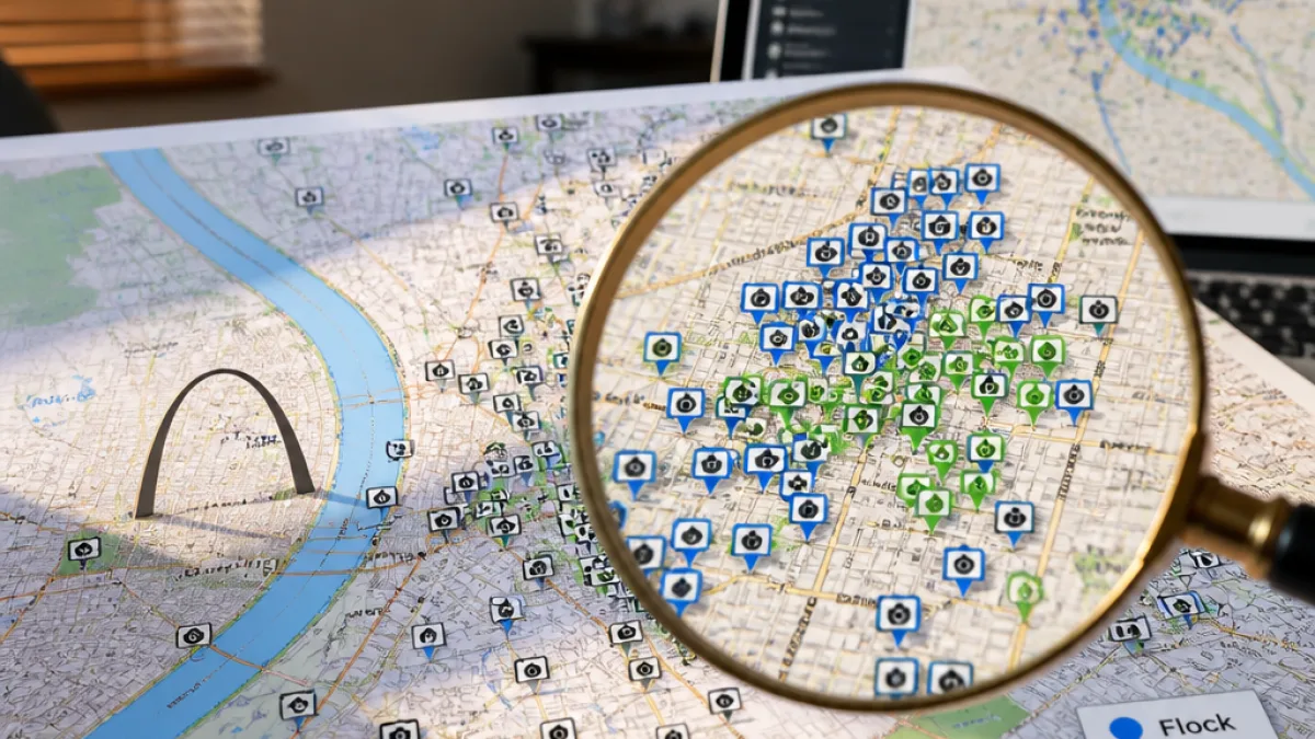
ST. LOUIS — A crowdsourced map of automated license plate readers suggests the St. Louis region is under extensive vehicle surveillance, listing between 1,400 and 1,500 cameras with approximately 70% identified as Flock Safety devices — roughly 1,000 cameras.
What the map shows
The map, maintained by the DeFlock project, aggregates volunteer-reported locations of automated license plate reader systems, commonly called ALPRs. Alongside Flock Safety cameras, the map includes cameras from other manufacturers such as Genetec and Motorola Solutions.
- DeFlock lists between 1,400 and 1,500 ALPRs across the greater St. Louis area.
- About 70% of those cameras are identified as Flock Safety devices — around 1,000 cameras.
- The map is crowdsourced, meaning locations come from volunteers and may be incomplete or incorrect.
How the technology works
Automated license plate readers photograph vehicles as they pass, capturing license-plate numbers and often recording additional vehicle details such as make, model, color and visible features. These records typically include time and location information that law enforcement can search during investigations.
“The information can include the time and location where a vehicle was photographed, creating a record that can be searched by law enforcement during investigations,”
Flock Safety says its systems provide evidence and investigative leads to law enforcement agencies; the company reports serving more than 5,000 law enforcement agencies across 49 states and more than 6,000 communities.
Local deployment and limitations
The map does not represent an official inventory. DeFlock warns that volunteer-collected data can include missing, relocated or misidentified cameras. Local officials and agencies do not always publish a comprehensive list of installed devices, and counts can change as equipment is added or removed.
Some jurisdictions and programs emphasize limits on biometric capabilities. For example, University City has said its Flock system does not use facial recognition or other biometric identification. St. Louis County Police Department has used mobile ALPR technology since 2017, according to public reporting on local deployments.
| Item | Figure |
|---|---|
| ALPRs mapped in St. Louis region | 1,400–1,500 |
| Estimated Flock Safety cameras | ~1,000 |
| Flock's reported agency network | 5,000+ agencies, 49 states, 6,000+ communities |
Why the numbers matter for St. Louis residents
For residents, the scale of ALPR deployment affects a range of public-policy debates: privacy protections, transparency about data retention and sharing, how law enforcement uses commercial networks, and oversight of surveillance technology in public spaces.
Advocates and civic groups have raised concerns about the reach of automated vehicle surveillance and the potential for data-sharing with federal or private entities. Supporters argue ALPRs can provide critical investigative leads and help recover stolen vehicles or apprehend suspects. The crowdsourced map brings those competing considerations into sharper focus for the St. Louis area by suggesting how widely cameras are distributed.
Because the map is volunteer-produced, the figures should be treated as an estimate. Still, the project offers a public starting point for local conversations about governance, transparency and whether municipal oversight or policy changes are needed as surveillance networks expand.
Local officials, law enforcement and private providers have differing policies on data use and retention. Residents seeking clarity should ask which agencies operate or contract for ALPRs in their municipality, what data are kept, how long they are retained and whether third parties can access the records.