Québec Innovative Materials Corp. has reported a major expansion of its helium exploration work in the New Salem–Apple River portion of the Cumberland Basin, adding hundreds of soil-gas measurements and isolating several concentrated helium anomalies that sit directly over mapped regional faults.
Survey expands regional dataset, sharpened targets
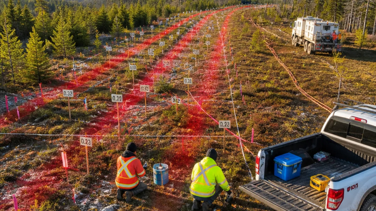
The company’s 2026 soil-gas campaign collected 526 samples on 28 survey lines, raising the cumulative number of samples in the district from 28 to 554. Independent analysis was carried out by GeoFrontiers Corporation of Wichita Falls, Texas, a laboratory specialising in petroleum and helium geochemistry.
The expanded dataset allowed the team to establish a statistically defensible regional background value of 5.40 ppmv and an anomaly threshold of 5.48 ppmv. Of the 526 new samples, 463 were classed as background while 63 returned anomalous values; 18 of those were categorised as strongly anomalous (above 5.57 ppmv).
Three fault-controlled zones identified
Analysts resolved three coherent helium zones, each associated with a mapped regional fault, and reported the program’s highest reading to date of 5.864 ppmv in what the company designates as Zone C. The other zones show similar elevated values and align along east–west structural trends in the survey area.
Key observations from the survey include:
- Zone C: peak concentration 5.864 ppmv; line 5002 recorded 17 of 25 stations above the anomaly threshold, including an uninterrupted anomalous run of 800 metres.
- Zone B: an anomalous segment roughly 1.5 kilometres long on line 5000, located about 4 km west of Zone C on the same east–west fault (F‑III), with a peak of 5.690 ppmv.
- Zone A: originally sampled in November 2025 with helium up to 5.722 ppmv together with thermogenic hydrocarbons; now confirmed to lie on fault F‑I, about 3–7 km south‑west of Zones B and C.
Faults appear to control helium distribution
The company reports a clear spatial relationship between anomalous helium concentrations and mapped faults. Across the full dataset, anomalous stations are roughly five times more common within 1.5 kilometres of a mapped fault than they are more than 2 kilometres away — about 17 per cent versus 3 per cent — a difference described as statistically robust.
In addition to the three main zones, the survey noted a sharp peak of 5.831 ppmv on line 6002 (labelled Zone D) situated on fault F‑II in the Apple River area.
| Zone | Peak helium (ppmv) | Notable feature |
|---|---|---|
| A | 5.722 | On fault F‑I; previously showed thermogenic hydrocarbons |
| B | 5.690 | 1.5-km anomalous segment on fault F‑III |
| C | 5.864 | Highest program value; 800-m continuous anomaly on line 5002 |
| D | 5.831 | Sharp peak on fault F‑II in Apple River area |
Next steps: focused sampling and seismic work
Following the soil-gas findings, the company says the footprint of its seismic program will expand to about 50 line-kilometres. The continuous anomalous stretch in Zone C and clustered anomalies along mapped faults will guide closer-spaced follow-up sampling and denser seismic coverage intended to refine subsurface targets.
Helium is a critical industrial gas with uses ranging from electronics manufacturing to medical imaging and leak detection. While the survey results do not in themselves confirm an economic resource, they form a key early stage in the exploration workflow: locating pathways and traps where the gas might accumulate.
For communities in Cumberland Basin and surrounding areas, increased exploration activity can touch on land access, local contracting opportunities and environmental oversight. At this stage the work reported is limited to surface soil-gas geochemistry and planned seismic surveys; any future drilling would require regulatory approvals and further technical evaluation.
As the company advances toward more detailed subsurface imaging, the pattern emerging in the data is straightforward: helium anomalies in the New Salem–Apple River area are clustered along faults, and the latest program has given drill planners clearer, tighter targets to assess.
Further technical releases from the company are expected as the seismic program expands and additional sampling is completed.