
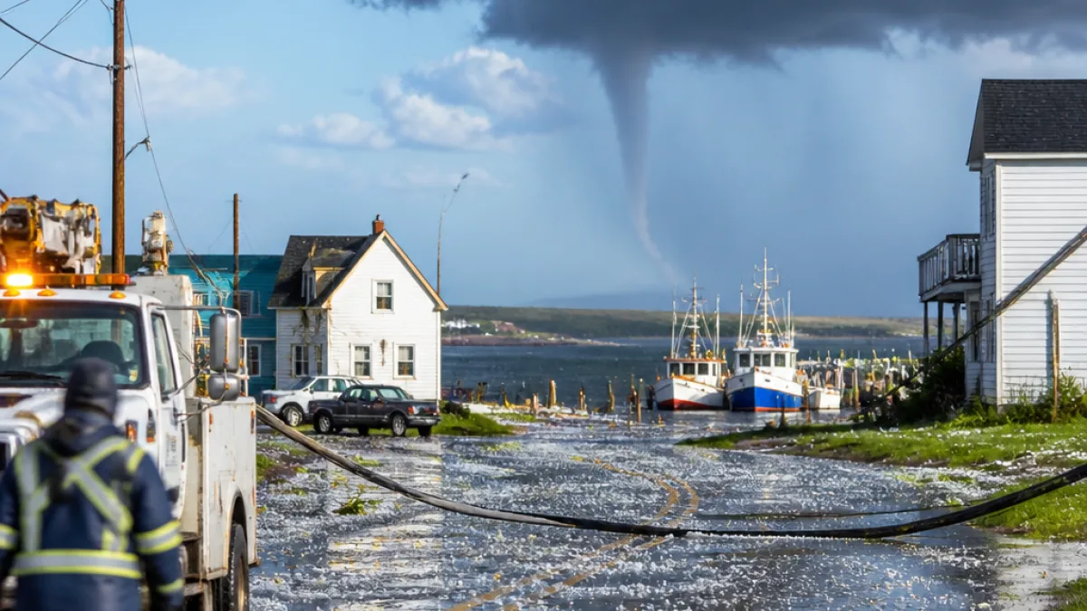
A powerful mid‑afternoon storm moved across central and eastern Prince Edward Island on Wednesday, delivering intense downpours, hail, frequent thunder and lightning and gusty winds that left several thousand Maritime Electric customers without power.
Timeline and areas affected
The line of storms arrived in Charlottetown at about 1:40 p.m., according to local reports, and pushed eastward over coastal communities. CBC meteorologist Ryan Snodden described the event as a "wild day of weather" for the central and eastern parts of the province, noting the severity of rainfall and wind.
| Time | Area | Noted impact |
|---|---|---|
| About 1:40 p.m. | Charlottetown | Power outages to thousands of Maritime Electric customers |
| Afternoon | Central & eastern P.E.I. | Heavy rain, hail, gusty winds, thunder and lightning |
| Afternoon | Little Harbour / Souris area | Video shows funnel over water and trees thrown into the air |
Reports of a possible tornado near Souris
Video footage submitted to CBC shows what appears to be a rotating funnel and trees being lifted into the air as the storm moved over the water near Souris. Residents in the Little Harbour area described seeing clouds that "seemed like the clouds were spinning" and observed debris being tossed around yards and fields.
"It seemed like the clouds were spinning. It started just on the ground, in the field. It spun things up. It was kind of crazy."
The footage and eyewitness accounts prompted meteorologists to conclude it is very likely a tornado touched down in that area. Radar estimates during the event suggested rainfall rates near 50 mm/h, producing torrential, localized rainfall along with hail and strong gusts.
Local accounts and damage
People who witnessed the storm described dramatic scenes. One resident reported shrubs being lifted into the air east of their property. In Charlottetown and surrounding communities, the combination of wind, hail and lightning also produced scattered power interruptions and hazardous travel conditions for a time.
- Residents reported hail and heavy rainfall reducing visibility during the storm.
- Thousands of Maritime Electric customers experienced outages, mostly centred around Charlottetown.
- Video evidence supports meteorologists' assessment of a likely tornado touchdown near Souris.
What officials have said
CBC meteorologist Ryan Snodden characterised the event as including slow‑moving thunderstorms that produced very heavy rainfall, gusty winds and localized hail. The combination of those elements, along with eyewitness video of a funnel, led to the conclusion that a tornado was very likely in the Souris area.
Practical considerations for Islanders
When severe storms sweep across the province, residents are reminded to take standard safety precautions: avoid downed power lines, stay indoors away from windows during high winds and lightning, and give emergency crews room to work in affected areas. If you lose power, check Maritime Electric’s outage map or contact their customer service for updates. For property damage or hazards, contact local municipal offices or 911 for immediate emergencies.
Weather like Wednesday’s highlights the variability Islanders can see in summer storms: short‑lived but intense bursts of rain and hail, and the potential for tornadic activity, especially near coastal waters where conditions can change rapidly.
Next steps
Provincial and municipal emergency management agencies will likely continue to assess damage and public safety concerns as crews restore power and clear debris. Residents with photos or video of the event, particularly offshore or coastal footage, may provide material to meteorologists and media to help clarify the storm’s behaviour.
The storm served as a reminder that even routine summer weather systems can produce hazardous conditions on short notice. Islanders impacted by outages or property damage are encouraged to follow updates from local authorities and their utility provider.